Atlas of Hungary
Countries of Europe: Albania · Andorra · Armenia‡ · Austria · Azerbaijan‡ · Belarus · Belgium · Bosnia and Herzegovina · Bulgaria · Croatia · Cyprus‡ · Czech Republic · Denmark · Estonia · Finland · France‡ · Georgia‡ · Germany · Greece · Hungary · Iceland · Republic of Ireland · Italy · Kazakhstan‡ · Latvia · Liechtenstein · Lithuania · Luxembourg · Malta · Moldova · Monaco · Montenegro · Netherlands‡ · North Macedonia · Norway · Poland · Portugal‡ · Romania · Russia‡ · San Marino · Serbia · Slovakia · Slovenia · Spain‡ · Sweden · Switzerland · Turkey‡ · Ukraine · United Kingdom · Vatican City
Specific status: Akrotiri and Dhekelia‡ · Faroe Islands · Gibraltar · Bailiwick of Guernsey · Isle of Man · Jersey · Svalbard – Limited recognition: Abkhazia‡ · Gagauzia · Kosovo · South Ossetia‡ · Transnistria · Northern Cyprus‡
‡: partly located in Europe
Specific status: Akrotiri and Dhekelia‡ · Faroe Islands · Gibraltar · Bailiwick of Guernsey · Isle of Man · Jersey · Svalbard – Limited recognition: Abkhazia‡ · Gagauzia · Kosovo · South Ossetia‡ · Transnistria · Northern Cyprus‡
‡: partly located in Europe

|
Wikimedia Commons Atlas of the World The Wikimedia Atlas of the World is an organized and commented collection of geographical, political and historical maps available at Wikimedia Commons. Discussion • Update the atlas • Index of the Atlas • Atlas in categories • Other atlases on line |
The introductions of the country, dependency and region entries are in the native languages and in English. The other introductions are in English.
|
| ||||||||||||||||||||||||||||||||||||||||


General maps

|
English: Hungary in Europe Magyar: Magyarország Európában
|

|
English: Hungary in Europe Magyar: Magyarország Európában
|

|
English: Map of Hungary Magyar: Magyarország térképe
|

|
English: Map of Hungary in Hungarian Magyar: Magyarország térképe magyarul
|

|
English: Topographic map Magyar: Topográfiai térkép
|

|
English: Administrative divisions of Hungary Magyar: Magyarország közigazgatási felosztása
|

|
English: Administrative map Magyar: Adminsisztratív térkép
|

|
English: Map of regions, counties, and subregions Magyar: Régiók, megyék és alrégiók térképe
|

|
English: Hungary, NUTS1 regions Magyar: Magyarország NUTS1 régiói
|

|
English: Regions of Hungary Magyar: Magyarország régiói
|

|
Regions of Hungary |
History maps
This section holds a short summary of the history of the area of present-day Hungary, illustrated with maps, including historical maps of former countries and empires that included present-day Hungary.
Historical maps of Hungary

|
Approximate extent of Pannonian Sea during the Miocene Epoch |

|
Approximate extent of Pannonian Sea during the Miocene Epoch |

|
approximate extent of Pannonian Sea during the Miocene Epoch |

|
The celts BC800-BC400 |

|
Territorial development of the Roman Empire 264 BC-192, including the conquest of present |

|
The extent of the Roman Republic and Roman Empire; 133 BC 44 BC (late Republic, after conquests by republican generals) AD 14 (death of Augustus) 117 (maximum extension)
|

|
Camps of the Roman Legions in 80 |

|
Ancient peoples in Pannonia |

|
Pannonia in the Roman Empire, 1st century |

|
Pannonia in the Roman Empire, 1st century |

|
Roman Pannonia, 1st century |

|
Map of the Roman Empire in 116 |

|
Pannonia in the Roman Empire (116) |

|
Roman Empire in 117 |

|
Upper Pannonia and Lower Pannonia, 2nd century |

|
Upper Pannonia and Lower Pannonia, 2nd century |

|
Pannonia provinces, 4th century |

|
Roman Empire divided 395, showing the dioceses and praetorian prefectures of Gaul, Italy, Illyricum and Oriens (east), roughly analogous to the four Tetrarch zones of influence after Diocletian's reforms. |

|
The division of the Empire after the death of Theodosius I, ca.395 AD superimposed on modern borders. |

|
Invasions of the Roman Empire 100-500 |

|
Invasions of the Roman Empire 100-500 |

|
Division of the Roman Empire in 406 |
.PNG)
|
Eastern Roman Empire and Western Roman Empire, c.476 |

|
Hun migration |

|
Hun Empire |

|
Hun Empire |
| [[|border|251x400px]] | Gepids and Langobards (6th century) |

|
Kingdom of the Gepids in the 6th century (539-551) |

|
Avar Khanate in 600 |

|
Avar Khanate in 650 |
| [[|border|251x400px]] | Avar Khanate, 7th-8th century |
| [[|border|251x400px]] | Avars in the Carpathian basin, 680-804 |

|
Avar Khanate in 700 |

|
Avar Khanate in 814 |

|
Avar Khanate in the 9th century |

|
Rise of the Frankish Empire |
| [[|border|251x400px]] | Carpathian basin in the 9th century |
| [[|border|251x400px]] | Carpathian basin in the 9th century - Slovak and Hungarian views |

|
Carpathian basin in the 9th century (according to the Gesta Hungarorum) |

|
Balaton Principality |

|
Location of Proto-Magyars (Proto-Hungarians) in 400 AD |

|
Location of Magyars (Hungarians) in 500 AD |

|
Location of Magyars (Hungarians) in 565 AD |

|
Location of Magyars (Hungarians) in 700 AD |

|
Hungarian Migration |

|
Hungarian Migration |

|
Hungarian Migration |

|
Hungarian Migration |

|
Hungarian campaigns |

|
Hungary around 900 |

|
Kingdom of Hungary in the 10th century |

|
Basic territory of Bijelo Brdo culture (10th-12th century) |

|
Hungarians, Slavs and Vlachs in the Kingdom of Hungary, 10th-12th century (according to Serbian historian Jovan Pejin) |

|
Hungary in 1000 |

|
Kingdom of Hungary in the 11th century |

|
Kingdom of Hungary in 1190 |

|
The journeys of Friar Julian |
| [[|border|251x400px]] | Mongol invasion in 1241 |
| [[|border|251x400px]] | Kingdom of Hungary in 1241 |

|
Kingdom of Hungary in the 13th century |

|
Realms of Hungarian oligarchs in the 14th century |

|
Kingdom of Hungary in 1360 |

|
Kingdom of Hungary in 1370-1387 |

|
Kingdom of Hungary in 1480 |

|
Kingdom of Hungary in 1490 |

|
Kingdom of Hungary in 1490 |

|
Border between Kingdom of Hungary and Ottoman Empire in the early 16th century |
| [[|border|251x400px]] | Kingdom of Hungary in 1514 |

|
Growth of the Ottoman Empire |

|
Development of the European part of the Ottoman Empire |

|
Growth of the Ottoman Empire |
| [[|border|251x400px]] | Kingdom of Hungary in the 16th century |

|
Kingdom of Hungary in the 16th century |

|
Kingdom of Hungary in 1526 |

|
Habsburg Monarchy in 1547 |
| [[|border|251x400px]] | Kingdom of Hungary in 1550 |

|
Kingdom of Hungary in 1550 |
| [[|border|251x400px]] | Map of the Ottoman Empire 1566 |

|
Captaincies of Royal Hungary and Budin Eyalet in 1572 |

|
Ottoman Empire in 1600 |

|
Ottoman Empire in 1683 |

|
Ottoman Empire in 1683 |

|
Ottoman Empire in 1683 |

|
Ottoman Empire in 1683 |

|
Kingdom of Hungary, Principality of Upper Hungary, Principality of Transylvania and Ottoman eyalets in 1683 |
| [[|border|251x400px]] | Kingdom of Hungary, Principality of Upper Hungary, Principality of Transylvania and Ottoman eyalets in 1683 |

|
Great Serb migration in 1690 |

|
Kingdom of Hungary within Habsburg Monarchy in 1699 |

|
Kingdom of Hungary in the Habsburg Monarchy in 1763-1787 |

|
Kingdom of Hungary within Habsburg Monarchy in 1782-1785 |

|
Kingdom of Hungary within Habsburg Monarchy in 1782-1785 |

|
Kingdom of Hungary within Austrian Monarchy |

|
Hungarian military districts in 1850 |
| Kingdom of Hungary in 1862 |
| Kingdom of Hungary in 1875 |

|
Ethnic groups in the Kingdom of Hungary in 1880 |

|
Hungarian language in 1880 (note: this map declares even areas with German minority as "German") |
.jpg)
|
Ethnic map of Austria-Hungary, census 1880. German version |

|
Religions in Austria-Hungary, Andrees Allgemeiner Handatlas, 1st Edition, Leipzig (Germany) 1881 |

|
Etnographic map (1885-1890) |
_in_Hungary,_census_1890.jpg)
|
Hungarians in the Kingdom of Hungary in 1890 |
.png)
|
Hungarians in the Kingdom of Hungary in 1890 |
.JPG)
|
Ethnic map of Austria-Hungary, census 1890. English version |

|
Kingdom of Hungary in 1900 |

|
Etnographic map (1900) |

|
Historical map of Austria-Hungary from the Bibliothek allgemeinen und praktischen Wissens für Militäranwärter Band I, 1905 |

|
Proposed United States of Greater Austria in 1906 |

|
Proposed United States of Greater Austria in 1906 |

|
Etnographic map (1910) |

|
Etnographic map (1910), made by Pál Teleki |

|
Etnographic map (1911) |

|
Hungarians in Austria-Hungary in 1911 |

|
Szekelys in the Kingdom of Hungary |

|
Location of the Kingdom of Hungary |

|
Kingdom of Hungary before 1913 |

|
Kingdom of Hungary in 1914 |
| [[|border|251x400px]] | Kingdom of Hungary in 1914 |

|
Kingdoms and countries of Austria–Hungary: Cisleithania: 1. Bohemia, 2. Bukovina, 3. Carinthia, 4. Carniola, 5. Dalmatia, 6. Galicia, 7. Austrian Littoral, 8. Lower Austria, 9. Moravia, 10. Salzburg, 11. Silesia, 12. Styria, 13. Tyrol, 14. Upper Austria, 15. Vorarlberg; Transleithania: 16. Hungary, 17. Croatia and Slavonia; 18. Bosnia and Herzegovina |

|
Austria-Hungary in 1914 |

|
South Front in World War I |

|
East Front open in World War I |

|
Cantonized Hungary, proposed by Miksa Strobl in 1918 |

|
Hungarian Soviet Republic |

|
The end of Austria-Hungary (in German) |

|
Treaty of Trianon (in Hungarian) |

|
Treaty of Trianon |

|
Treaty of Trianon |

|
Treaty of Trianon |

|
Treaty of Trianon - Ethnic map |

|
Treaty of Trianon - Ethnic map |
| [[|border|251x400px]] | Treaty of Trianon - Ethnic map |

|
Hungary between World Wars |

|
Hungary in 1923 |

|
Hungary in 1938 |

|
Hungary in 1939 |

|
Hungary in 1940 |

|
Hungary in 1941-1944 |

|
Hungary during World War II |

|
Hungary during World War II |

|
Hungary during World War II |

|
Hungary during World War II |

|
Hungary during World War II |

|
Hungary during World War II |

|
Hungary during World War II |

|
Hungary during World War II |

|
1942 Raid in southern Bačka |

|
The Allied offensive on Southern Central Europe |

|
Hungary from 1867 to 1947 |

|
Hungary in 1950 |
Historical maps of Hungarians in Transylvania
| Magyars in Transylvania, 10th-11th century |

|
Transylvania in the 13th century |

|
Székely Land in medieval Transylvania |

|
Transylvania in the 16th century |

|
Székely Seats |

|
Transylvania in 1570 |
| Northern Transylvania annexed to Hungary in World War II |

|
Hungarian Autonomous Province, 1952-1960 |

|
Hungarian Autonomous Province, 1952-1968 |

|
Emigration of the Székelys |
Historical maps of Hungarians in Slovakia

|
Hungarians in Slovakia in 1910 |

|
Hungarian language in Czechoslovakia in 1930 |

|
Hungarian annexation of southern Slovakia in 1938 |

|
Hungarian annexation of southern Slovakia in 1938 |
Historical maps of Hungarians in Vojvodina

|
Domain of medieval Hungarian oligarch Ugrin Csak |

|
Serb-Hungarian frontlines in the territory of present-day Vojvodina in 1848-1849 |

|
Hungarian counties in the territory of present-day Vojvodina in 1881-1882 |
.png)
|
Ethnic Hungarians in the territory of present-day Vojvodina in 1910 |

|
Hungarian language in the territory of present-day Vojvodina in 1910 |

|
Hungarian language in Vojvodina in 1921 |

|
Hungarian language in Vojvodina in 1931 |
Old maps
This section holds copies of original general maps more than 70 years old.

|
Hungary and Turkey in Europe |
Linguistic, ethnic and religion maps

|
Hungarians outside of Hungary |

|
Distribution of the Hungarian language |

|
Alternative map |
_in_Hungary_(census_2001).png)
|
Roma (Gypsies) in Hungary (census 2001, by localities) |

|
Roma (Gypsies) in Hungary (census 2001, by counties) |
.png)
|
Roma (Gypsies) in Hungary (census 2001, by counties) |

|
Religion map of Hungary |

|
Religion map of Hungary |
Regions and counties of Hungary
-
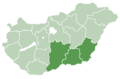 Dél-Alföld region
 -
 Dél-Dunántúl region
 -
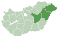 Észak-Alföld region
 -
 Észak-Magyarország region
 -
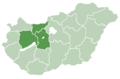 Közép-Dunántúl region
 -
 Közép-Magyarország region
 -
 Nyugat-Dunántúl region


|
Counties of Hungary |
-
 Magyar: Budapest
 -
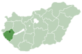
 English: Baranya countyMagyar: Baranya megye
 -
 English: Bács-Kiskun countyMagyar: Bács-Kiskun megye
 -
 English: Békés countyMagyar: Békés megye
 -
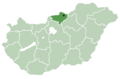
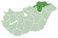 English: Borsod-Abaúj-Zemplén countyMagyar: Borsod-Abaúj-Zemplén megye
 -
 English: Csongrád countyMagyar: Csongrád megye
 -
 English: Fejér countyMagyar: Fejér megye
 -
 English: Győr-Moson-Sopron countyMagyar: Győr-Moson-Sopron megye
 -
 English: Hajdú-Bihar countyMagyar: Hajdú-Bihar megye
 -
 Jász-Nagykun-Szolnok county
 -
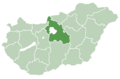
 Komárom-Esztergom county
 -
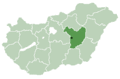
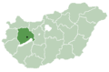
 Nógrád county
 -
Pest county
-
 Somogy county
 -
 Szabolcs-Szatmár-Bereg county
 -
 Tolna county
 -
 Vas county
 -
 Veszprém county
 -
 Zala county


|
Counties |

|
Subregions of Hungary |

|
városok, községek, and megyei jogú városok |

|
Jászság (Jazygia) region in Hungary |

|
Baranya / Baranja region, divided between Hungary and Croatia |

|
Bačka / Bácska region, divided between Serbia and Hungary |

|
Banat region, divided between Romania, Serbia and Hungary |
Satellite maps

|
Satellite map |

|
Satellite map |
Notes and references
|
General remarks:
|