Atlas of Luxembourg
Specific status: Akrotiri and Dhekelia‡ · Faroe Islands · Gibraltar · Bailiwick of Guernsey · Isle of Man · Jersey · Svalbard – Limited recognition: Abkhazia‡ · Gagauzia · Kosovo · South Ossetia‡ · Transnistria · Northern Cyprus‡
‡: partly located in Europe

|
Wikimedia Commons Atlas of the World The Wikimedia Atlas of the World is an organized and commented collection of geographical, political and historical maps available at Wikimedia Commons. Discussion • Update the atlas • Index of the Atlas • Atlas in categories • Other atlases on line |
|
| ||||||||||||||||||||||||||||||||||||||||||||


General maps

|
Map of Luxembourg |

|
Same map in Luxembourgish |

|
Same map in French |

|
Same map in German |

|
Map of Luxembourg |

|
Administrative divisions of Luxembourg |

|
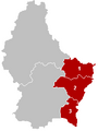
Districts of Luxembourg |

|
Districts of Luxembourg |
This section holds a short summary of the history of the area of present-day Luxembourg, illustrated with maps, including historical maps of former countries and empires that included present-day Luxembourg.
-
 District of Diekirch
 -
 Clervaux
 -
 Diekirch
 -
 Redange
 -
 Vianden
 -
 Wiltz
Wiltz -
 District of Grevenmacher
 -
 Grevenmacher
 -
 Echternach
 -
 Remich
 -
 District of Luxembourg
 -
 Capellen
 -
 Esch-sur-Alzette
 -
 Luxembourg
 -
 Mersch


|
Cantons of Luxembourg |

|
Cities of Luxembourg |

|
Communes of Luxembourg |

|
Topograpic map of Luxembourg |
History maps

|
Possible extent of (proto-)Celtic influence 800-400 BC |

|
Territorial development of the Roman Empire 264 BC-192, including the conquest of present Luxembourg |

|
Map of the Roman Empire in 50 |

|
The extent of the Roman Republic and Roman Empire; 133 BC 44 BC (late Republic, after conquests by republican generals) AD 14 (death of Augustus) 117 (maximum extension))
|

|
Camps of the Roman Legions in 80 |

|
Map of the Roman Empire in 116 |

|
Germania Superior in the Roman Empire (116) |

|
The Roman Empire in CE 116 and Germania Magna Das Römische Reich und Magna Germania im Jahr 116 |

|
Roman Empire in 117 |

|
Roman Empire divided 395, showing the dioceses and praetorian prefectures of Gaul, Italy, Illyricum and Oriens (east), roughly analogous to the four Tetrarch zones of influence after Diocletian's reforms. |

|
Western Roman Empire 395 |

|
The division of the Empire after the death of Theodosius I, ca.395 AD superimposed on modern borders. |

|
Invasions of the Roman Empire 100-500 |

|
Invasions of the Roman Empire 100-500 |

|
Division of the Roman Empire in 406 |
.PNG)
|
Eastern Roman Empire and Western Roman Empire, c.476 |

|
Rise of the Frankish Empire |

|
Empire of Clovis |

|
Europe 526-600 |

|
Carolingian Empire around 800 |

|
Carolingian Empire (in French) |

|
Europe in 814 |

|
The Frankish Empire |

|
Treaty of Verdun (843) and Treaty of Meerssen (870) |

|
Division of the Frankish Empire after 870 |

|
Central Europe 919-1125 |
| [[|border|251x400px]] | Holy Roman Empire 10th century |

|
Hanseatic trade routes |

|
The Holy Roman Empire in the 14th century |

|
Map of the Low Countries 1477 |

|
Burgundian possessions |
-en.png)
|
The Netherlands as part of the Holy Roman Empire |

|
Habsburgian ruled Europe, inclusive the Netherlands |

|
The Habsburigians around 1547 |

|
Unions of Utrecht and Arras |

|
Unions of Utrecht and Arras |

|
The Netherlands 1559-1608 |

|
Area ruled by the Spanish king around 1580 (Netherlands in blue) on a map showing modern-day state borders |

|
The United and the Spanish Netherlands |

|
The religious situation in central Europe about 1618 |

|
Area controlled by the Holy Roman Empire around 1630 |

|
The Austrian Netherlands |

|
Luxembourg annexed to the French Empire 1811 |

|
Europe under Napoleon |

|
Luxemburg under French occupation |

|
The Talleyrand partition plan |

|
The United Kingdom of the Netherlands Het Verenigde Koninkrijk der Nederlanden (1815-1831) |
.png)
|
The Netherlands, Belgium, Luxembourg and Limburg in 18391, 2 and 3 United Kingdom of the Netherlands (until 1830) 1 and 2 Kingdom of the Netherlands (after 1830) 2 Duchy of Limburg (In the German Confederacy after 1839 as compensation for Waals-Luxemburg) 3 and 4 Kingdom of Belgium (after 1830) 4 and 5 Grand Duchy of Luxembourg (borders until 1830) 4 Province of Luxembourg (Waals-Luxemburg, to Belgium in 1839) 5 Grand Duchy of Luxembourg (German Luxemburg; borders after 1839) In blue, the borders of the German Confederacy Splitsing van de Nederlanden. 1 en 2: Koninkrijk der Nederlanden, waarvan 2 Limburg, lid van de Duitse Bond. 3 en 4: Koninkrijk België, inclusief 4 Waals Luxemburg. 5: Groothertogdom Luxemburg, in personele unie met Nederland, lid van de Duitse Bond, maar exclusief 4 Waals Luxemburg. |

|
Partitions of Luxembourg (historical) |

|
Schuster line, 1940 |

|
German invasion of Luxembourg, 1940 |

|
Second map |

|
Luxembourgian military sectors, 1945-1955 |
Old maps
This section holds copies of original general maps more than 70 years old.

|
The 17 Netherlands, depicted as Leo Belgicus |

|
Duchy of Luxembourg, Map by Blaeu, 1645 |

|
Leo Belgicus by Josse de Hond |

|
Blaeu map of the Low Countries in 1645 |

|
Luxembourg, Belgium and the Netherlands in 1905 |
Other maps

|
the Benelux states |

|
Railways |

|
Legislative circonscriptions |

|
District Tribunals |

|
Lower tribunals |
Satellite maps

|
Satellite map |
Notes and references
|
General remarks:
|