Atlas of Poland
Specific status: Akrotiri and Dhekelia‡ · Faroe Islands · Gibraltar · Bailiwick of Guernsey · Isle of Man · Jersey · Svalbard – Limited recognition: Abkhazia‡ · Gagauzia · Kosovo · South Ossetia‡ · Transnistria · Northern Cyprus‡
‡: partly located in Europe

|
Wikimedia Commons Atlas of the World The Wikimedia Atlas of the World is an organized and commented collection of geographical, political and historical maps available at Wikimedia Commons. Discussion • Update the atlas • Index of the Atlas • Atlas in categories • Other atlases on line |
|
| ||||||||||||||||||||||||||||||||||||||||||


General maps
This section holds maps of the administrative divisions.


|
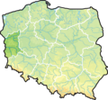
Map of Poland |

|
Same map in Polish |

|
Map of Poland |

|
Topographic map |

|
Relief map |

|
Map of physico-geographical regions |

|
Map of physico-geographical regions |

|
Map of physico-geographical regionalization |

|
Hydrographic map |

|
Polish borders |

|
la: In limitem orientalem poloniae sunt: San, Buga, et Svislach
pl: Rzeki na wschodniej granicy Polski (San, Bug i Świsłocz) - mapa w j. łacińskim en: Rivers on the east border of Poland (San, Bug and Svislach) - map in latin de: Flüsse an den polnischen Ostgrenzen (San, Bug und Świsłocz) - die Karte in lateinischer Sprache ru: Реки на восточной границе Польши (Сан, Буг, Свислочь) – карта на латине |
Maps of divisions

|
Poland has three levels of administrative divisions, shown in this map: voivodeships (województwa), counties (powiaty) and communes (gminy). |

|

|

|

|

|
This map shows both the voivodeships (województwa) and the counties (powiaty) of Poland. See the List of counties |

|
Voivodeships and counties |

|
Counties (powiaty) |

|
Counties |

|
Counties |

|
Voivodeships and communes. See the List of communes of Poland |

|
Communes (gminy) |

|
Communes |

|
Municipalities in Poland deprived of town privileges |

|
Historical Pomerania |
.png)
|
Historical Silesia |
-
 Zachodniopomorskie
 -
 Wielkopolskie
 -
 Pomorskie
 -
 Podlaskie
 -
 Podkarpackie
 -
 Opolskie
 -
 Mazowieckie
 -
 Lubuskie
 -
 Lubelskie
 -
 Kujawsko-pomorskie
 -
 Dolnoślaskie
.png)
.png)
.png)
.png)
.png)
.png)
.png)
.png)
.png)
.png)
.png)
History maps
This section holds a short summary of the history of the area of present-day Poland, illustrated with maps, including historical maps of former countries and empires that included present-day Poland. Template:Left-par

|
Possible extent of (proto-)Celtic influence 800-400 BC |

|
Celts in Europe |
.PNG)
|
Pre-Roman iron age (Proto-Germanic) peoples |

|
Map showing the pre-Migration Age distribution of the Germanic tribes in Proto-Germanic times, and stages of their expansion up to 50 BC, AD 100 and AD 300. |

|
The origin and dispersion of Slavs in the 5th-10th centuries |

|
Slavic tribes in 7th-9th century Europe |

|
West Slavs in the 9th-10th centureis |

|
Map of Slavic peoples in the 8/9c. |
Independent Poland

|
Polan strongholds during the early reign of Mieszko I |

|
Map of Poland 960-992 |

|
Map of Poland 992-1025 |

|
Map of Poland 1039-1058 |
.png)
|
Poland 1201-1241 |
.png)
|
Poland 1275-1300 |
.png)
|
Poland 1304-1333 |

|
Poland 1333-1370 |

|
Poland and Hungary in 1360 |

|
Hanseatic trade routes |
_and_the_Crown_of_the_Kingdom_of_Poland_(red)_in_1386_-_1434.png)
|
Poland and Lithuania during reign of Władysław II Jagiełło 1386-1434 since Ilustrowany atlas historii Polski, wyd. Demart, Warszawa 2006 |
_and_the_Crown_of_the_Kingdom_of_Poland_(red)_and_its_neighborhood_in_1386_%E2%80%93_1434_(English_version).png)
|
English version of Poland and Lithuania during reign of Władysław II Jagiełło 1386-1434 since Hans-Erich Stier (dir.) Grosser Atlas zur Weltgeschichte, Westermann 1985, ISBN 3-14-100919-8 |

|
In 1386 Poland and Lithuania formed a Polish-Lithuanian personal union. Large parts of present-day Belarus and Ukraine were part of Poland-Lithuania. This map shows the borders in 1466 |

|
In the years 1490-1526 Poland, Lithuania, Bohemia and Hungary were ruled by Polish Jagiellon dynasty |

|
Poland and Lithuania in 1526 |
Polish-Lithuanian Commonwealth

|
1569-1795: Commonwealth of Two Nations {Rzeczpospolita Obojga Narodów, Abiejų Tautų Respublika} - Independent country, better known as Polish-Lithuanian Commonwealth In 1569 the personal union is succeeded by the Polish-Lithuanian Commonwealth, a state that existed until the 3rd partition of 1795. |

|
Polish-Lithuanian Commonwealth 1569 |

|
Location of the Polish Lithuanian Commonwealth |

|
Polish Lithuanian Commonwealth compared with present borders |

|
Religions in Poland 1573 |

|
Polish Lithuanian Commonwealth |

|
Polish-Swedish Union 1592-1599 |

|
Commonwealth 1600 |

|
Commonwealth in 1619 |

|
Commonwealth 1635 |

|
Commonwealth 1648 |

|
Commonwealth 1658 |

|
Commonwealth 1660 |

|
Commonwealth 1686 |

|
Commonwealth, division in voivodships |

|
Commonwealth 1701 |

|
Religions in Poland 1750 |

|
Physical map of Poland-Lithuania 1764 |

|
7 years war 1756-1762 |

|
Bar Confederation 1768-1772 |

|
Polish-Lithuanian Commonwealth as a protectorate of Russian Empire in 1772 |

|
The partitions of the Commonwealth |

|
Commonwealth after 1st partition |

|
Polish-Russian War 1792 |

|

|
Commonwealth after 2nd partition |

|
Poland 1794 |
Divided Poland

|
The third partition meant the end of the Polish-Lithuanian Commonwealth and the final division between Prussia, Russia and Austria after 3rd partition |

|
Border changes between Poland and Prussia 1600-1795 |

|
Duchy of Warsaw and Republic of Gdańsk, during the Napoleon era |

|
Duchy of Warsaw |

|
Duchy of Warsaw 1810/Ks. Warszawskie 1810 |

|
Wolne Miasto Kraków, 1815-1846 |

|
Free City of Cracow, 1815-1846 |

|
Physical map of Galicia 1846-1918 |

|
Galicia, administrative 1914 |

|
Kingdom of Poland 1815-1831 |

|
Wolne Miasto Gdańsk 1807-1815/Free City Gdańsk/Danzig 1807-1815 |

|
Congress Poland, Grand Duchy of Posen and Free City of Kraków in 1815 |

|
Poland 1815-30 (Congress Poland), inside the Russian Empire |

|
Ethnic map of European Russia before the First World War (in French) |

|
Congress Poland, administrative division as of 1907 |

|
The Russian Empire in 1914 |

|
History of the Russian Empire (in German) |

|
Borders between Poland and Prussia 1807-1871 |

|
Republic of Cracow 1815 |

|
Galicia (Central Europe), annexed by Austria became in 1867 part of the Austria half of Austria-Hungary (nr. 6). |

|
Kingdom of Galicia |

|

|
Proposed United States of Greater Austria |

|
The end of Austria-Hungary (in German) |
Independent Poland

|
After the Russian revolution, Poland regained independence. A war between Poland and the new regime in Russia started March 1919 |

|
December 1919 |

|
June 1920 |

|
August 1920 |

|
Battle of Warsaw (1920) - Phase 1 |

|
Battle of Warsaw (1920) - Phase 1 |

|
Battle of Warsaw (1920) - Phase 2 |

|
Battle of Warsaw (1920) - Phase 2 |

|
Borders of newly independent Poland after the Peace Treaty of Riga of 1921 |

|
Wolne Miasto Gdańsk 1920-1939/Free City Gdańsk/Danzig 1920-1939 |

|
Languages of Poland 1937 |

|
Physical map of Poland 1938-39 |

|
Border changes between Poland and Germany 1919-45 |

|
Foreign claims in Poland in 1920 |

|
Comparison 1789-1920 |

|
Poland between 1921 and 1939 |

|
Poland 1921-1939 |

|
Administrative division in 1922 |

|
Same map in Polish |

|
Nationalities in Poland |

|
Locator map of Free City of Danzig 1923-1939 |

|
Republic of Central Lithuania |

|
Lithuania claims and the Republic of Central Lithuania |

|
Changing border between Lithuania and Poland |

|
Curzon line |

|
Borders with Germany |

|
Situation in 1939 |

|
Situation in 1939 in a European context |

|
Administrative districts in territories under the control of Nazi Germany in 1941, inclusive Poland. |

|
Idem |

|
Eastern front of the Second World War circa 1941-1942. |
| [[|border|251x400px]] | Main German Nazi concentration and extermination camps. Bordures from 1943. |

|
Oder-Neisse border between Poland and Germany |

|
Oder Neisse Linie |
.png)
|
Changing of the borders |

|
idem |
_rus.png)
|
Border changes after WW2 (Russian text) |

|
Administrative division of Poland as of August 22, 1944 |

|
Administrative division of Poland as of March 14, 1945 |

|
Administrative division of Poland as of April 1, 1945 |

|
Administrative division of Poland as of April 7, 1945 |

|
Administrative division of Poland as of August 9, 1945 |

|
Administrative division of Poland as of August 18, 1945 |

|
Administrative division of Poland as of June 28, 1946 |
.svg)
|
Administrative division in 1946 |

|
Administrative division in 1957 |
.svg)
|
Administrative division in 1957 |

|
Administrative division in 1968 |

|
Administrative division in 1975 |
History of other entities
Danzig
| 1923-1939: Free City of Gdańsk (Freie Stadt Danzig/Wolne Miasto Gdańsk) - free city under protection of the League of Nations |
|
|
In 1923 the city of Gdańsk became a Free City under protection of the Leage of Nations. Gdańsk was annexed by Germany in 1939 and is now part of Poland. |
Old maps
This section holds copies of original general maps more than 70 years old.

|
English map of Poland - XVIII century |

|
Poland in 1836 |

|
Poland in 1902 |
Other maps

|
Airports |

|
Polish airports in 2011 - passenger traffic |

|
Polish airports in 2007 - passenger traffic |

|
Polish airports in 2006 - passenger traffic |

|
Polish airports in 2005 - passenger traffic |

|
Catholic Dioceses |
Satellite maps

|
Satellite map |

|
Satellite map |

|
Satellite map |
Notes and references
|
General remarks:
|