Atlas of Vojvodina

|
Wikimedia Commons Atlas of the World The Wikimedia Atlas of the World is an organized and commented collection of geographical, political and historical maps available at Wikimedia Commons. Discussion • Update the atlas • Index of the Atlas • Atlas in categories • Other atlases on line |
|
| ||||||||||||||||||||||||||||||||||||||||||||||||
General maps
|
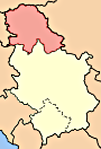
Vojvodina within Serbia |

|
Vojvodina within Serbia |

|
Vojvodina within Serbia |

|
Vojvodina within Serbia |
|
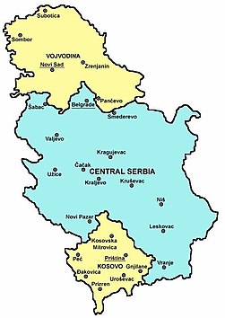
Vojvodina within Serbia |

|
Vojvodina within Serbia |
|
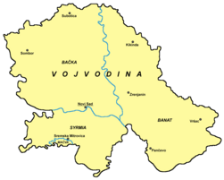
Map of Vojvodina |

|
Blank map of Vojvodina |
|
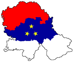
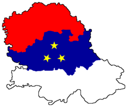
Map of Vojvodina with colours from Vojvodinian flag |
|
Map of Vojvodina with colours from Vojvodinian flag |

|
Map of districts of Vojvodina |

|
Map of districts of Vojvodina |
| Map of districts of Vojvodina |

|
Map of the municipalities of Vojvodina |
|
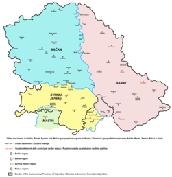
Map of cities and towns in Vojvodina |
History maps
This section holds a short summary of the history of the area of present-day Vojvodina, illustrated with maps, including historical maps of former countries and empires that included present-day Vojvodina.

|
approximate extent of Pannonian Sea during the Miocene Epoch |

|
approximate extent of Pannonian Sea during the Miocene Epoch |

|
approximate extent of Pannonian Sea during the Miocene Epoch |

|
detailed map of the south-eastern part of Pannonian Sea during the Miocene Epoch |

|
detailed map of the south-eastern part of Pannonian Sea during the Miocene Epoch |
|
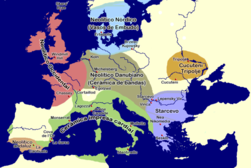
Starčevo culture, 7th-5th millennium BC |

|
Neolithic Starčevo culture (5300-4400 BC) |

|
Vinča culture (6th-5th milennium BC) |

|
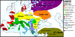
Neolithic cultures, 4500-4000 BC |
|
Neolithic cultures, 4000-3500 BC |
|
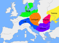
Neolithic cultures - Vinča and Lengyel cultures, late 4th millennium BC |

|
Indo-European expansion |
|
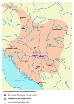
Indo-European Vučedol culture (3000-2400 BC) |

|
Vatin culture (16th-13th century BC) |

|
Bronze Age Dubovac-Žuto Brdo culture |

|
Bronze Age Belegiš culture |

|
Iron Age Bosut culture |
|
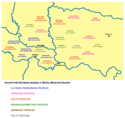
Indo-European peoples in Vojvodina in ancient times |
|
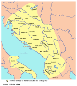
Ethnic territory of the Illyrians and Illyrian tribes (8th-3rd century BC) |

|
Celtic expansion, 800-400 BC |
|
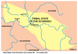
Tribal State of the Scordisci (3rd century BC - 1st century BC) with capital in Singidunum (present-day Belgrade) |

|
Dacian Kingdom, under the rule of Burebista, 82 BC |

|
Dacian Kingdom, under the rule of Burebista, 82 BC |

|
Ancient peoples in Pannonia |

|
Dalmato-Pannonian uprising in the first century (6 AD) |

|
Dalmato-Pannonian uprising in the first century (7 AD) |

|
Dalmato-Pannonian uprising in the first century (8 AD) |

|
Dalmato-Pannonian uprising in the first century (9 AD) |

|
Pannonia, Roman province (1st century) |

|
Pannonia, Roman province (1st century) |

|
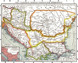
Roman cities and provinces in middle Danube area (2nd century) |
|
Roman provinces in middle Danube area (2nd century) |

|
Pannonia Inferior, Roman province (2nd century) |

|
Pannonia Inferior, Roman province (2nd century) |

|
Territory of emperor Galerius (whose capital was Sirmium) during the Tetrarchy, 3rd-4th century |

|
Prefecture of Illyricum with capital in Sirmium, 318-379 AD |

|
Prefecture of Illyricum in the 4th century |

|
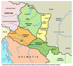
Prefecture of Illyricum in the 4th century, Gepids and Iazyges |
|
Pannonia Secunda, Roman province, 4th century |

|
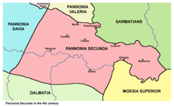
Pannonia Secunda, Roman province, Goths and Iazyges, 4th century |
|
Pannonia Secunda, Roman province, 4th century |

|
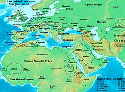
Sirmium as part of the Prefecture of Italy, 395 AD |
|
Kingdom of the Gepids and Kingdom of the Ostrogoths in 500 AD |

|
Kingdom of the Ostrogoths and Gepids in 526 AD |
| [[|border|251x400px]] | Kingdom of the Gepids, 6th century |
| [[|border|251x400px]] | Kingdom of the Gepids, 6th century |
| [[|border|251x400px]] | Kingdom of the Gepids, 6th century |

|
Kingdom of the Gepids in the 6th century (539-551) |
|
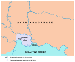
Byzantine province of Pannonia, 6th century |

|
Slavs in Vojvodina in the 6th century |
|
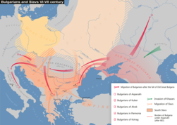
Slavs in Vojvodina, 6th-7th century |

|
Ethnic situation in Vojvodina in the 6th-8th century |

|
Slavs in Vojvodina, 6th-10th century |

|
Avaro-Slav state, 7th century |

|
Avaro-Slav state, 7th century |

|
Slavs in Vojvodina, 7th-8th century |
|
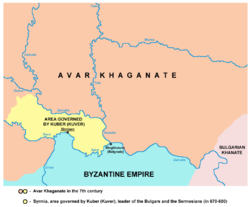
Territory ruled by Kuver, 7th century |

|
Lands ruled by Buta-ul, 8th century |

|
Slavic Principality of Lower Pannonia in the 9th century |

|
Great Moravia in the 9th century |

|
Location of Great Moravia (9th century) in the territory of present-day Vojvodina according to the Peter Nagy Puspoki's theory |

|
Bulgarian Empire in the 9th century under khan Krum |

|
Bulgarian Empire in the 9th century under Krum and Omurtag |

|
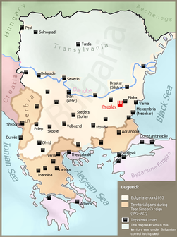
Bulgarian Empire in the 9th century under Presian and Boris |
|
Bulgarian Empire in the 9th century under tsar Simeon |

|
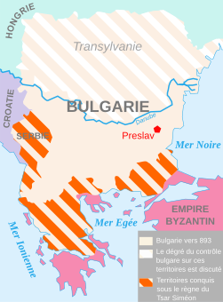
Bulgarian Empire in the 9th century under tsar Simeon |
|
Bulgarian Empire in the 9th century under tsar Simeon |

|
Bulgarian Empire in the 9th century under tsar Simeon |
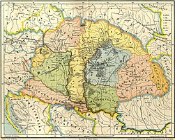
| [[|border|251x400px]] | Culture of the First Bulgarian Empire |
|
Duchies of Salan, Glad and Braslav in the 9th century |

|
Duchies of Salan and Glad in the 9th century |

|
Duchy of Salan in the 9th century |

|
Basic territory of Bijelo Brdo culture (10th-12th century) |
|
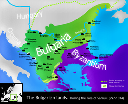
Bulgarian Empire in the 10th-11th century under tsar Samuil |

|
Duchies of Ahtum and Sermon in the 11th century |

|
Duchy of Ahtum in the 11th century |

|
Patriarchate of Ohrid in 1020 |

|
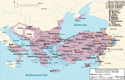
Byzantine Empire in 1025 |

|
Theme of Sirmium within Byzantine Empire in 1025 |
|
Theme of Sirmium within Byzantine Empire in 1025 |

|
Theme of Sirmium within Byzantine Empire in 1045 |

|
Religion map of the territory of present-day Vojvodina in 1054 |
|
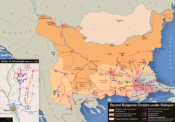
Bulgarian Empire in the 12th-13th century under Kaloyan |

|
Bulgarian Empire in the 13th century under Ivan Asen II |

|
Bulgarian Empire in the 13th century under Ivan Asen II |

|
Bulgarian Empire in the 13th century under Constantine Tikh |

|
State of Stefan Dragutin and Domain of Ugrin Čak, 13th-14th century |

|
State of Stefan Dragutin, 13th-14th century (according to the book of historian Stanoje Stanojević) |

|
Serbian despotate, 1455-1459, including town Kovin in Banat |

|
Possessions of the Serbian despots in Syrmia, Bačka and Banat, 15th-16th century |

|
Empire of Jovan Nenad in 1526-1527 |
| [[|border|251x400px]] | Empire of Jovan Nenad in 1526-1527 and Duchy of Syrmia of Radoslav Čelnik in 1527-1530 |

|
Duchy of Syrmia of Radoslav Čelnik in 1527-1530 |

|
Growth of the Ottoman Empire |

|
Development of the European part of the Ottoman Empire |
| [[|border|251x400px]] | Ottoman Empire in 1566 |

|
Ottoman Empire in 1566 |
|
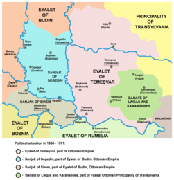
Eyalet of Temeşvar, Sanjak of Sirem, Sanjak of Segedin, and Banate of Lugos and Karansebes in 1568-1571 |
|
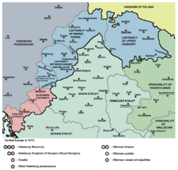
Eyalet of Temeşvar in 1572 |
|
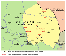
Banat uprising in 1594 |

|
Ethno-religious situation in Vojvodina during Ottoman administration (16th-17th century) |

|
Serbian Patriarchate of Peć (16th-17th century) |
|
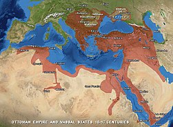
Ottoman Empire in 1600 |

|
Ottoman Empire in 1639 |
|
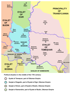
Eyalet of Temeşvar, Sanjak of Sirem, and Sanjak of Segedin in the middle of the 17th century |

|
Ottoman Empire in 1672 |

|
Ottoman Empire in 1683 |

|
Ottoman Empire in 1683 |

|
Ottoman Empire in 1683 |

|
Ottoman Empire in 1683 |

|
Ottoman Empire in 1683 |

|
Ottoman Empire in 1683 |

|
Eyalet of Temeşvar in 1683 |

|
Eyalet of Temeşvar, Sanjak of Semendire and Military Frontier in 1699 |

|
Approximate territory that, according to various sources, was ethnographically named Rascia (Raška, Racszag, Ráczország, Ratzenland, Rezenland) between 16th and 18th century |

|
Great Serb migration in 1690 |

|
Bunjevci migration |

|
Separate territory for the Serbs with political autonomy within Habsburg Monarchy, demanded at the Serb assembly in Baja in 1694 |
|
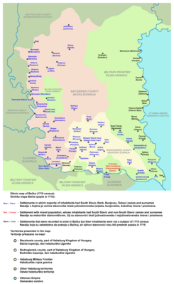
Ethnic map of Bačka (1715 census) |

|
Treaty of Passarowitz in 1718 |

|
Banat of Temeswar and Military Frontier in 1718 |
|
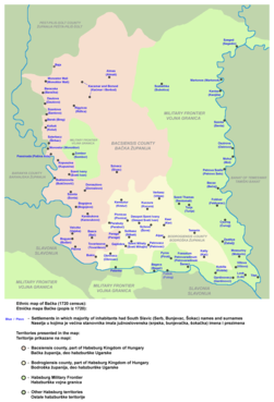
Ethnic map of Bačka (1720 census) |

|
Banat of Temeswar and Military Frontier in 1739 |

|
Districts and ethnic groups in the Banat of Temeswar in 1743 |

|
Banat of Temeswar, Kingdom of Slavonia and Military Frontier in 1745 |

|
Banat of Temeswar, Kingdom of Slavonia and Military Frontier in 1751-1778 |

|
Location map of New Serbia (1752-1764) and Slavo-Serbia (1753-1764) in modern-day Ukraine, where Serbs from Vojvodina migrated in the middle of the 18th century |

|
Location map of New Serbia (1752-1764) |

|
Detailed map of New Serbia (1752-1764) with names of the settlements. Many of the settlement names are same as settlement names in Vojvodina |

|
Location map of Slavo-Serbia (1753-1764) |

|
Detailed map of Slavo-Serbia (1753-1764) |

|
Districts and ethnic groups in the Banat of Temeswar in 1774 |
|
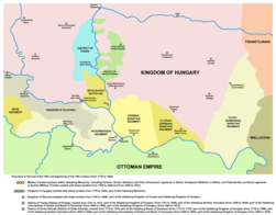
Vojvodina, 18th-19th century - Districts of Potisje and Velika Kikinda, Military Frontier sections in Banat, Bačka and Syrmia and Kingdom of Slavonia |
|
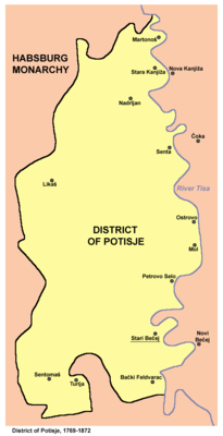
District of Potisje, 1751-1872 |

|
District of Velika Kikinda, 1774-1876 |

|
Banat, a separate Serb autonomous oblast - voivodeship, demanded at the Temeschwar assembly in 1790 |

|
Serbian Vojvodina in 1848 |

|
Principality of Serbia and Serbian Vojvodina in 1848 |

|
frontlines in Vojvodina in 1848-1849 |

|
Voivodeship of Serbia and Banat of Temeschwar in 1849-1860 |

|
Districts of the Voivodeship of Serbia and Banat of Temeschwar (1849-1850) |

|
Districts of the Voivodeship of Serbia and Banat of Temeschwar (1850-1860) |

|
Principality of Serbia and Voivodeship of Serbia and Banat of Temeschwar in 1849 |

|
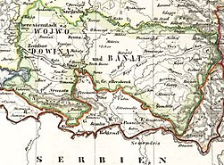
Voivodeship of Serbia and Banat of Temeschwar in 1849-1860 |
|
Voivodeship of Serbia and Banat of Temeschwar in 1849-1860 |
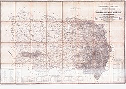
|
Voivodeship of Serbia and Banat of Temeschwar in 1849-1860 |
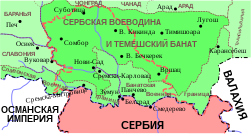
|
Voivodeship of Serbia and Banat of Temeschwar in 1849-1860 |

|
Vojvodina in the 19th century - Military Frontier and counties in Banat, Bačka and Syrmia |
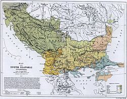
|
Ethnic map of Vojvodina in 1867 |

|
Ethnic map of Vojvodina in 1868 |
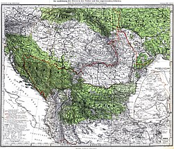
|
Slavs in Vojvodina in 1869 |

|
Ethnic map of Vojvodina in 1876 |

|
Ethnic map of Vojvodina in 1880 |
|
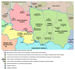
Counties in Bačka, Banat and Syrmia in 1881-1882 |

|
Ethnic map of Vojvodina in 1892 |

|
Dispersal of Slavs as of 1900 |
| [[|border|251x400px]] | Ethnographic map of Slavs (1902-24) |

|
Proposed State of Vojvodina within the proposed United States of Greater Austria in 1906 |

|
Proposed State of Vojvodina within the proposed United States of Greater Austria in 1906 |

|
Proposed State of Vojvodina within the proposed United States of Greater Austria in 1906 |

|
Magyarization of Vojvodina, 1720-1910 |
|
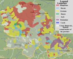
Linguistic map of Vojvodina, 1910 census |

|
Ethnic map of Vojvodina, 1910 census |

|
Ethnic map of Vojvodina in 1910 |

|
Ethnic map of Vojvodina in 1911 |

|
Ethnic map of Vojvodina in 1914 |
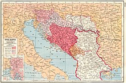
| [[|border|251x400px]] | Lands offered to Serbia by the London agreement in 1915 |

|
Ethnic map of Vojvodina in 1917 |
|
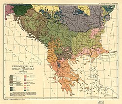
Ethnic map of Vojvodina, 1918 |

|
Cantonized Hungary with Serb and Bunjevci cantons, proposed by Miksa Strobl in 1918 |
|
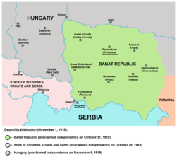
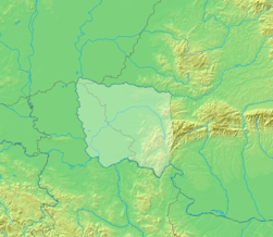
Banat Republic in 1918 |
|
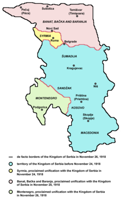
Banat Republic in 1918 |
|
Unification of Vojvodina with Serbia in 1918 |

|
Unification of Vojvodina with Serbia in 1918 |

|
Banat, Bačka and Baranja in 1918 |
|
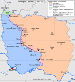
Division of Banat in 1919-1923 |
|
Banat, Bačka and Baranja in 1920 |

|
Republic of Banatia (proposed by Banatian Germans at a Paris Peace Conference in 1920) |

|
Banat, Bačka and Baranja in 1920 |

|
Language map of Vojvodina, 1921 census |

|
Oblasts in Vojvodina, 1922-1929 |
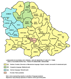
|
Language map of Vojvodina, 1931 census |

|
Danube Banovina in 1931 |

|
Danube Banovina in 1931 |
| [[|border|251x400px]] | Danube Banovina in 1931 |
| [[|border|251x400px]] | Danube Banovina in 1931 |

|
Proposal for creation of Banovina of Serbia, 1939-1941 |
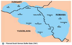
|
Proposal for creation of South German Buffer State, 1941 |

|
Occupation of Vojvodina, 1941-1944 |

|
Occupation of Vojvodina, 1941-1943 |

|
Occupation of Vojvodina, 1941-1943 |

|
Occupation of Vojvodina, 1943-1944 |
| [[|border|251x400px]] | Occupation of Vojvodina, 1941-1944 |
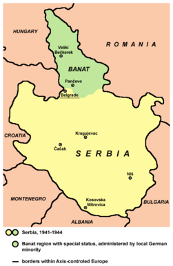
|
Serbia and Banat, 1941-1944 |

|
Danube Banovina, 1941 |
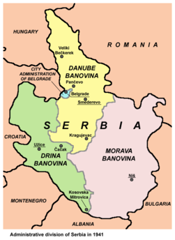
|
Danube Banovina, 1941 |

|
Serbia and Banat, 1941-1944 |

|
Liberated partisan territory in Syrmia in the end of 1942 |

|
Fascist genocide in Vojvodina in WW2 |

|
Fascist concentration camps in Vojvodina in WW2 |

|
Hungarian occupation of Bačka and Baranja, 1941-1944 |

|
Greater Serbia in Greater Yugoslavia, proposed by Stevan Moljević in 1941 |

|
Greater Serbia, proposed by Stevan Moljević in 1941 |

|
SveSrbija ("All Serbia"), an enlarged Serbia proposed by Milan Nedić in 1943 |

|
Vojvodina from October 1944 to April 1945 - territory of Military Administration in Banat, Bačka and Baranja and Syrmian frontline |

|
SAP Vojvodina as part of SFRJ |

|
SAP Vojvodina as part of SFRJ |

|
SAP Vojvodina as part of SFRJ |
|
SAP Vojvodina as part of SFRJ |

|
SAP Vojvodina as part of SFRJ |

|
SAP Vojvodina within SR Serbia |

|
Vojvodina as part of Federal Republic of Yugoslavia (1992-2003) and Serbia and Montenegro (2003-2006) |

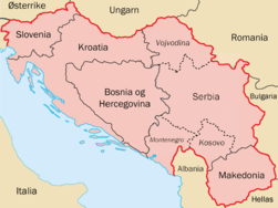
|
Central Balkans in 1998. |
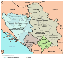
|
Central Balkans in 2010 (de facto situation). Note: Serbia does not recognizing Independence of Kosovo. |
Ethnic, linguistic and religion maps
Ethnic maps
| Ethnic map of Vojvodina in 1991 |
| Ethnic map of Vojvodina in 1991 |
| Ethnic map in 2002 |
| Ethnic map in 2002 |
| Ethnic map in 2002 |
| Ethnic map in 2011 |
| Ethnic map in 2011 |
| Ethnic map in 2011 |
| Serbs in Vojvodina in 2002 |
| Serbs in Vojvodina in 2011 |
| Hungarians in Vojvodina in 2002 |
| Hungarians in Vojvodina in 2011 |
| Slovaks, Rusyns and Czechs in Vojvodina (2002) |
| Montenegrins, Bunjevci and Croats in Vojvodina (2002) |
Linguistic maps
| Languages of Vojvodina (as of 2002) |
| Languages of Vojvodina (as of 2011) |
| Official usage of Serbian language and its scripts in Vojvodina (as of 2003) |
| Official usage of Hungarian language in Vojvodina (as of 2003) |
| Official usage of Slovak language in Vojvodina (as of 2003) |
| Official usage of Romanian language in Vojvodina (as of 2003) |
| Official usage of Rusyn, Croatian, and Czech language in Vojvodina (as of 2003) |
| Serbo-Croatian language in Vojvodina (as of 2005) |
| Serbian language in Vojvodina (as of 2006) |
| Serbian language in Vojvodina (as of 2006) |
| Historical distribution of Serbo-Croatian dialects (before 16th century migrations) |
| [[|border|251x400px]] | Shtokavian Serbo-Croatian dialects in Vojvodina |
| Shtokavian Serbo-Croatian dialects in Vojvodina |
| Shtokavian Serbo-Croatian dialects in Vojvodina |
| [[|border|251x400px]] | Shtokavian Serbo-Croatian dialects in Vojvodina |
| Shtokavian Serbo-Croatian dialects in Vojvodina |
Religion maps
| Religion in Vojvodina (2002) |
| Religion in Vojvodina (2011) |
| Eparchies and monasteries of the Serbian Orthodox Church in Vojvodina |
| Eparchies of the Serbian Orthodox Church in Vojvodina |
| Eparchies of the Serbian Orthodox Church in Vojvodina |
| Eparchies of the Serbian Orthodox Church in Vojvodina |
| Eparchies of the Serbian Orthodox Church in Vojvodina |
| New Orthodox churches in Vojvodina |
| Organization of the Catholic Church in Vojvodina |
| Muftiship of Novi Sad for Vojvodina of the Islamic Community in Serbia |
Regional maps
| Map of Bačka region |
| Ethnic map of Bačka region |
| Map of Banat region |
| Ethnic map of Banat region |
| Map of Srem region |
| Map of Srem region |
| Map of Šajkaška region |
| Map of Mačva region |
| Map of Mačva region |
District maps
| West Bačka district |
| West Bačka district |
| Ethnic map of West Bačka district |
| North Bačka district |
| North Bačka district |
| Ethnic map of North Bačka district |
| South Bačka district |
| South Bačka district |
| Ethnic map of South Bačka district |
| Srem district |
| Srem district |
| Ethnic map of Srem district |
| North Banat district |
| North Banat district |
| Ethnic map of North Banat district |
| Central Banat district |
| Central Banat district |
| Ethnic map of Central Banat district |
| South Banat district |
| South Banat district |
| Ethnic map of South Banat district |
Municipality maps
-
Ada Municipality
-
Alibunar Municipality
-
Apatin Municipality
-
Bač Municipality
-
Bačka Palanka Municipality
-
Bačka Topola Municipality
-
Bačka Topola Municipality, ethnic map
-
Bački Petrovac Municipality
-
Bečej Municipality
-
Bela Crkva Municipality
-
Beočin Municipality
-
Čoka Municipality
-
Inđija Municipality
-
Irig Municipality
-
Kanjiža Municipality
-
Kikinda Municipality
-
Kovačica Municipality
-
Kovin Municipality
-
Kula Municipality
-
Mali Iđoš Municipality
-
Mali Iđoš Municipality - ethnic map
-
Nova Crnja Municipality
-
Novi Bečej Municipality
-
Novi Kneževac Municipality
-
Novi Sad City
-
Novi Sad City - municipalities
-
Novi Sad City - municipalities
-
Novi Sad Municipality
-
Novi Sad - former municipalities
-
Odžaci Municipality
-
Opovo Municipality
-
Pančevo City
-
Pećinci Municipality
-
Petrovaradin Municipality
-
Plandište Municipality
-
Ruma Municipality
-
Sečanj Municipality
-
Senta Municipality
-
Šid Municipality
-
Sombor City
-
Srbobran Municipality
-
Sremska Mitrovica City
-
Sremski Karlovci Municipality
-
Stara Pazova Municipality
-
Subotica City
-
Subotica City
-
Subotica City - ethnic map
-
Temerin Municipality
-
Titel Municipality
-
Vrbas Municipality
-
Vršac Municipality
-
Žabalj Municipality
-
Žitište Municipality
-
Zrenjanin City
City maps
-
Novi Sad - urban local communities
-
Novi Sad - city quarters
-
Novi Sad - city quarters, ethnic map
-
Novi Sad - prehistoric settlements
-
Novi Sad - ancient settlements
-
Novi Sad - 5th-10th century settlements
-
Novi Sad - 13th-16th century settlements
-
Novi Sad - 16th-17th century settlements
-
Novi Sad - 18th century settlements
-
Novi Sad - city development, 1716-2009
-
Novi Sad - former urban municipalities, 1980-1989
-
Subotica - urban local communities
-
Subotica - city quarters
-
Subotica - city quarters, ethnic map
-
Zrenjanin - urban local communities
-
Pančevo - urban local communities
-
Sombor - urban local communities
-
Sombor - city quarters
-
Kikinda - urban local communities
-
Sremska Mitrovica - urban local communities
-
Vršac - urban local communities
Old maps
| Old map from 1528 showing settlement named Bistritz (Bistrica) in the territory of present-day Novi Sad |
| Old map from the 16th century showing settlement named Bistritz (Bistrica) in the territory of present-day Novi Sad |
| Old map of Banat from 1568 with the name Rasciani |
| Old map from 1590 in which name Rascia is located in Banat |
| Old map from first half of the 17th century in which name Rascia is located in Banat |
| Old map from 1645 in which name Rascia is located in Banat |
| Old map from 1661 in which name Rascia is located in Banat and Srem |
| Old map of Novi Sad (Ratzen Stadt) with surroundings (beginning of the 18th century) |
| Old map of Novi Sad (Ratzenstatt) with surroundings (including Almaš village) in 1716-1717 |
| Old map of Novi Sad (Ratzen Stadt) from 1745 |
| Old map of Novi Sad from 1745 |
| Old map of Novi Sad from 1805 |
| Old map of Novi Sad from 1845 |
Regional cooperation maps
| Vojvodina as part of Danube-Kris-Mures-Tisa Euroregion, 1997-2004 |
| Vojvodina as part of Danube-Kris-Mures-Tisa Euroregion, 1997-2004 |
| Vojvodina as part of Danube-Kris-Mures-Tisa Euroregion, since 2004 |
Political maps
| Local elections in Vojvodina in 2004 |
| Local elections in Vojvodina in 2008 |
| Local elections in Vojvodina in 2012 |
| Republic of Vojvodina, proposed by the League of Social Democrats of Vojvodina |
| Hungarian Regional Autonomy, proposed by the Alliance of Vojvodina Hungarians |
Notes and references
|
General remarks:
|


