Category:Brea Hill, Cornwall
hill in Cornwall, England  | |||||
| Upload media | |||||
| Instance of | |||||
|---|---|---|---|---|---|
| Location | St Minver Lowlands, Cornwall, South West England, England | ||||
 | |||||
Media in category "Brea Hill, Cornwall"
The following 16 files are in this category, out of 16 total.
-

-
 Brae Hill from St George's Well cove - geograph.org.uk - 1468268.jpg 640 × 426; 76 KB
-
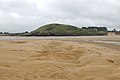
 Brea Hill, Trebetherick - geograph.org.uk - 29595.jpg 640 × 385; 88 KB
-
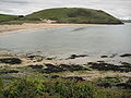
 Daymer Bay and Brea Hill - geograph.org.uk - 930055.jpg 640 × 457; 144 KB
-
 DaymerBayBreaHillCornwallUK.jpg 640 × 480; 79 KB
-

-

-
 Padstow Ferry - geograph.org.uk - 1298023.jpg 640 × 480; 50 KB
-
 Remains of emplacement on Gun Point - geograph.org.uk - 1468275.jpg 640 × 416; 115 KB
-

-

-
 Trebetherick Point from Brea Hill - geograph.org.uk - 1651582.jpg 640 × 480; 66 KB
-
 View from Harbour Cove (1) - geograph.org.uk - 1470321.jpg 640 × 403; 73 KB
-
 View from Harbour Cove (2) - geograph.org.uk - 1470323.jpg 640 × 429; 85 KB
-
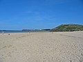
 Beach near Rock Cornwall - geograph.org.uk - 289373.jpg 640 × 480; 60 KB
-
 Beach north of Rock Cornwall - geograph.org.uk - 289377.jpg 640 × 480; 74 KB


_-_geograph.org.uk_-_1473409.jpg)

_-_geograph.org.uk_-_1470321.jpg)
_-_geograph.org.uk_-_1470323.jpg)

