File:600x600 GMT France topo-R1.jpg
No higher resolution available.
600x600_GMT_France_topo-R1.jpg (600 × 600 pixels, file size: 343 KB, MIME type: image/jpeg)
Captions
Captions
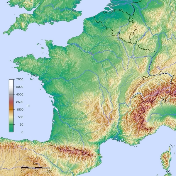
Topographical Map of France
- Carte France GMT topographique R1
- Source:travail personnel
- licence:
The map has been created with the Generic Mapping Tools: https://www.generic-mapping-tools.org/ using one or more of these public-domain datasets for the relief:
|

|
Permission is granted to copy, distribute and/or modify this document under the terms of the GNU Free Documentation License, Version 1.2 or any later version published by the Free Software Foundation; with no Invariant Sections, no Front-Cover Texts, and no Back-Cover Texts. A copy of the license is included in the section entitled GNU Free Documentation License. |
- Auteur:Wikisoft* @@@-fr 10:22, 12 January 2013 (UTC)
-
- Projection Equirectangulaire
- top:52.30°
- bottom:41.00°
- left:-6.00°
- right:10.00°
File history
Click on a date/time to view the file as it appeared at that time.
| Date/Time | Thumbnail | Dimensions | User | Comment | |
|---|---|---|---|---|---|
| current | 10:22, 12 January 2013 | | 600 × 600 (343 KB) | Wikisoft* (talk | contribs) | *Carte France GMT topographique R1 *Source:travail personnel *licence:{{GFDL-GMT}} *Auteur:~~~~ *Category:France *{{Atelier graphique carte}} *Projection Equirectangulaire *top:52.15 *bottom:41.00 *left:-6.00 *right:10.05 |
You cannot overwrite this file.
File usage on Commons
There are no pages that use this file.
File usage on other wikis
The following other wikis use this file:
- Usage on az.wikipedia.org
- Usage on bg.wikipedia.org
- Usage on bxr.wikipedia.org
- Usage on de.wikipedia.org
- Usage on el.wikipedia.org
- Usage on en.wikipedia.org
- Usage on eu.wikipedia.org
- Usage on fr.wikipedia.org
- Usage on hi.wikipedia.org
- Usage on hy.wikipedia.org
- Usage on id.wikipedia.org
- Usage on ja.wikipedia.org
- Usage on ko.wikipedia.org
- Usage on lfn.wikipedia.org
- Usage on nds.wikipedia.org
- Usage on pt.wikipedia.org
- Usage on rm.wikipedia.org
- Usage on ru.wikipedia.org
- Usage on sl.wikipedia.org
- Usage on uk.wikipedia.org
- Usage on uz.wikipedia.org
- Usage on zh.wikipedia.org