File:Aix-en-Provence location map.svg

Size of this PNG preview of this SVG file: 573 × 600 pixels. Other resolutions: 229 × 240 pixels | 458 × 480 pixels | 734 × 768 pixels | 978 × 1,024 pixels | 1,956 × 2,048 pixels | 618 × 647 pixels.
Original file (SVG file, nominally 618 × 647 pixels, file size: 1.88 MB)
Captions
Captions
Add a one-line explanation of what this file represents
Summary edit
| Description |
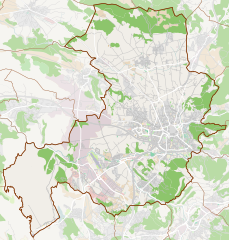
Français : Carte d'Aix-en-Provence. Limites : |
| Date | |
| Source | Own work from OpenStreetMap |
| Author | Flappiefh |
Licensing edit
I, the copyright holder of this work, hereby publish it under the following license:
This file is licensed under the Creative Commons Attribution-Share Alike 4.0 International license.
- You are free:
- to share – to copy, distribute and transmit the work
- to remix – to adapt the work
- Under the following conditions:
- attribution – You must give appropriate credit, provide a link to the license, and indicate if changes were made. You may do so in any reasonable manner, but not in any way that suggests the licensor endorses you or your use.
- share alike – If you remix, transform, or build upon the material, you must distribute your contributions under the same or compatible license as the original.
File history
Click on a date/time to view the file as it appeared at that time.
| Date/Time | Thumbnail | Dimensions | User | Comment | |
|---|---|---|---|---|---|
| current | 22:19, 15 August 2019 | | 618 × 647 (1.88 MB) | Flappiefh (talk | contribs) | User created page with UploadWizard |
You cannot overwrite this file.
File usage on Commons
There are no pages that use this file.
File usage on other wikis
The following other wikis use this file:
- Usage on eo.wikipedia.org
- Usage on fr.wikipedia.org
- Montperrin
- Puyricard
- Luynes (Bouches-du-Rhône)
- Les Milles
- Aix-en-Provence
- Pont-de-l'Arc
- Célony
- Cité du livre
- Muséum d'histoire naturelle d'Aix-en-Provence
- Quartier des Pinchinats
- Couteron
- Histoire d'Aix-en-Provence au Moyen Âge
- Pontès
- Théâtre antique d'Aix-en-Provence
- La Duranne
- Les Granettes
- Stade Georges-Carcassonne
- Les Platanes
- Aérodrome d'Aix - Les Milles
- Stade Maurice-David
- Parc Jourdan
- Quartier Mazarin
- Hôtel Peyronetti
- Hôtel de Suffren
- Hôtel de Foresta
- Hôtel Ravel d'Esclapon
- Nécropole nationale de Luynes
- Caserne Forbin
- Bastide du Jas de Bouffan
- Hôtel de Grimaldi-Régusse
- Aréna du Pays d'Aix
- Modèle:Géolocalisation/Aix-en-Provence
- Bastide la Torse
- Campagne Bruguier
- Chapelle des Pénitents bleus d'Aix-en-Provence
- Chapelle des Ursulines d'Aix-en-Provence
- Château de Lenfant
- Château de Montjustin (Aix-en-Provence)
- Château du Seuil
- Hôtel du Poët
- Collège Mignet
- Collège des Jésuites d'Aix-en-Provence
- Enclos des Décormis
- Fontaine des Augustins (Aix-en-Provence)
- Fontaine des Bagniers
View more global usage of this file.