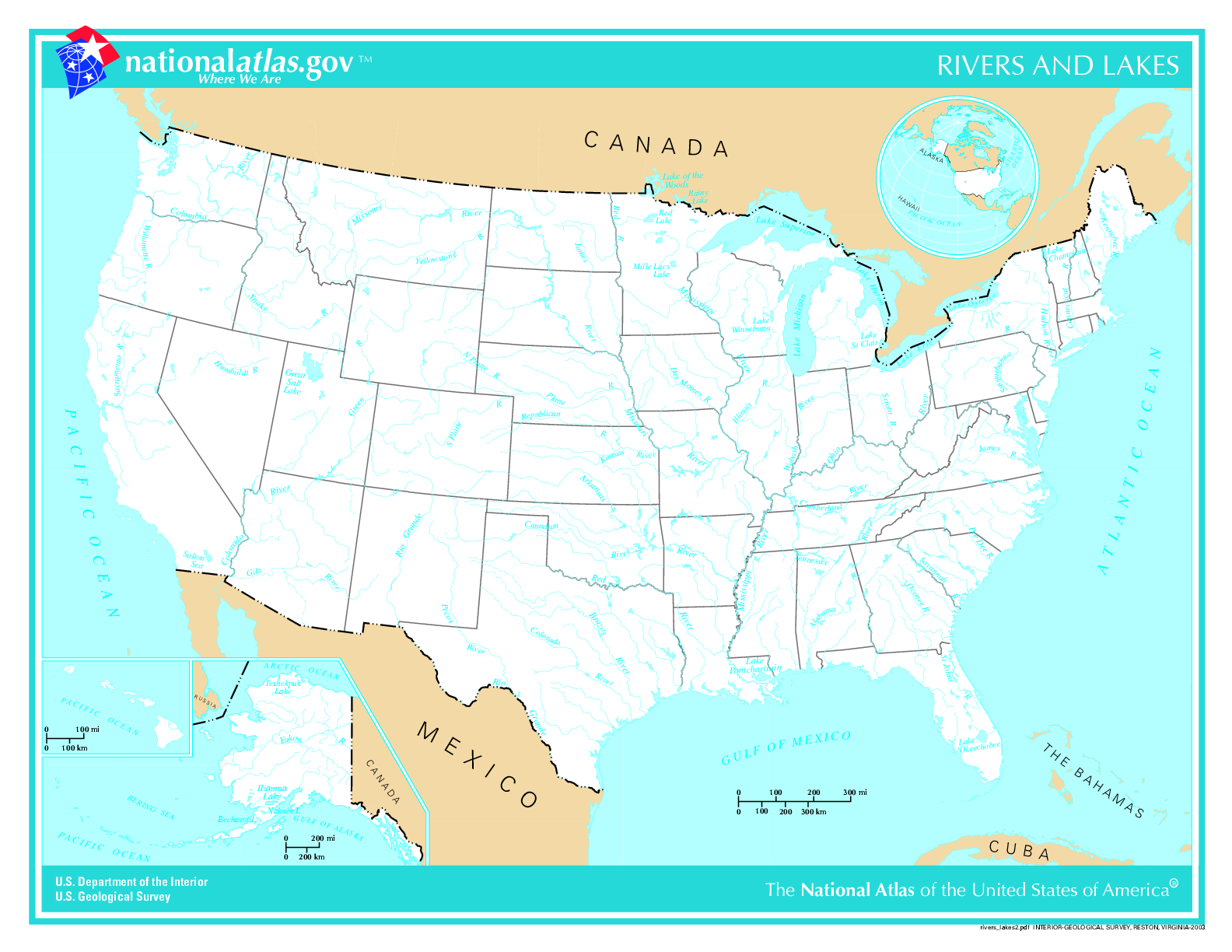
File:US map - rivers and lakes.png
Size of this preview: 776 × 600 pixels. Other resolutions: 311 × 240 pixels | 621 × 480 pixels | 994 × 768 pixels | 1,280 × 989 pixels | 1,584 × 1,224 pixels.
Original file (1,584 × 1,224 pixels, file size: 301 KB, MIME type: image/png)
Captions
Captions
Add a one-line explanation of what this file represents

|
This map image could be re-created using vector graphics as an SVG file. This has several advantages; see Commons:Media for cleanup for more information. If an SVG form of this image is available, please upload it and afterwards replace this template with
{{vector version available|new image name}}.
It is recommended to name the SVG file “US map - rivers and lakes.svg”—then the template Vector version available (or Vva) does not need the new image name parameter. |
Summary edit
.
- Credits
- Author: US Department of Interior
- Source: http://nationalatlas.gov, there also available as PDF
This map was obtained from an edition of the National Atlas of the United States. Like almost all works of the U.S. federal government, works from the National Atlas are in the public domain in the United States.
Online access: NationalAtlas.gov | 1970 print edition: Library of Congress, Perry-Castañeda Library
|
List of images provided by user Duesentrieb (This link helps me to find all my images) -- Duesentrieb
File history
Click on a date/time to view the file as it appeared at that time.
| Date/Time | Thumbnail | Dimensions | User | Comment | |
|---|---|---|---|---|---|
| current | 15:11, 12 November 2004 | | 1,584 × 1,224 (301 KB) | Duesentrieb (talk | contribs) | Rivers and lakes in the US; Dept. of Interior, Public Domain |
You cannot overwrite this file.
File usage on Commons
The following 5 pages use this file:
File usage on other wikis
The following other wikis use this file:
- Usage on bg.wikipedia.org
- Usage on fr.wikiversity.org
- Usage on ro.wikipedia.org
- Usage on sl.wikipedia.org
- Usage on uk.wikipedia.org