File:Achaemenid Empire at its greatest extent according to Oxford Atlas of World History 2002.jpg

Size of this preview: 800 × 600 pixels. Other resolutions: 320 × 240 pixels | 640 × 480 pixels | 1,024 × 768 pixels | 1,280 × 960 pixels | 2,560 × 1,920 pixels | 3,000 × 2,250 pixels.
Original file (3,000 × 2,250 pixels, file size: 1.71 MB, MIME type: image/jpeg)
| This is a file from the Wikimedia Commons. Information from its description page there is shown below. Commons is a freely licensed media file repository. You can help. |


Summary
| Description |
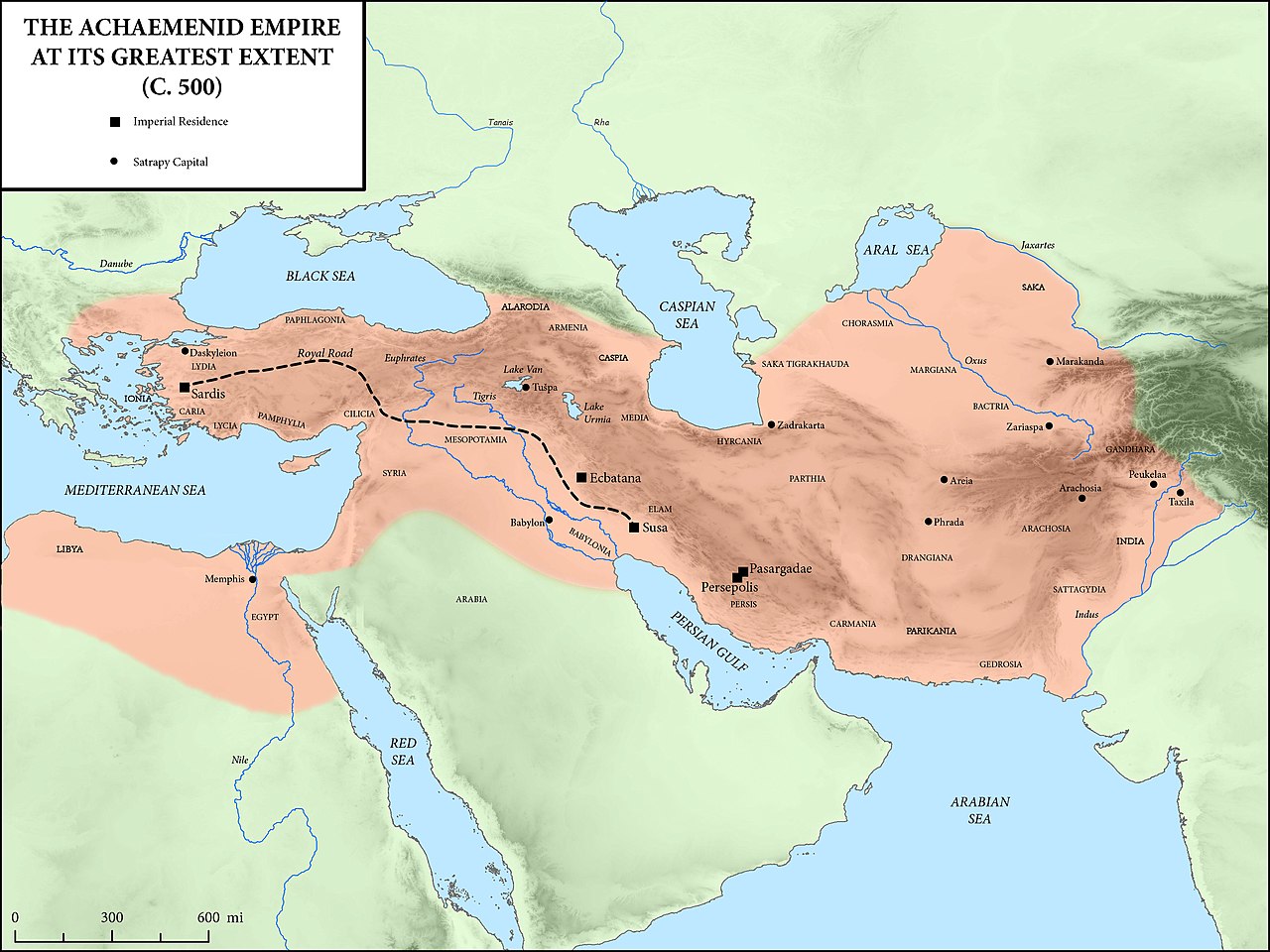
English: Achaemenid Empire at its greatest extent according to Oxford Atlas of World History 2002. Sources:
|
| Date | |
| Source |
This file was derived from: The Achaemenid Empire at its Greatest Extent.jpg |
| Author |
Original creator: Mossmaps |
Licensing
This file is licensed under the Creative Commons Attribution-Share Alike 4.0 International license.
- You are free:
- to share – to copy, distribute and transmit the work
- to remix – to adapt the work
- Under the following conditions:
- attribution – You must give appropriate credit, provide a link to the license, and indicate if changes were made. You may do so in any reasonable manner, but not in any way that suggests the licensor endorses you or your use.
- share alike – If you remix, transform, or build upon the material, you must distribute your contributions under the same or compatible license as the original.
File history
Click on a date/time to view the file as it appeared at that time.
| Date/Time | Thumbnail | Dimensions | User | Comment | |
|---|---|---|---|---|---|
| current | 15:06, 12 August 2022 | | 3,000 × 2,250 (1.71 MB) | Claude Zygiel | Coastlines of the 5th cen. BC: see please the discussion file. This is not an ancient map. |
| 15:15, 20 October 2018 |  | 3,000 × 2,250 (2.62 MB) | पाटलिपुत्र | User created page with UploadWizard |
File usage
The following pages on the English Wikipedia use this file (pages on other projects are not listed):
- Achaemenid Empire
- Achaemenid coinage
- Ancient history
- Angarum
- Apadana hoard
- Classical Anatolia
- Comana Pontica
- Cursus publicus
- DNa inscription
- Historic roads and trails
- History of Afghanistan
- History of Asia
- History of Iran
- Maka (satrapy)
- Return to Zion
- Royal Road
- Yehud Medinata
- User:Falcaorib
- User:Lodzdeena/Əfqanıstan tarixi
- User:Northamerica1000/Portals of the world
- User talk:LouisAragon/Archive 4
- Portal:Afghanistan
- Portal:Asia
- Portal:Iran
Global file usage
The following other wikis use this file:
- Usage on ar.wikipedia.org
- Usage on bg.wikipedia.org
- Usage on bn.wikipedia.org
- Usage on ceb.wikipedia.org
- Usage on cs.wikipedia.org
- Usage on de.wikipedia.org
- Usage on es.wikipedia.org
- Usage on eu.wikipedia.org
- Usage on fa.wikipedia.org
- Usage on fr.wikipedia.org
- Usage on gl.wikipedia.org
- Usage on hy.wikipedia.org
- Usage on ka.wikipedia.org
- Usage on lfn.wikipedia.org
- Usage on mk.wikipedia.org
- Usage on nl.wikipedia.org
- Usage on pnb.wikipedia.org
- Usage on pt.wikipedia.org
- Usage on ru.wikipedia.org
- Usage on sq.wikipedia.org
- Usage on ta.wikipedia.org
- Usage on uk.wikipedia.org
- Usage on ur.wikipedia.org
- Usage on vi.wikipedia.org
- Usage on www.wikidata.org
- Usage on zh.wikipedia.org