Original file (5,342 × 1,746 pixels, file size: 4.16 MB, MIME type: image/jpeg)
| This is a file from the Wikimedia Commons. Information from its description page there is shown below. Commons is a freely licensed media file repository. You can help. |
Summary
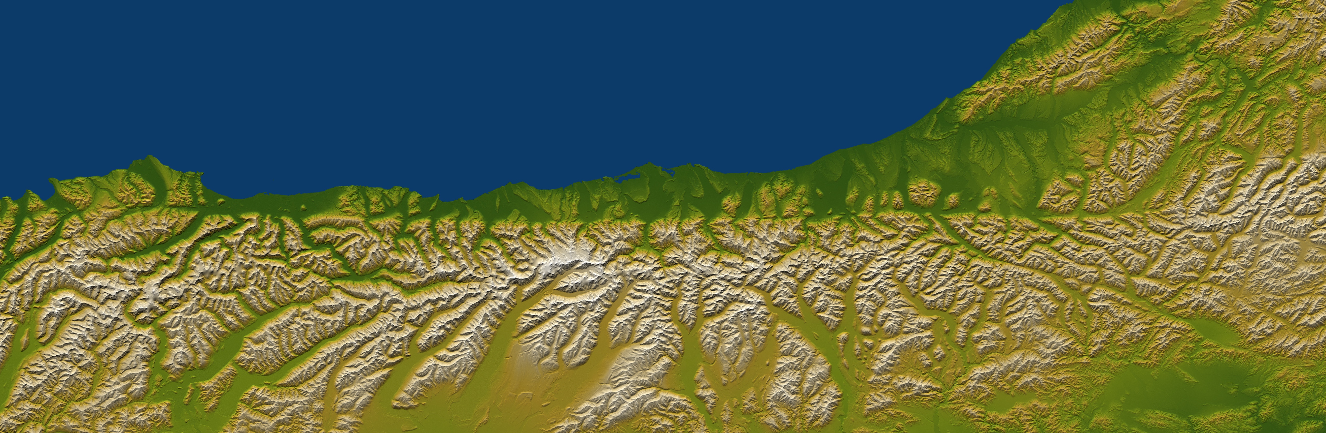
| Description | Shaded and colored image from the Shuttle Radar Topography Mission elevation model of New Zealand's Alpine Fault. Northwest is towards the top. |
| Date | |
| Source | [1] |
| Author | NASA/JPL/NGA |
| Permission (Reusing this file) |
Public domain - original work of NASA |
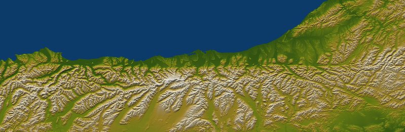
| Other versions | Image:Alpine Fault SRTM (vertical).jpg |
.jpg)
Description from [2]:
The Alpine fault runs parallel to, and just inland of, much of the west coast of New Zealand's South Island. This view was created from the near-global digital elevation model produced by the Shuttle Radar Topography Mission (SRTM) and is almost 500 kilometers (just over 300 miles) wide. Northwest is toward the top. The fault is extremely distinct in the topographic pattern, nearly slicing this scene in half lengthwise.
In a regional context, the Alpine fault is part of a system of faults that connects a west dipping subduction zone to the northeast with an east dipping subduction zone to the southwest, both of which occur along the juncture of the Indo-Australian and Pacific tectonic plates. Thus, the fault itself constitutes the major surface manifestation of the plate boundary here. Offsets of streams and ridges evident in the field, and in this view of SRTM data, indicate right-lateral fault motion. But convergence also occurs across the fault, and this causes the continued uplift of the Southern Alps, New Zealand's largest mountain range, along the southeast side of the fault.
Two visualization methods were combined to produce this image: shading and color coding of topographic height. The shade image was derived by computing topographic slope in the northwest-southeast (image top to bottom) direction, so that northwest slopes appear bright and southeast slopes appear dark. Color coding is directly related to topographic height, with green at the lower elevations, rising through yellow and tan, to white at the highest elevations.
Elevation data used in this image were acquired by the Shuttle Radar Topography Mission aboard the Space Shuttle Endeavour, launched on Feb. 11, 2000. SRTM used the same radar instrument that comprised the Spaceborne Imaging Radar-C/X-Band Synthetic Aperture Radar (SIR-C/X-SAR) that flew twice on the Space Shuttle Endeavour in 1994. SRTM was designed to collect 3-D measurements of the Earth's surface. To collect the 3-D data, engineers added a 60-meter (approximately 200-foot) mast, installed additional C-band and X-band antennas, and improved tracking and navigation devices. The mission is a cooperative project between NASA, the National Geospatial-Intelligence Agency (NGA) of the U.S. Department of Defense and the German and Italian space agencies. It is managed by NASA's Jet Propulsion Laboratory, Pasadena, Calif., for NASA's Earth Science Enterprise, Washington, D.C.
Size: 495 kilometers (307 miles) by 162 kilometers (100 miles) Location: 43.2 degrees South latitude, 170.5 degrees East longitude Orientation: Northwest toward the top Image Data: Shaded and colored SRTM elevation model Date Acquired: February 2000
This image or video was catalogued by Jet Propulsion Laboratory of the United States National Aeronautics and Space Administration (NASA) under Photo ID: PIA06661. This tag does not indicate the copyright status of the attached work. A normal copyright tag is still required. See Commons:Licensing. Other languages:
|
Licensing
| This file is in the public domain in the United States because it was solely created by NASA. NASA copyright policy states that "NASA material is not protected by copyright unless noted". (See Template:PD-USGov, NASA copyright policy page or JPL Image Use Policy.) | ||
 |
Warnings:
|
This image uses high-resolution digital topography data from NASA's Shuttle Radar Topography Mission (SRTM) at JPL-Caltech [6]. It is in the public domain in the United States.
|
 | |
File history
Click on a date/time to view the file as it appeared at that time.
| Date/Time | Thumbnail | Dimensions | User | Comment | |
|---|---|---|---|---|---|
| current | 12:30, 2 June 2010 | 5,342 × 1,746 (4.16 MB) | Avenue | Saved with higher quality, to reduce the compression artefacts (e.g. by the coast) | |
| 05:04, 22 May 2006 | 5,342 × 1,746 (1.4 MB) | Avenue | {{Information| |Description=Shaded and colored image from the Shuttle Radar Topography Mission (SRTM) elevation model of New Zealand's Alpine Fault. |Source=[http://photojournal.jpl.nasa.gov/catalog/PIA06661] |Date=February 2000 |Author |
File usage
Global file usage
The following other wikis use this file:
- Usage on de.wikipedia.org
- Usage on en.wikiversity.org
- Usage on hu.wikipedia.org
- Usage on it.wikipedia.org
- Usage on mk.wikipedia.org
- Usage on nl.wikipedia.org
- Usage on pl.wikipedia.org
- Usage on ru.wikipedia.org
- Usage on sr.wikipedia.org
- Usage on tr.wikipedia.org
- Usage on uk.wikipedia.org
- Usage on vi.wikipedia.org