Size of this preview: 417 × 599 pixels. Other resolutions: 167 × 240 pixels | 334 × 480 pixels | 535 × 768 pixels | 713 × 1,024 pixels | 1,338 × 1,921 pixels.
Original file (1,338 × 1,921 pixels, file size: 492 KB, MIME type: image/jpeg)
| This is a file from the Wikimedia Commons. Information from its description page there is shown below. Commons is a freely licensed media file repository. You can help. |
Summary
| Description |
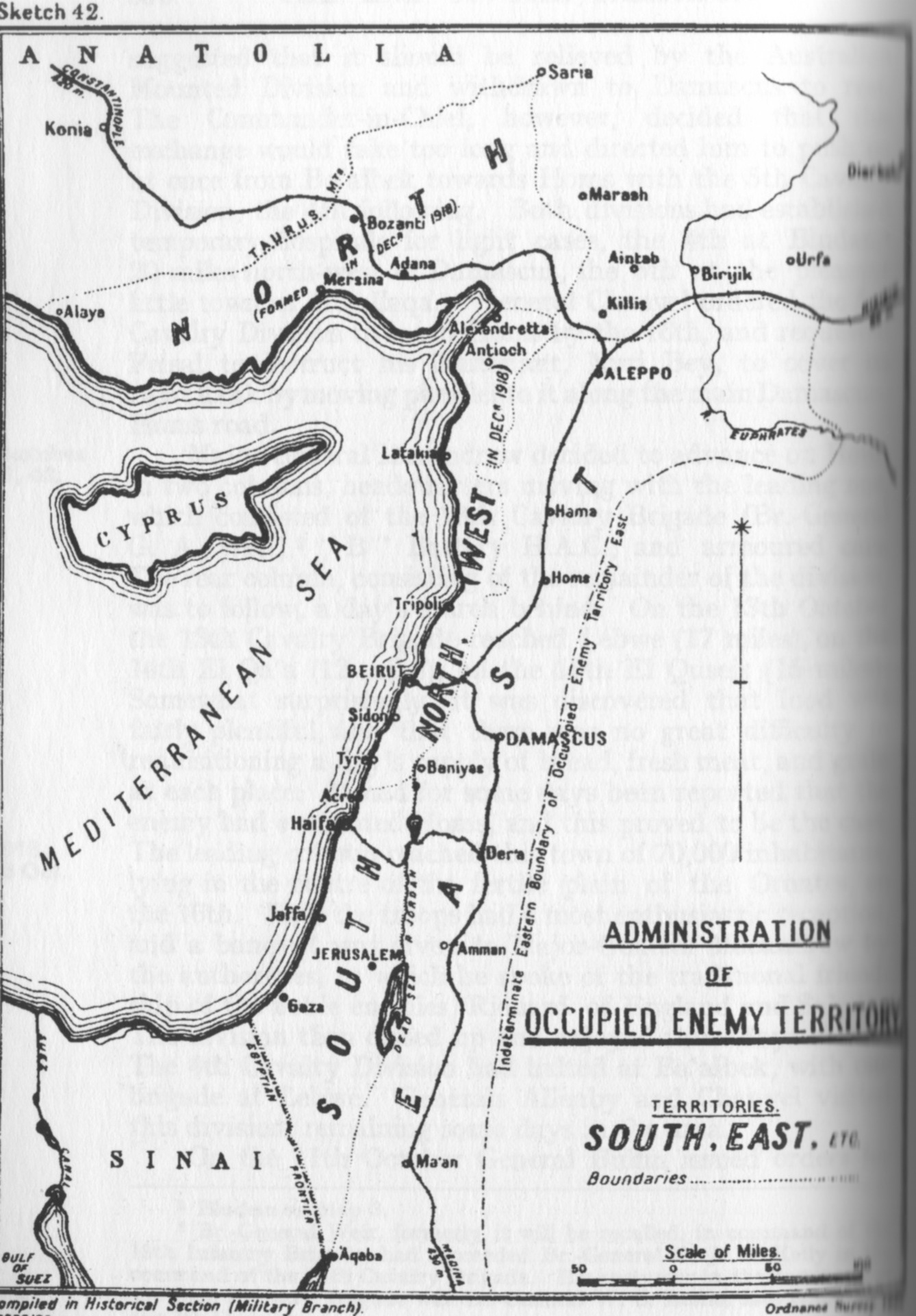
English: Falls Sketch Map 42 Administration of occupied territory |
| Date | |
| Source | Official History of the Great War Based on Official Documents by Direction of the Historical Section of the Committee of Imperial Defence; Military Operations Egypt & Palestine from June 1917 to the End of the War Vol. 2 Part II |
| Author | Cyril Falls, A. F. Becke (maps) |
| Other versions |
 |
Licensing
This work created by the United Kingdom Government is in the public domain.
This is because it is one of the following:
HMSO has declared that the expiry of Crown Copyrights applies worldwide (ref: HMSO Email Reply)
|
 |
File history
Click on a date/time to view the file as it appeared at that time.
| Date/Time | Thumbnail | Dimensions | User | Comment | |
|---|---|---|---|---|---|
| current | 06:30, 9 September 2012 | | 1,338 × 1,921 (492 KB) | RoslynSKP | Uploading a public-domain item using File Upload Wizard |
| 06:14, 9 September 2012 |  | 1,338 × 1,921 (492 KB) | RoslynSKP | Uploading a public-domain item using File Upload Wizard |
File usage
The following pages on the English Wikipedia use this file (pages on other projects are not listed):
Global file usage
The following other wikis use this file:
- Usage on ar.wikipedia.org
- Usage on fr.wikipedia.org
- Usage on ko.wikipedia.org
- Usage on sr.wikipedia.org