No higher resolution available.
French_West_Africa_1913_map.png (440 × 363 pixels, file size: 46 KB, MIME type: image/png)
| This is a file from the Wikimedia Commons. Information from its description page there is shown below. Commons is a freely licensed media file repository. You can help. |

|
This map image could be re-created using vector graphics as an SVG file. This has several advantages; see Commons:Media for cleanup for more information. If an SVG form of this image is available, please upload it and afterwards replace this template with
{{vector version available|new image name}}.
It is recommended to name the SVG file “French West Africa 1913 map.svg”—then the template Vector version available (or Vva) does not need the new image name parameter. |
Summary
| Description |
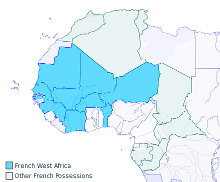
English: I created this, using the Gimp, from a blank GPL Map on Wikipedia, 2007-06-15.
Released to Public Domain |
| Date | 15 June 2007 (original upload date) |
| Source | Transferred from en.wikipedia to Commons. |
| Author | T L Miles at English Wikipedia |
Licensing
| This work has been released into the public domain by its author, T L Miles at English Wikipedia. This applies worldwide. In some countries this may not be legally possible; if so: T L Miles grants anyone the right to use this work for any purpose, without any conditions, unless such conditions are required by law. |
Original upload log
The original description page was here. All following user names refer to en.wikipedia.
- 2007-06-15 15:18 T L Miles 440×363×8 (47401 bytes) I created this, using the Gimp, from a blank GPL Map on Wikipedia, 2007-06-15. Released to Public Domain
File history
Click on a date/time to view the file as it appeared at that time.
| Date/Time | Thumbnail | Dimensions | User | Comment | |
|---|---|---|---|---|---|
| current | 18:47, 13 April 2013 | | 440 × 363 (46 KB) | Fry1989 | vandalism |
| 16:02, 13 April 2013 |  | 440 × 363 (35 KB) | Mouh2jijel | Reverted to version as of 07:47, 9 April 2013 | |
| 15:11, 13 April 2013 |  | 440 × 363 (46 KB) | Omar-toons | Reverted to version as of 15:49, 21 December 2007 rv file degradation by user:Adrian12, a sockpuppet of user:Bokpasa | |
| 07:47, 9 April 2013 |  | 440 × 363 (35 KB) | Mouh2jijel | Reverted to version as of 15:51, 7 April 2012 | |
| 00:32, 14 May 2012 |  | 440 × 363 (46 KB) | Omar-Toons | Reverted to version as of 15:49, 21 December 2007 - reverting file degradation | |
| 15:51, 7 April 2012 |  | 440 × 363 (35 KB) | Adrian12 | Frontiers of Italy and Spain | |
| 15:49, 21 December 2007 |  | 440 × 363 (46 KB) | File Upload Bot (Magnus Manske) | {{BotMoveToCommons|en.wikipedia}} {{Information |Description={{en|I created this, using the Gimp, from a blank GPL Map on Wikipedia, 2007-06-15. Released to Public Domain}} |Source=Transfered from [http://en.wikipedia.org en.wikipedia] |Date=2007-06-15 ( |
File usage
The following pages on the English Wikipedia use this file (pages on other projects are not listed):
Global file usage
The following other wikis use this file:
- Usage on af.wikipedia.org
- Usage on ar.wikipedia.org
- Usage on bn.wikipedia.org
- Usage on br.wikipedia.org
- Usage on es.wikipedia.org
- Usage on fi.wikipedia.org
- Usage on fr.wikipedia.org
- Usage on ha.wikipedia.org
- Usage on he.wikipedia.org
- Usage on hu.wikipedia.org
- Usage on id.wikipedia.org
- Usage on is.wikipedia.org
- Usage on it.wikipedia.org
- Usage on ko.wikipedia.org
- Usage on ky.wikipedia.org
- Usage on lt.wikipedia.org
- Usage on ml.wikipedia.org
- Usage on mt.wikipedia.org
- Usage on nl.wikipedia.org
- Usage on ru.wikipedia.org
- Usage on sd.wikipedia.org
- Usage on si.wikipedia.org
- Usage on tum.wikipedia.org
- Usage on uk.wikipedia.org
- Usage on vi.wikipedia.org