
Size of this PNG preview of this SVG file: 429 × 600 pixels. Other resolutions: 172 × 240 pixels | 343 × 480 pixels | 549 × 768 pixels | 732 × 1,024 pixels | 1,465 × 2,048 pixels | 744 × 1,040 pixels.
Original file (SVG file, nominally 744 × 1,040 pixels, file size: 878 KB)
| This is a file from the Wikimedia Commons. Information from its description page there is shown below. Commons is a freely licensed media file repository. You can help. |
Summary
| Description |
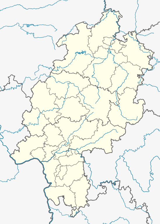
Deutsch: Positionskarte Hessen, Deutschland. Geographische Begrenzung der Karte:
English: Location map Hesse, Germany. Geographic limits of the map:
|
| Date | |
| Source |
Own work
|
| Author | TUBS, versions later 2013-11: NordNordWest |
| Other versions |
Derivative works of this file: Location map of the scope of the Rhein-Main-Verkehrsverbund.svg
|
| SVG development |

Licensing
I, the copyright holder of this work, hereby publish it under the following licenses:

|
Permission is granted to copy, distribute and/or modify this document under the terms of the GNU Free Documentation License, Version 1.2 or any later version published by the Free Software Foundation; with no Invariant Sections, no Front-Cover Texts, and no Back-Cover Texts. A copy of the license is included in the section entitled GNU Free Documentation License. |
This file is licensed under the Creative Commons Attribution-Share Alike 3.0 Unported, 2.5 Generic, 2.0 Generic and 1.0 Generic license.
- You are free:
- to share – to copy, distribute and transmit the work
- to remix – to adapt the work
- Under the following conditions:
- attribution – You must give appropriate credit, provide a link to the license, and indicate if changes were made. You may do so in any reasonable manner, but not in any way that suggests the licensor endorses you or your use.
- share alike – If you remix, transform, or build upon the material, you must distribute your contributions under the same or compatible license as the original.
You may select the license of your choice.
File history
Click on a date/time to view the file as it appeared at that time.
| Date/Time | Thumbnail | Dimensions | User | Comment | |
|---|---|---|---|---|---|
| current | 08:25, 12 November 2013 | | 744 × 1,040 (878 KB) | NordNordWest | c |
| 20:38, 11 November 2013 |  | 744 × 1,040 (878 KB) | NordNordWest | upd | |
| 20:37, 11 November 2013 |  | 744 × 1,040 (878 KB) | NordNordWest | upd | |
| 10:46, 28 January 2009 |  | 868 × 1,164 (773 KB) | TUBS | == Summary == {{Information |Description= {{de|Positionskarte Hessen, Deutschland. Geographische Begrenzung der Karte:}} {{en|Location map Hesse, Germany. Geographic limits of the map:}} * N: 51.756153° N * S: 49.31706° N |
File usage
More than 100 pages use this file. The following list shows the first 100 pages that use this file only. A full list is available.
- Ahnatal
- Altenstadt, Hesse
- Altstadt (Frankfurt am Main)
- Bad Arolsen
- Bad Hersfeld
- Bad Homburg
- Bahnhofsviertel
- Battenberg (Eder)
- Bensheim
- Biebrich (Wiesbaden)
- Bierstadt
- Bischofsheim, Hesse
- Bockenheim (Frankfurt am Main)
- Bonames
- Bornheim (Frankfurt am Main)
- Büdingen
- Darmstadt
- Dieburg
- Dillenburg
- Dornbusch (Frankfurt am Main)
- Eckenheim
- Einhausen, Hesse
- Eppstein
- Eschborn
- Eschersheim
- Eschwege
- Fechenheim
- Fischbach (Taunus)
- Flughafen
- Frankfurt
- Frankfurt Airport long-distance station
- Frankfurter Berg
- Friedberg, Hesse
- Friedrichsdorf
- Fritzlar
- Fulda
- GSI Helmholtz Centre for Heavy Ion Research
- Gallus (Frankfurt am Main)
- Gelnhausen
- Giessen
- Ginnheim
- Griesheim, Hesse
- Griesheim (Frankfurt am Main)
- Groß-Gerau
- Groß-Umstadt
- Großauheim
- Grünberg, Hesse
- Gutleutviertel
- Hainburg, Germany
- Hanau
- Harheim
- Hausen (Frankfurt am Main)
- Heddernheim
- Helsa
- Heppenheim
- Herborn, Hesse
- Hofheim, Hesse
- Homberg (Efze)
- Höchst (Frankfurt am Main)
- Idstein
- Innenstadt (Frankfurt am Main)
- Karben
- Kassel
- Korbach
- Kronberg im Taunus
- Lichtenfels, Hesse
- Limburg an der Lahn
- Lindenfels
- Mainflingen
- Marburg
- Michelstadt
- Münchhausen am Christenberg
- Neu-Anspach
- Nidda, Hesse
- Nied (Frankfurt am Main)
- Nieder-Erlenbach
- Nieder-Eschbach
- Nordend (Frankfurt am Main)
- Oberstedten
- Obertshausen
- Oberursel (Taunus)
- Offenbach am Main
- Pfungstadt
- Rauschenberg, Hesse
- Reichelsheim (Odenwald)
- Reichelsheim (Wetterau)
- Rodgau
- Rödermark
- Rüdesheim am Rhein
- Rüsselsheim am Main
- Saalburg
- Seeheim-Jugenheim
- Usingen
- Waldeck, Hesse
- Wartenberg, Hesse
- Westend (Frankfurt am Main)
- Wetter, Hesse
- Wetzlar
- Wiesbaden
- Wiesbaden-Erbenheim
View more links to this file.
Global file usage
The following other wikis use this file:
- Usage on als.wikipedia.org
- Usage on ar.wikipedia.org
- Usage on azb.wikipedia.org
- Usage on ba.wikipedia.org
- Usage on be.wikipedia.org
- Франкфурт-на-Майне
- Браўнфельс
- Марбург
- Вецлар
- Гісен
- Ідштайн
- Бебра
- Фульда
- Шаблон:На карце/Германія Гесэн
- Польгайм
- Афенбах
- Бенсгайм
- Фірнгайм
- Лампертгайм
- Бюрштат
- Русельсгайм
- Мёрфельдэн-Вальдорф
- Грос-Герау
- Рыдштат
- Родгау
- Ротэнбург-на-Фульдзе
- Бад-Герсфельд
- Бад-Швальбах
- Гайзенгайм
- Эстрых-Вінкель
- Таўнусштайн
- Гатэрсгайм-на-Майне
- Ланген (Гесэн)
- Фрыдберг (Гесэн)
- Usage on bg.wikipedia.org
- Usage on ceb.wikipedia.org
- Usage on cs.wikipedia.org
- Usage on da.wikipedia.org
- Usage on de.wikipedia.org
View more global usage of this file.