
Size of this preview: 523 × 600 pixels. Other resolutions: 209 × 240 pixels | 418 × 480 pixels | 670 × 768 pixels | 893 × 1,024 pixels | 1,786 × 2,048 pixels | 4,580 × 5,253 pixels.
Original file (4,580 × 5,253 pixels, file size: 11.55 MB, MIME type: image/png)
| This is a file from the Wikimedia Commons. Information from its description page there is shown below. Commons is a freely licensed media file repository. You can help. |
Summary
| Description |
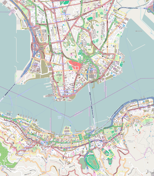
English: Map of the Hong Kong urban core
Geographic limits of the map:
|
| Date | |
| Source | OpenStreetMap (direct link) |
| Author | OpenStreetMap editors |
Licensing
| This work contains information from OpenStreetMap, which is made available under the Open Database License (ODbL).
The ODbL does not require any particular license for maps produced from ODbL data. Prior to 1 August 2020, map tiles produced by the OpenStreetMap Foundation were licensed under the CC-BY-SA-2.0 license. Maps produced by other people may be subject to other licences. |
File history
Click on a date/time to view the file as it appeared at that time.
| Date/Time | Thumbnail | Dimensions | User | Comment | |
|---|---|---|---|---|---|
| current | 14:56, 24 October 2014 | | 4,580 × 5,253 (11.55 MB) | Jc86035 | Replaced with version one zoom up and rendered pixel-doubled in Inkscape, and also using the default tiles instead of MapQuest's because the latter are copyrighted by MapQuest and not CC-BY-SA. |
| 11:48, 7 October 2014 |  | 645 × 741 (831 KB) | Underbar dk | User created page with UploadWizard |
File usage
The following pages on the English Wikipedia use this file (pages on other projects are not listed):
- 2014 Hong Kong protests
- Admiralty station (MTR)
- Austin station (MTR)
- Causeway Bay North station
- Causeway Bay station
- Central station (MTR)
- Cordis Hong Kong
- East Tsim Sha Tsui station
- Exhibition Centre station (MTR)
- Fortress Hill station
- Ho Man Tin station
- Hong Kong Cultural Centre
- Hong Kong station
- Hung Hom station
- Jordan station
- Kowloon station (MTR)
- Mong Kok East station
- Mong Kok station
- North Point station
- Olympic station
- Prince Edward station
- Sheung Wan station
- Sung Wong Toi station
- Tamar station
- The Peninsula Hong Kong
- Tin Hau station
- To Kwa Wan station
- Tsim Sha Tsui station
- Wan Chai station
- Whampoa station
- Yau Ma Tei station
- User:KX675/Sandbox
- Module:Location map/data/Hong Kong urban core
- Module:Location map/data/Hong Kong urban core/doc
Global file usage
The following other wikis use this file:
- Usage on ar.wikipedia.org
- Usage on eo.wikipedia.org
- Usage on fa.wikipedia.org
- Usage on fr.wikipedia.org
- Usage on ja.wikipedia.org
- ランガムプレイス
- 国際金融中心 (香港)
- 界限街
- ハッピーバレー競馬場
- セントラルプラザ
- 中国銀行タワー
- ザ・センター
- 香港上海銀行・香港本店ビル
- 長江センター
- 香港コンベンション・アンド・エキシビション・センター
- タイムズスクウェア (香港)
- マニュライフプラザ
- ホープウェル・センター
- エンターテインメント・ビルディング
- リッポーセンター
- ファー・イースト・フィナンシャル・センター
- 交易廣場
- 環球貿易広場
- 天璽 (香港)
- マンダリン・オリエンタル香港
- ジャーディン・ハウス
- インターコンチネンタル香港
- ニューワールドミレニアム香港ホテル
- マルコポーロ・香港
- ハイアットリージェンシー香港
- 1ペキンロード
- シティバンクタワー
- マカオ・フェリー・ターミナル
- 軒尼詩道
- 怡和街
- 高士威道
- モジュール:Location map/data/Hong Kong urban core
- モジュール:Location map/data/Hong Kong urban core/doc
- 2019年6月9日香港逃亡犯条例改正案反対デモ
- 利用者:Tcafwt/sub002/002b
- Usage on si.wikipedia.org
- Usage on th.wikipedia.org
- Usage on uz.wikipedia.org
- Usage on zh-yue.wikipedia.org
- Usage on zh.wikipedia.org
View more global usage of this file.