Size of this preview: 775 × 600 pixels. Other resolutions: 310 × 240 pixels | 620 × 480 pixels | 993 × 768 pixels | 1,242 × 961 pixels.
Original file (1,242 × 961 pixels, file size: 311 KB, MIME type: image/jpeg)
| This is a file from the Wikimedia Commons. Information from its description page there is shown below. Commons is a freely licensed media file repository. You can help. |
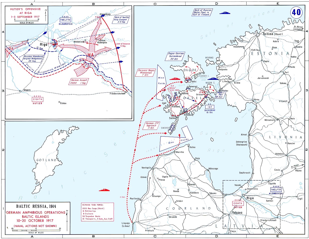
| Description | Map showing amphibious operations of Operation Albion, Baltic Islands, 10 - 20 October 1917, and Hutier's Offensive at Riga 1 - 5 September 1917 (inset) | |||
| Date | circa 1938 | |||
| Source | United States Military Academy Campaign Atlas to the Great War. http://www.dean.usma.edu/history/web03/atlases/WorldWarOne/WWOneJPG/WWOne40.jpg | |||
| Author | United States Military Academy | |||
| Permission (Reusing this file) |
|

File history
Click on a date/time to view the file as it appeared at that time.
| Date/Time | Thumbnail | Dimensions | User | Comment | |
|---|---|---|---|---|---|
| current | 16:56, 22 January 2012 | | 1,242 × 961 (311 KB) | Hohum | Cleanup, made sea blue. |
| 17:49, 4 February 2009 |  | 1,242 × 961 (198 KB) | Rcbutcher | {{Information |Description=Map showing amphibious operations of Operation Albion, Baltic Islands, 10 - 20 October 1917, and Hutiers Offensive at Riga 1 - 5 Septemver 1917 (inset) |Source=United States Military Academy Campaign Atlas to the Great War. http |
File usage
The following pages on the English Wikipedia use this file (pages on other projects are not listed):
- High Seas Fleet
- List of wars involving Estonia
- Operation Albion
- SMS Karlsruhe (1916)
- SMS Kolberg
- SMS Königsberg (1915)
- SMS Markgraf
- SMS Nautilus (1906)
- SMS Nürnberg (1916)
- Wikipedia:WikiProject Military history/News/June 2013/Book reviews
- Wikipedia:WikiProject Military history/News/October 2017/World War I timeline
Global file usage
The following other wikis use this file:
- Usage on cs.wikipedia.org
- Usage on da.wikipedia.org
- Usage on es.wikipedia.org
- Usage on et.wikipedia.org
- Usage on fr.wikipedia.org
- Usage on he.wikipedia.org
- Usage on hu.wikipedia.org
- Usage on it.wikipedia.org
- Usage on ja.wikipedia.org
- Usage on lv.wikipedia.org
- Usage on nl.wikipedia.org
- Usage on no.wikipedia.org
- Usage on pt.wikipedia.org
- Usage on sv.wikipedia.org
- Usage on tr.wikipedia.org
- Usage on uk.wikipedia.org
- Usage on vi.wikipedia.org
- Usage on www.wikidata.org
- Usage on zh.wikipedia.org