
Size of this PNG preview of this SVG file: 800 × 482 pixels. Other resolutions: 320 × 193 pixels | 640 × 386 pixels | 1,024 × 617 pixels | 1,280 × 772 pixels | 2,560 × 1,543 pixels | 1,304 × 786 pixels.
Original file (SVG file, nominally 1,304 × 786 pixels, file size: 21 KB)
| This is a file from the Wikimedia Commons. Information from its description page there is shown below. Commons is a freely licensed media file repository. You can help. |
Summary
| Description |
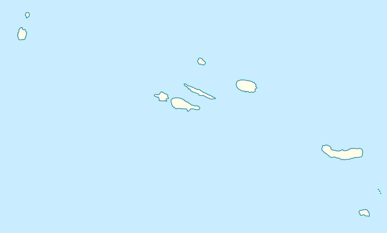
Quadratische Plattkarte, N-S-Streckung 130 %. Geographische Begrenzung der Karte:
Equirectangular projection, N/S stretching 130 %. Geographic limits of the map:
|
||
| Date | |||
| Source | own work, using World Data Base II data | ||
| Author | NordNordWest | ||
| Other versions |
|
||
| SVG development |
|


Licensing
I, the copyright holder of this work, hereby publish it under the following licenses:

|
Permission is granted to copy, distribute and/or modify this document under the terms of the GNU Free Documentation License, Version 1.2 or any later version published by the Free Software Foundation; with no Invariant Sections, no Front-Cover Texts, and no Back-Cover Texts. A copy of the license is included in the section entitled GNU Free Documentation License. |
This file is licensed under the Creative Commons Attribution-Share Alike 3.0 Unported license.
- You are free:
- to share – to copy, distribute and transmit the work
- to remix – to adapt the work
- Under the following conditions:
- attribution – You must give appropriate credit, provide a link to the license, and indicate if changes were made. You may do so in any reasonable manner, but not in any way that suggests the licensor endorses you or your use.
- share alike – If you remix, transform, or build upon the material, you must distribute your contributions under the same or compatible license as the original.
You may select the license of your choice.
File history
Click on a date/time to view the file as it appeared at that time.
| Date/Time | Thumbnail | Dimensions | User | Comment | |
|---|---|---|---|---|---|
| current | 08:31, 29 August 2008 | | 1,304 × 786 (21 KB) | NordNordWest | |
| 18:45, 13 August 2008 |  | 652 × 393 (21 KB) | NordNordWest | {{Information |Description= {{de|Positionskarte der Azoren, Portugal}} Quadratische Plattkarte, N-S-Streckung 130 %. Geographische Begrenzung der Karte: * N: 39.9° N * S: 36.7° N * W: 31.6° W * O: 24.7° W {{en|Location |
File usage
More than 100 pages use this file. The following list shows the first 100 pages that use this file only. A full list is available.
- ANA Aeroportos de Portugal
- Achada
- Agualva (Praia da Vitória)
- Algarvia
- Azores Senior Open
- Bay of Angra
- Biscoitos
- Cabo da Praia
- Calhetas
- Candelária (Ponta Delgada)
- Caveira (parish)
- Cedros (Santa Cruz das Flores)
- Conceição (Ribeira Grande)
- Corvo Airport
- Covoada
- Doze Ribeiras
- Estreitinho
- Faial da Terra
- Fajã Grande
- Fajãzinha
- Fazenda (Lajes das Flores)
- Feteira (Angra do Heroísmo)
- Flores Airport
- Fonte do Bastardo
- Fontinhas
- Formigas
- Furnas
- Graciosa Airport
- Guadalupe (Santa Cruz da Graciosa)
- Horta Airport
- João Paulo II Airport
- Lajedo (Lajes das Flores)
- Lajes (Praia da Vitória)
- Lajes Airport
- Lajes Field
- Landscape of the Pico Island Vineyard Culture
- List of airports in Portugal
- List of top-division football clubs in UEFA countries
- Lomba (Lajes das Flores)
- Lomba da Fazenda
- Lomba da Maia
- Lomba de São Pedro
- Luz (Santa Cruz da Graciosa)
- Maia (Ribeira Grande)
- Manadas
- Matriz (Ribeira Grande)
- Mosteiro (Lajes das Flores)
- Mount Pico
- Norte Grande (Azores)
- Norte Pequeno
- Nossa Senhora da Conceição (Angra do Heroísmo)
- Nossa Senhora do Rosário
- Pico Airport
- Pico da Esperança
- Ponta Delgada
- Ponta Delgada, Santa Cruz das Flores
- Porto Formoso
- Porto Judeu
- Porto Martins
- Posto Santo
- Praia (Santa Cruz da Graciosa)
- Quatro Ribeiras
- Raminho
- Ribeira Chã
- Ribeira Quente
- Ribeira Seca (Calheta)
- Ribeira Seca (Vila Franca do Campo)
- Ribeira das Tainhas
- Ribeirinha (Angra do Heroísmo)
- Ribeirinha (Ribeira Grande)
- Rosais
- Sabrina Island (Azores)
- Salga
- Santa Bárbara (Angra do Heroísmo)
- Santa Bárbara (Ribeira Grande)
- Santa Cruz (Lagoa)
- Santa Luzia (Angra do Heroísmo)
- Santa Maria Airport (Azores)
- Santana (Nordeste)
- Santo Amaro (Velas)
- Santo Antão (Calheta)
- Santo António (Ponta Delgada)
- Santo António de Nordestinho
- Serreta (Angra do Heroísmo)
- Sete Cidades (Ponta Delgada)
- São Bartolomeu de Regatos
- São Bento (Angra do Heroísmo)
- São Brás (Praia da Vitória)
- São Brás (Ribeira Grande)
- São Jorge Airport
- São Mateus da Calheta
- São Miguel (Vila Franca do Campo)
- São Pedro (Angra do Heroísmo)
- São Pedro (Vila Franca do Campo)
- São Pedro de Nordestinho
- São Sebastião (Ponta Delgada)
- Sé (Angra do Heroísmo)
- Topo (Calheta)
- Vila Nova (Praia da Vitória)
- Vila de São Sebastião
View more links to this file.
Global file usage
The following other wikis use this file:
- Usage on af.wikipedia.org
- Usage on ar.wikipedia.org
- Usage on ast.wikipedia.org
- Usage on az.wikipedia.org
- Usage on ba.wikipedia.org
- Usage on be.wikipedia.org
- Usage on bg.wikipedia.org
- Usage on bn.wikipedia.org
- Usage on bs.wikipedia.org
- Usage on ceb.wikipedia.org
- Usage on ce.wikipedia.org
- Usage on ckb.wikipedia.org
- Usage on cs.wikipedia.org
- Usage on cv.wikipedia.org
- Usage on da.wikipedia.org
- Usage on de.wikipedia.org
View more global usage of this file.