
Size of this preview: 477 × 599 pixels. Other resolutions: 191 × 240 pixels | 382 × 480 pixels | 611 × 768 pixels | 1,060 × 1,332 pixels.
Original file (1,060 × 1,332 pixels, file size: 194 KB, MIME type: image/jpeg)
| This is a file from the Wikimedia Commons. Information from its description page there is shown below. Commons is a freely licensed media file repository. You can help. |
| Description |
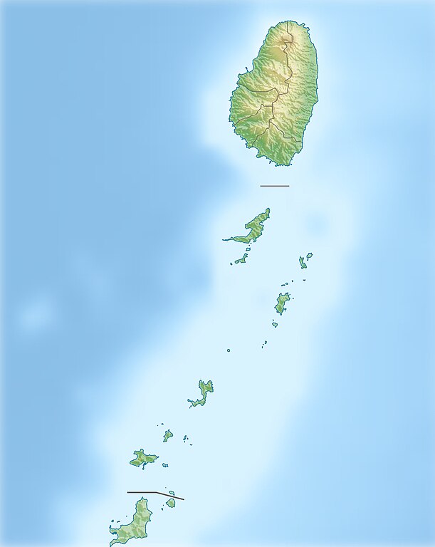
Deutsch: Physische Positionskarte von St. Vincent und die Grenadinen
Geographische Begrenzung der Karte:
English: Location map of Saint Vincent und the Grenadines
Geographic limits of the map:
|
| Date | |
| Source |
Own work, using
|
| Author | Carport |
| Permission (Reusing this file) |
This file is licensed under the Creative Commons Attribution-Share Alike 3.0 Unported license.
|
| Other versions |
|

File history
Click on a date/time to view the file as it appeared at that time.
| Date/Time | Thumbnail | Dimensions | User | Comment | |
|---|---|---|---|---|---|
| current | 10:52, 1 January 2013 | | 1,060 × 1,332 (194 KB) | Carport | {{Information |Description= {{de|Physische Positionskarte von St. Vincent und die Grenadinen}} Geographische Begrenzung der Karte: * N: 13.42° N * S: 12.44° N * W: 61.7° W * O: 60.9° W {{en|Location map of [[:... |
File usage
The following pages on the English Wikipedia use this file (pages on other projects are not listed):
- Baliceaux
- Battowia
- Bequia
- Canouan
- Clifton, Union Island
- Colonarie River
- Grand Bonhomme
- Grenadines
- La Soufrière (Saint Vincent)
- Martinique Channel
- Mayreau
- Mustique
- Palm Island, Grenadines
- Petit Canouan
- Petit Nevis
- Petit Saint Vincent
- Petite Mustique
- Pigeon Island (Grenadines)
- Port Elizabeth, Saint Vincent and the Grenadines
- Quatre
- Saint Elairs Cay
- Saint Vincent (Saint Vincent and the Grenadines)
- Savan (island)
- Tobago Cays
- Union Island
- Young Island (Grenadines)
- Draft:Sail Rock (Grenadines)
- Module:Location map/data/Saint Vincent and the Grenadines
- Module:Location map/data/Saint Vincent and the Grenadines/doc
Global file usage
The following other wikis use this file:
- Usage on ar.wikipedia.org
- Usage on ast.wikipedia.org
- Usage on az.wikipedia.org
- Usage on bg.wikipedia.org
- Usage on bn.wikipedia.org
- Usage on bs.wikipedia.org
- Usage on ceb.wikipedia.org
- Usage on da.wikipedia.org
- Usage on de.wikipedia.org
- St. Vincent und die Grenadinen
- Mustique
- Bequia
- Soufrière (St. Vincent)
- Union Island
- Canouan
- Tobago Cays
- Mayreau
- Palm Island (Grenadinen)
- Wikipedia:Kartenwerkstatt/Positionskarten/Nordamerika
- Petit St. Vincent
- Baliceaux
- Vorlage:Positionskarte St. Vincent und die Grenadinen
- Young Island (Grenadinen)
- Pigeon Island (Grenadinen)
- Saint Elairs Cay
- Samples Cay
- Grand Bonhomme
- All Awash Island
- Big Pillory
- Middle Pillory
- Little Pillory
- Rabbit Island (Grenadinen)
- Savan Island
- Little Savan
- Petit Canouan
- Petite Nevis
- Petite Mustique
- Isle à Quatre
- Wallilabou Bay
- Petit Bonhomme (St. Vincent)
- Mount Saint Andrew
- Milligan Cay
- Bettowia
- Church Cay
View more global usage of this file.