Size of this preview: 309 × 598 pixels. Other resolutions: 124 × 240 pixels | 248 × 480 pixels | 396 × 768 pixels | 529 × 1,024 pixels | 2,000 × 3,872 pixels.
Original file (2,000 × 3,872 pixels, file size: 1.9 MB, MIME type: image/jpeg)
| This is a file from the Wikimedia Commons. Information from its description page there is shown below. Commons is a freely licensed media file repository. You can help. |
Summary
| Description |
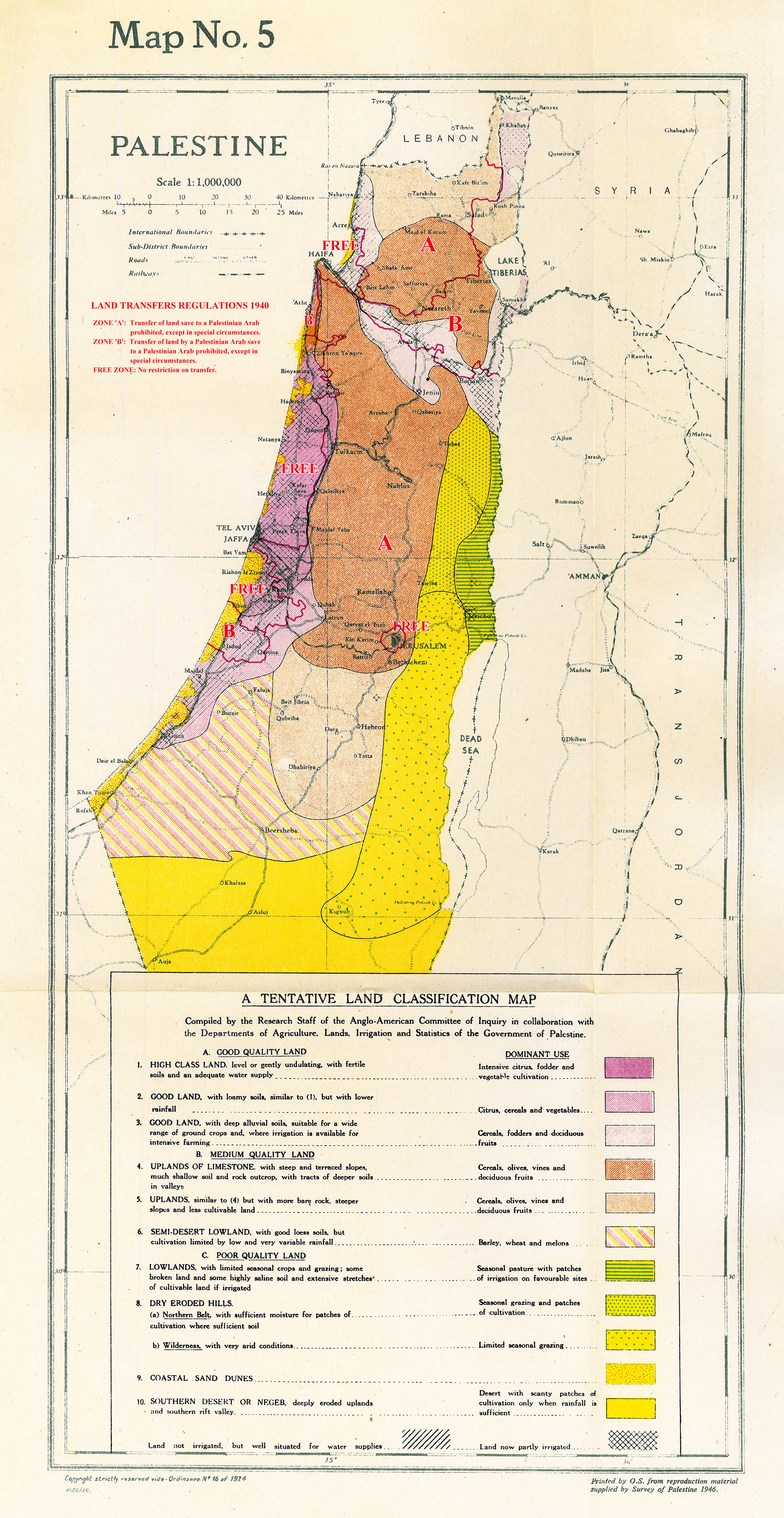
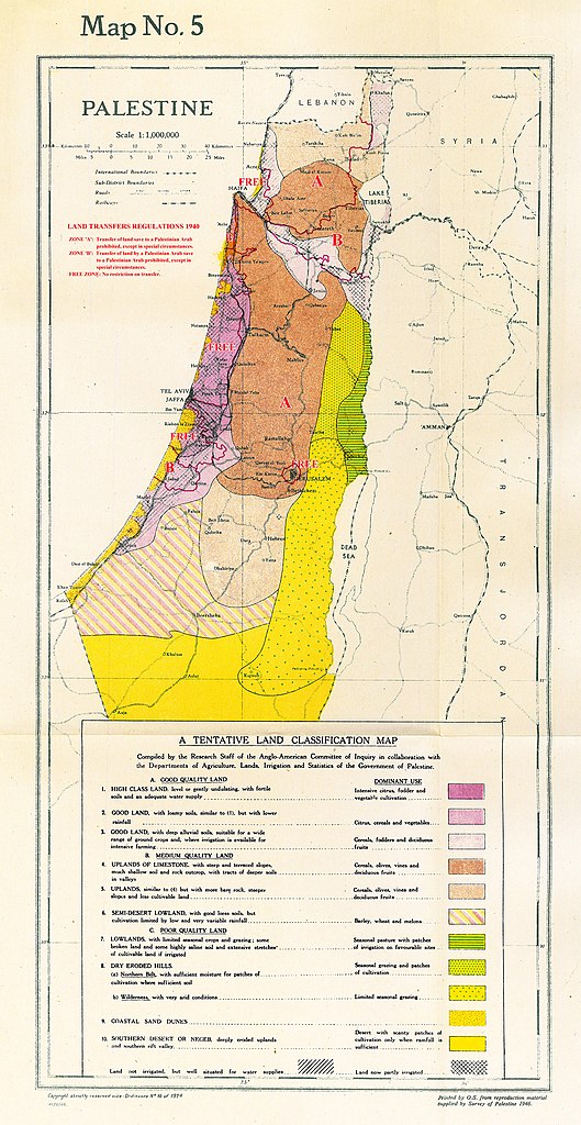
English: Map 5. Land Classification map of Palestine.
Notated with boundaries of land transfer regions as prescribed in 1940, taken from Map 4.
العربية: خريطة 5. خريطة تصنيف الأراضي لفلسطين. مسجلة بحدود مناطق النقل البري كما هو محدد في عام 1940 ، مأخوذة من الخريطة 4. |
| Date | |
| Source | Maps relating to the Report of the Anglo-American Committee of Enquiry regarding the problems of European Jewry and Palestine. Suppl. to Cmd. 6808. London: His Majesty's Stationery Office, 1946. |
| Author | UK Government |
Licensing
This work created by the United Kingdom Government is in the public domain.
This is because it is one of the following:
HMSO has declared that the expiry of Crown Copyrights applies worldwide (ref: HMSO Email Reply)
|
 |
File history
Click on a date/time to view the file as it appeared at that time.
| Date/Time | Thumbnail | Dimensions | User | Comment | |
|---|---|---|---|---|---|
| current | 13:14, 11 September 2013 | | 2,000 × 3,872 (1.9 MB) | Zero0000 | User created page with UploadWizard |
File usage
The following pages on the English Wikipedia use this file (pages on other projects are not listed):
Global file usage
The following other wikis use this file:
- Usage on ar.wikipedia.org
- Usage on arz.wikipedia.org
- Usage on azb.wikipedia.org
- Usage on da.wikipedia.org
- Usage on es.wikipedia.org
- Usage on fr.wikipedia.org