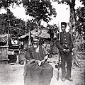
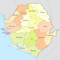
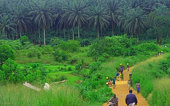
The Sierra Leone Portal  Sierra Leone, officially the Republic of Sierra Leone, is a country on the southwest coast of West Africa. It shares its southeastern border with Liberia and is bordered by Guinea to the north. With a land area of 71,740 km2 (27,699 sq mi), Sierra Leone has a tropical climate and with a variety of environments ranging from savannas to rainforests. According to the 2015 census, Sierra Leone has a population of 7,092,113, with Freetown serving as both the capital and largest city. The country is divided into five administrative regions, which are further subdivided into 16 districts. Sierra Leone is governed as a presidential republic, with a unicameral parliament and a directly elected president. Sierra Leone is a secular state with the constitution providing for the separation of state and religion and freedom of conscience, encompassing freedom of thought and religion. Muslims constitute three-quarters of the population with a significant Christian minority. Notably, religious tolerance is very high, reflecting a social norm and part of the nation's cultural identity. Sierra Leone's current territorial configuration was established by the British Empire through two historical phases: initially, the coastal Sierra Leone Colony was founded in 1808 to resettle returning Africans following the abolition of the slave trade; subsequently, the inland Protectorate was created in 1896 in the wake of the Berlin Conference of 1884–1885. This led to the formal recognition of the territory as the Sierra Leone Colony and Protectorate, or British Sierra Leone. Independence from the United Kingdom was attained in 1961, with Sierra Leone transitioning into a Commonwealth realm as the Dominion of Sierra Leone under the leadership of Prime Minister Sir Milton Margai of the Sierra Leone People's Party (SLPP). Under prime minister Siaka Stevens of the All People's Congress (APC), the country adopted a new constitution in 1971, transforming Sierra Leone into a presidential republic with Stevens as the inaugural president. After declaring the APC the sole legal party in 1978, Stevens was succeeded by Joseph Saidu Momoh in 1985. Momoh's enactment of a new constitution in 1991 reintroduced a multi-party system. That year, a protracted civil war initiated, featuring the government and the Revolutionary United Front (RUF) rebel group, leading to significant turmoil. The conflict, characterized by multiple coups d'état, persisted for 11 years. Intervention by ECOMOG forces and later the United Kingdom resulted in the defeat of the RUF in 2002, ushering in a period of relative stability and recovery efforts. The remaining two main political parties are the APC and the SLPP. (Full article...) Selected article -The Temne, also called Atemne, Témené, Temné, Téminè, Temeni, Thaimne, Themne, Thimni, Timené, Timné, Timmani, or Timni, are a West African ethnic group, They are predominantly found in the Northern Province of Sierra Leone. Some Temne are also found in Guinea. The Temne constitute the largest ethnic group in Sierra Leone, at 35.5% of the total population, which is slightly bigger than the Mende people at 31.2%. They speak Temne, a Mel branch of the Niger–Congo languages. The Temne people migrated from the Futa Jallon region of Guinea, who left their original settlements to escape Fula jihads in the 15th century, and migrated south before settling between the Kolenté and Rokel River area of Sierra Leone. They initially practiced their traditional religion before Islam was adopted through contact with Muslim traders from neighboring ethnic groups. Though most Temne converted to Islam over time, Some have continued with their traditional religion. (Full article...)General images -The following are images from various Sierra Leone-related articles on Wikipedia.
Entries here consist of Good and Featured articles, which meet a core set of high editorial standards.
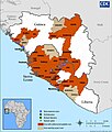
The 2013–2016 epidemic of Ebola virus disease, centered in Western Africa, was the most widespread outbreak of the disease in history. It caused major loss of life and socioeconomic disruption in the region, mainly in Guinea, Liberia and Sierra Leone. The first cases were recorded in Guinea in December 2013; later, the disease spread to neighbouring Liberia and Sierra Leone, with minor outbreaks occurring in Nigeria and Mali. Secondary infections of medical workers occurred in the United States and Spain. In addition, isolated cases were recorded in Senegal, the United Kingdom and Italy. The number of cases peaked in October 2014 and then began to decline gradually, following the commitment of substantial international resources. It caused significant mortality, with a considerable case fatality rate. By the end of the epidemic, 28,616 people had been infected; of these, 11,310 had died, for a case-fatality rate of 40%. , the World Health Organization (WHO) and respective governments reported a total of 28,646 suspected cases and 11,323 deaths (39.5%), though the WHO believes that this substantially understates the magnitude of the outbreak. (Full article...)CategoriesDid you knowTopicsProvinces: Eastern Province • Northern Province • Southern Province • Western Area History: Sierra Leone Colony and Protectorate • Kingdom of Koya • British West Africa • Sierra Leone Liberated Africans • Sierra Leone Civil War • United Nations Mission in Sierra Leone Law: Sierra Leone Police • Special Court for Sierra Leone • Truth and Reconciliation Commission • Prisons in Sierra Leone Politics: List of Presidents • Political Parties • Parliament • Foreign relations • Elections • Military of Sierra Leone Geography: Protected • Sierra Leone River • Western Guinean lowland forests • Outamba-Kilimi National Park • Transport Society: Sport • Demographics • Education • Cuisine • Media • Music Symbols: Flag • Coat of arms • National anthem (High We Exalt Thee, Realm of the Free) Selected picture -
Related portalsWikiProjectsAssociated WikimediaThe following Wikimedia Foundation sister projects provide more on this subject:
Things to do
Discover Wikipedia using portals |


