
File:Nicaragua relief location map.jpg

Size of this preview: 704 × 599 pixels. Other resolutions: 282 × 240 pixels | 564 × 480 pixels | 902 × 768 pixels | 1,203 × 1,024 pixels | 1,400 × 1,192 pixels.
Original file (1,400 × 1,192 pixels, file size: 615 KB, MIME type: image/jpeg)
| This is a file from the Wikimedia Commons. Information from its description page there is shown below. Commons is a freely licensed media file repository. You can help. |
Summary
| Description |
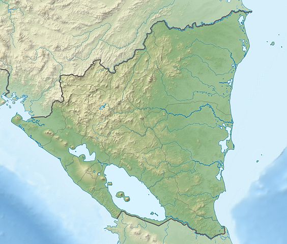
Deutsch: Physische Positionskarte Nicaragua mit Departamentos, Quadratische Plattkarte, N-S-Streckung 100 %. Geographische Begrenzung der Karte:
English: Physical Location map Nicaragua with Departamentos, Equirectangular projection, N/S stretching 100 %. Geographic limits of the map:
|
| Date | |
| Source | Own work, VMAP0, http://maplibrary.org, SRTM3, ETOPO1 |
| Author | Alexrk2 |
| Other versions |
Derivative works of this file:
|


|
This map has been made or improved in the German Kartenwerkstatt (Map Lab). You can propose maps to improve as well.
|
Licensing
I, the copyright holder of this work, hereby publish it under the following license:
This file is licensed under the Creative Commons Attribution-Share Alike 3.0 Unported license.
- You are free:
- to share – to copy, distribute and transmit the work
- to remix – to adapt the work
- Under the following conditions:
- attribution – You must give appropriate credit, provide a link to the license, and indicate if changes were made. You may do so in any reasonable manner, but not in any way that suggests the licensor endorses you or your use.
- share alike – If you remix, transform, or build upon the material, you must distribute your contributions under the same or compatible license as the original.
File history
Click on a date/time to view the file as it appeared at that time.
| Date/Time | Thumbnail | Dimensions | User | Comment | |
|---|---|---|---|---|---|
| current | 21:05, 17 February 2010 | | 1,400 × 1,192 (615 KB) | Alexrk2 | == Summary == {{Information |Description= {{de|Physische Positionskarte Nicaragua mit Departamentos, Quadratische Plattkarte, N-S-Streckung 100 %. Geographische Begrenzung der Karte:}} {{en|Physical Location map [[:en:Nicaragua|Nicaragua |
File usage
The following pages on the English Wikipedia use this file (pages on other projects are not listed):
- Bosawás Biosphere Reserve
- Brito Formation
- Camoapa
- Cerro Negro
- Concepción (volcano)
- Cosigüina
- El Salto Formation, Nicaragua
- Escondido River (Nicaragua)
- Flor de Caña Open
- Kukra River
- Lake Apanás
- Lake Managua
- Lake Nicaragua
- Las Lajas (volcano)
- Las Pilas
- Las Sierras Formation
- León Viejo
- List of fossiliferous stratigraphic units in Central America
- Los Guatuzos Wildlife Refuge
- Maderas
- Mancotal Dam
- Mogotón
- Mombacho
- Momotombo
- Punta Gorda River
- Rota (volcano)
- Río Grande de Matagalpa
- San Cristóbal Volcano
- San Juan River (Nicaragua)
- Telica (volcano)
- Tumarín Dam
- Virgen Dam
- Water resources management in Nicaragua
- Zapatera
- Zapatera (archaeological site)
- User:Ty654/List of earthquakes from 1900-1949 exceeding magnitude 7+
- User:Ty654/List of earthquakes from 1920-1929 exceeding magnitude 6+
- User:Ty654/List of earthquakes from 1930-1939 exceeding magnitude 6+
- User:Ty654/List of earthquakes from 1950-1954 exceeding magnitude 6+
- User:Ty654/List of earthquakes from 1950-1999 exceeding magnitude 7+
- User:Ty654/List of earthquakes from 1955-1959 exceeding magnitude 6+
- User:Ty654/List of earthquakes from 1960-1964 exceeding magnitude 6+
- User:Ty654/List of earthquakes from 1970-1974 exceeding magnitude 6+
- User:Ty654/List of earthquakes from 1980-1984 exceeding magnitude 6+
- User:Ty654/List of earthquakes from 1985-1989 exceeding magnitude 6+
- User:Ty654/List of earthquakes from 1990-1994 exceeding magnitude 6+
- User:Ty654/List of earthquakes from 1995-1999 exceeding magnitude 6+
- User:Ty654/List of earthquakes from 2000-2004 exceeding magnitude 6+
- User:Ty654/List of earthquakes from 2000-present exceeding magnitude 7+
- User:Ty654/List of earthquakes from 2005-2009 exceeding magnitude 6+
- User:Ty654/List of earthquakes from 2010-2014 exceeding magnitude 6+
- User:Ty654/List of earthquakes from 2015-2019 exceeding magnitude 6+
- Module:Location map/data/Nicaragua
- Module:Location map/data/Nicaragua/doc
Global file usage
The following other wikis use this file:
- Usage on ar.wikipedia.org
- Usage on ast.wikipedia.org
- Usage on ba.wikipedia.org
- Usage on be-tarask.wikipedia.org
- Usage on be.wikipedia.org
- Usage on bg.wikipedia.org
- Usage on bh.wikipedia.org
- Usage on bn.wikipedia.org
- Usage on bs.wikipedia.org
- Usage on ca.wikipedia.org
- Usage on ceb.wikipedia.org
- Usage on ce.wikipedia.org
- Usage on ckb.wikipedia.org
- Usage on cs.wikipedia.org
- Usage on da.wikipedia.org
- Usage on de.wikipedia.org
View more global usage of this file.