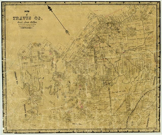
Travis County is in Central Texas, 150 miles inland from the Gulf of Mexico. Austin, the state capital and county seat, is at the intersection of Interstate Highway 35 and U.S. highways 183 and 290, 100 miles southwest of Waco and seventy-five miles northeast of San Antonio. The geographical center of the county lies two miles northwest of downtown Austin at 30°18' north latitude and 97°45' west longitude. Travis County comprises 989 square miles on the eastern edge of the Edwards Plateau and is divided by the Balcones Escarpment. The land west of the escarpment is more arid than that to the east, and the vegetation varies accordingly, ranging from juniper, mesquite, and scrub brush to oak, cottonwood, redbud, and pecan trees. Elevations in Travis County range from 400 to 1,300 feet above sea level. Between 21 and 30 percent of the land is considered prime farmland. The Colorado River, which bisects the county from northwest to southeast, flows from the Hill Country onto the Coastal Plain and provides drainage for the entire area. Wildlife in the area includes deer, coyote, bobcat, squirrel, beaver, opossum, ring-tailed cat, badger, fox, raccoon, and skunk, as well as a variety of birds, fish, and reptiles. Among the county's mineral resources are dolomite, limestone, industrial sand, gravel, oil, and gas. The climate is subtropical, with an average low temperature in January of 38° F and an average high in July of 96°. The average yearly rainfall is thirty-two inches, and the growing season is 270 days.
Fossilized remains of fish and aquatic plant life indicate that the Central Texas region, including Travis County, was once the floor of a shallow sea. Remnants of an extinct volcano (seePILOT KNOB) stand testament to a violent geological past. Archeological evidence dating from the Archaic Period suggests that hunting and gathering peoples established themselves in the region as early as 10,000 years ago. The Tonkawa and the Lipan Apache Indians were well established in Central Texas by the fourteenth century, and Comanche and Kiowa tribes arrived in the area by the eighteenth century. The first European known to have crossed the region was Domingo Terán de los Ríos, who made an inspection tour to East Texas in 1691. When the Spanish moved their missions out of East Texas in 1730, they relocated the missions of San Francisco de los Neches, Nuestra Señora de la Purísima Concepción de los Hasinai, and San José de los Nazonis near Barton Springs. In 1827 the Mexican government granted Stephen F. Austin his third, or "Little Colony," which was located east of the Colorado River and north and west of the Old San Antonio Road. Mina (Bastrop) became the headquarters of the colony, and Travis County developed as an offshoot of Mina. Settlers moving into the area in the early 1830s included Josiah and Mathias Wilbarger, Reuben Hornsby, Jacob M. Harrell, and John F. Webber. The onset of the Texas Revolution delayed further settlement activity, and the news of the fall of the Alamo prompted those settlers already in residence to flee.
Settlement resumed after the revolution, but it proceeded slowly because of the constant threat of raids by the Comanche Indians. During the 1830s a chain of small forts ranged from Bastrop northwest along Wilbarger's Bend, Coleman Branch, Webber's Prairie, and Gilleland Creek, to Fort Colorado or Fort Prairie, five miles east of the site of present Austin. In June 1835, Thomas Jefferson Chambers surveyed part of an eight-league grant covering the present site of Austin and the Capitol. Sometime before 1837 William Barton settled near the springs that were to bear his name. In 1837 or 1838 President Mirabeau B. Lamar was on a buffalo hunt in the area and commented on its possibilities as a site for the permanent capital. In 1838 the community of Waterloo (Austin) consisted of four families; about twenty families established homes at nearby Montopolis in 1839. When the Congress of the Republic of Texas chose Waterloo as the site of the new capital, opponents were quick to point out the disadvantages: the site's proximity to the frontier, the lack of timber, the poor soil, and the threat of Indian raids. In spite of this opposition, however, the new capital—renamed Austin in honor of Stephen F. Austin—was approved on January 19, 1840. A few days later the Congress established Travis County, naming it in honor of William Barret Travis and making Austin its county seat. An election for county officials was held in February 1840, at which time the population was reported to be 856. The initial boundaries of Travis County included roughly 40,000 square miles. Counties that were later carved from Travis County include Callahan (1858), Coleman (1858), Comal (1846), Gillespie (1848), Hays (1848), Burnet (1852), Brown (1856), Lampasas (1856), Eastland (1858), Runnels (1858), and Taylor (1858). Sam Houston moved the government of the Republic of Texas from Austin to Houston when Mexican troops invaded San Antonio in March 1842. When he tried to have the government archives removed as well, Austin citizens resisted with the Archives War. The Texas Congress held sessions at Washington-on-the-Brazos from 1842 to 1845, but the convention that drafted the Constitution of 1845 met in Austin in July 1845, and by October the rest of the government had returned to the capital city. The first legislature of the new state convened in Austin in February 1846.
The late 1840s and early 1850s were building years for Austin and Travis County, with much of the growth fed by the presence of the state government: the Governor's Mansion, office buildings, hotels, new homes, and newspapers. In 1850 Travis County had a population of 3,138, of whom 2,336 were White, 791 were enslaved people, and eleven were free Blacks; by 1860 the number of residents had more than doubled to 8,080, with 4,931 of them White, 3,136 enslaved people, and thirteen free Blacks. Although the city of Austin grew faster than the county as a whole—its population rose from 629 in 1850 to 3,494 in 1860—most county residents lived in small communities. Pflugerville and Del Valle were the most prominent of these communities, but rural post offices were also established at Bluff Springs, Webberville, Merrilltown, Gilleland, Cage's Mill, and Hornsby Bend. During the 1850s the amount of land in farms in what was then Travis County increased from 73,300 acres to 1,363,500 acres. Corn was the primary field crop, while cattle and sheep were the principal livestock: in 1860 farmers produced 137,700 bushels of corn, and 27,900 bushels of wheat and had 58,000 cattle and 11,800 sheep.
The earliest schools in Travis County were private institutions which usually met in someone's home or in space donated by a church or Masonic lodge. More elaborate private facilities began to appear by the late 1840s: Colorado Female College in 1848, Austin Male and Female Academy in 1849, Austin Female Academy in 1850, and Austin Collegiate Female Institute in 1852. By 1850 Travis County also had six public schools serving a scholastic population of 183. The county was divided into nineteen common school districts in 1852. The state established the Asylum for the Blind in Austin in 1856 and the Deaf and Dumb School in 1857. (seeTEXAS SCHOOL FOR THE BLIND AND VISUALLY IMPAIRED; TEXAS SCHOOL FOR THE DEAF). Travis County became a center for higher education in the 1880s with the establishment of the University of Texas in 1881, Tillotson Collegiate and Normal Institute in 1881, and Saint Edward's University in 1885; Samuel Huston College began holding classes in the 1890s (seeHUSTON-TILLOTSON COLLEGE). The Austin Presbyterian Theological Seminary opened in 1902, Texas Wesleyan College in 1912, Concordia Lutheran College in 1926, and the Episcopal Theological Seminary of the Southwest in 1952. Austin Community College began operations in 1972. The availability of schools resulted in a high level of education for a large portion of the county's population. In the 1940s, while more rural areas of the state reported less than 10 percent of their population over the age of twenty-five with high school diplomas, nearly 20 percent of Travis County residents had graduated. By 1980 that number had jumped to 75 percent.
The earliest churches in Travis County were the Catholic missions relocated to the area by the Spanish in 1730, but these were moved to San Antonio in 1731, and it was more than a century before any organized religious practices were firmly established. In the 1830s a variety of religious groups began to appear: Methodist circuit riders held services along Gilleland Creek in 1837 or 1838; Presbyterians organized a church in Austin in October 1839; Mormons settled near Fort Coleman, Webberville, and Hornsby Bend in the late 1830s; and Catholic priests, among them Jean Marie Odin, returned to the area in 1840. A Baptist church and a Church of Christ were organized in Austin in 1847, a Lutheran church in New Sweden and a Jewish synagogue in Austin began in 1876, and a Christian Science church in Austin in 1889. In the early 1980s Travis County's 266 churches had an estimated combined membership of 194,194; Catholic, Southern Baptist, and United Methodist were the largest denominations.
In spite of the rapid growth that Travis County experienced during the 1850s, the area was at that time still very much at the edge of the frontier. The absence of railroads meant that goods had to be shipped by wagon to and from Houston and Port Lavaca; poor roads meant that goods sometimes could not be shipped at all. In 1852 the Austin Railroad Association was established to encourage railroad construction to the area, and considerable progress had been made by the late 1850s; however, the Civil War intervened, and work on railroad acquisition was postponed. The Secession Convention convened in Austin on January 28, 1861. Although a group of Austin citizens staged a demonstration in favor of secession, Unionist sentiment was high, and Travis County residents voted against secession, 704 to 450. Nevertheless, when the Civil War began, Travis County provided several hundred volunteers, among them the Travis Rifles, the Tom Green Rifles, the Capitol Guard, and the Austin City Light Infantry. In the two months between the end of the war and the arrival of federal troops in the county, looting of farms and businesses was common. Although the inevitable clashes between the Unionist forces and the former rebels resulted in the arrest of as many as thirty people a day, the presence of federal troops did serve to curb much of the lawlessness. By early 1866 most of the federal soldiers had been mustered out of service, leaving only about 200 men to police the Austin area until the end of the military occupation in 1870. Austin was the site of the constitutional conventions of 1866 and 1868–69, and witnessed both the removal of Governor James W. Throckmorton in 1867 and the Coke-Davis Controversy in 1874. In the gubernatorial election of 1869 Travis County residents favored Andrew J. Hamilton to Edmund J. Davis by a margin of 798 to 593.
Like most areas in the south, Travis County suffered considerable economic hardship immediately after the Civil War and throughout the Reconstruction period. Between 1864 and 1866 the county as a whole experienced a 49 percent loss in property tax receipts. Roughly two-thirds of this property loss was in slaves, with the rest coming from declines in farm and livestock values, each of which fell 25 to 40 percent. The county began to show signs of recovery by 1880. The overall population rose from 13,153 in 1870 to 27,028 in 1880, and the 1880 census reported 1,912 farms, an increase of 656 over the 1870 totals. The amount of improved land rose from 83,200 acres in 1870 to 139,800 in 1880. Field crops such as corn, cotton, wheat, and oats took up nearly half of the improved farmland, while livestock dominated the rest. Economic recovery was facilitated by the arrival of the Houston and Texas Central Railway, which completed its track to Austin in 1871, and the International and Great Northern Railroad, which was built between Rockdale and Austin in 1876 and completed from Austin to Laredo in 1881. The Austin and Northwestern Railroad laid track between Austin and Burnet in 1882, and the Missouri, Kansas and Texas line arrived in 1904. Communities besides Austin that benefited directly from easy railroad access included Pflugerville, Manor, Oak Hill, and Manchaca.
After the war many former slaves remained in the area. In the year after the war the Black population increased by 60 percent, while the White population rose by only 12 percent. By 1870 Black residents numbered 4,647, comprising 35 percent of the county's total population. Clarksville, Kincheonville, Masontown, and Wheatville were among the communities established by former enslaved people. The number of Black residents in Travis County continued to increase steadily, reaching 13,299 in 1900. It fluctuated between 13,000 and 15,000 from 1900 to 1930, but increased rapidly thereafter, rising to 22,493 in 1950, 32,270 in 1970, and 63,173 in 1990. Because other segments of the population grew at an even faster rate, the percentage of Black residents, with respect to the total population, declined significantly, falling to 20 percent by 1930 and 11 percent by 1990.
Contributing to the shift in the ethnic makeup of the county were a variety of immigrant groups, the most prominent of which were German, Swedish, and Mexican. By the turn of the century 8 percent of the population were natives of one of these countries. Although the early Swedish and German settlers contributed to the diversity of Travis County through their religious and educational institutions, the Mexican influence was also reinforced by the continued arrival of large numbers of new immigrants fleeing the unrest of the Mexican Revolution in the early twentieth century. The 1930 census reported that 10,225 residents—or 13 percent of the county's total population—were of Hispanic descent; by 1990 the number of Hispanic residents had risen to 121,689, or 21 percent.
In 1890 Travis County had 36,322 residents. Of these, 14,575 lived in Austin, which was fast outgrowing its efforts to become a modern city. Innovations and improvements in progress at that time included a trolley system and water-generated electricity, but most of its streets remained unpaved. By the turn of the century several hundred assorted businesses filled the needs of the 22,000 Austin residents. Yet, in spite of this rapid increase in Austin's population, the majority of the county's residents lived on farms or in smaller towns, and agriculture dominated the area economy. Cotton became the principal field crop in the late 1880s and remained so for more than sixty years. The 1890 census reported 65,000 acres—nearly 30 percent of the county's improved farmland—planted in cotton; by the turn of the century the amount of land devoted to cotton had increased to 113,300 acres, or 56 percent of the improved farmland. However, as more marginal land was used and the soil became depleted, production levels fell; in 1930, 143,000 acres produced only 19,000 bales. By the late 1950s cotton accounted for only 26 percent of the total cropland harvested, and by 1980 it had fallen to only 8 percent. Farm tenancy had increased steadily since the 1890s and peaked in 1930, with tenants operating two-thirds of the 3,642 farms. The number of farms fell by more than 1,000 in the 1930s, as many tenant farmers either move away or turned to other occupations. Farmers who remained in the area began to devote more of their resources to crops other than cotton and to livestock. The number of cattle increased from 32,000 in 1920 to 51,000 in 1950; the number of sheep and goats increased as well, boosting wool and mohair production from 23,600 and 4,292 pounds, respectively, in 1920 to 127,800 and 183,600 pounds in 1959. By the late 1960s hay and sorghum combined to account for 60 percent of the cropland harvested.
The Great Depression was slow to hit Travis County, but by the mid-1930s many people were unemployed and very glad of the New Deal programs that resulted in work paving streets, building bridges, sewers, and parks, and constructing the tower of the University of Texas campus. In part because of the jobs opportunities made available through relief projects, state government, and the university community, the population increased by 43 percent in the 1930s, rising from 77,777 in 1930 to 111,053 in 1940. One major job-producing project in the 1930s was the construction of a series of dams on the Colorado River. Austin and Travis County had begun efforts to tame the Colorado as early as 1869, when the army built a pontoon bridge across the river. In 1893 the city of Austin completed a dam designed to provide power for its water and electrical systems. By 1899 the city was already experiencing power shortfalls, and a major flood in 1900 destroyed the dam. Another flood in 1915 washed out the repairs that were underway, and the project was abandoned. The flood of 1935 put much of downtown Austin under water, and the area's interest in a lasting flood control system was renewed. The Lower Colorado River Authority was established, and a series of dams was built, forming Lake Austin, Lake Travis, Lake Buchanan, Lake Lyndon B. Johnson, Inks Lake, and Lake Marble Falls. Travis County also profited from the establishment of several military bases. Camp Mabry in northwest Austin, established as the main Texas National Guard facility in 1890, served as an army training center during the World War I. After the United States became involved in World War II, the Del Valle Army Air Base, soon renamed Bergstrom Army Air Field was established in southeast Travis County. (seeBERGSTROM AIR FORCE BASE.) After the war was over the presence of military personnel continued to bring changes to the county. Thousands of returning veterans enrolled in the local colleges and universities, greatly increasing the student population, as well as intensifying the demand for housing and the growth of service industries.
In the 1950s and 1960s Travis County underwent two significant developments. The first of these was desegregation. The Sweatt v. Painter decision in 1950 pushed the University of Texas to the forefront in the fight for civil rights, leading it to become the first southern university to admit Blacks as undergraduates, although it was not until 1962 that all of the university's facilities were fully integrated. Public schools in Travis County began to follow suit in 1955. Local Mexican-American organizations also achieved a measure of success against discriminatory practices. Some local businesses resisted these changes, prompting strikes and protests in the 1960s, but in the end desegregation was accomplished without the violence prevalent in other urban areas of the country. The change became even more visible as Blacks and Hispanics were elected to public office: Wilhelmina Delco to the school board in 1968 and to the Texas House of Representatives in 1976; Berl Handcox to the Austin city council in 1971; Richard Moya to the Travis County commissioner's court in 1970; and Gonzalo Barrientos to the Texas House of Representatives in 1974. The second major development was the establishment of several high-tech industries. In 1951 a small local company became Texas Instruments, and in 1955 Tracor, Incorporated, made Austin its base of operations. International Business Machines opened an Austin branch in 1967, followed by Motorola in 1974. These companies, along with Microelectronics and Computer Technology Corporation (1983), Dell Computers (1984), and Sematech (1988), became the county's largest employers.
From the end of Reconstruction to the present, most Travis County residents chose to support Democratic presidential candidates, with exceptions in 1896, 1928, 1952, 1956, 1972, 1984, and 2000. Occasionally, a third-party candidate drew a sizable portion of the vote, but only one of them —Ralph Nader in 2000 — garnered sufficient support to affect the county's overall election results. In state elections Travis County residents were staunchly Democratic until the mid-1990s, when Republican candidates began to win majorities in the county for some state and local offices.
In the early 1980s, 63 percent of the land in Travis County was devoted to farms and ranches. About 23 percent of the farmland was under cultivation, with sorghum, hay, wheat, and cotton accounting for nearly 70 percent of the 94,000 acres harvested; other crops were potatoes, sweet potatoes, peaches, and pecans. Sixty-six percent of the county's $32 million in agricultural receipts came from livestock and livestock products, the most important ones being cattle, milk, sheep, wool, and hogs. Although agriculture remained an important aspect of the local economy, farm receipts were greatly surpassed by the income generated by non-agricultural industries. Professional and related services, manufacturing, wholesale and retail trade, and government administration involved 70 percent of the work force in the 1980s; of the rest, 7 percent were self-employed and 3 percent employed outside the county. Since shortly after the turn of the century, the majority of Travis County residents had resided in the city of Austin. The jobs made available by the growth of the high-tech industries reinforced that trend, and by 1970, 85 percent of the 295,516 residents lived in the capital city. In the 1970s and 1980s, however, residential development near Lake Travis encouraged many people to move away from the city, and although Austin continued to grow at a rapid pace, the number of residents choosing to live near the lake and in northern and southern suburbs increased at an even faster rate. By 1990 Lago Vista (population, 2,199), Jonestown (1,250), Briarcliff (335), Lakeway (4,044), and Pflugerville (4,444) in Travis County, as well as Round Rock and even Georgetown in Williamson County, had become popular alternatives to living in Austin. Like the rest of Texas, Travis County weathered a serious economic downturn in the mid-1980s; newly-built office space sat empty, and many people lost their jobs. Added to this was news that Bergstrom Air Force Base was scheduled to close. In the early 1990s, however, plans were underway to convert the Bergstrom site into a new municipal airport, and the county was looking forward to a period of growth. The population of Travis County was reported at 576,407 in 1990, an increase of 37 percent from 1980. Among the area's most prevalent concerns was that future growth should not destroy the ecological balance of environmentally sensitive areas in the western hills.
Travis County’s population rose dramatically during the 1990s and into the twenty-first century, particularly because of the rise of high-technology industries in Austin and nearby Round Rock. The creation of the Sematech research consortium in 1988 helped to attract and create several high-tech companies in Central Texas, and the rise of Round Rock’s Dell Computer company and other firms created thousands of jobs and generated millions of dollars of capital for research and development. Meanwhile the Austin city council, increasingly sensitive to environmental concerns and seeking to expand Austin’s tax base, aggressively annexed areas surrounding the city. From 1990 to 2000 alone, the city of Austin annexed 33,226 acres (full purpose annexations) and 9,284 acres (limited purpose), mostly in Travis County; by 2006, most of Travis County lay within the city’s extraterritorial jurisdiction.
In 2014 the U.S. census counted 1,151,145 people living in Travis County. About 50 percent were Anglo, 33.8 percent were Hispanic, and 8.9 percent African American. More than 84 percent of residents 25 and older had four years of high school, and almost 41 percent had college degrees. Most lived in Austin (population, 877,210), but other communities in the county had also grown considerably recently, including Pflugerville (54,235), Wells Branch (12,783), Lago Vista (6,577), Lakeway (14,059), Lost Creek, and Tanglewood Forest. Though the area was rapidly urbanizing, in 2002 Travis County had 1,306 farms and ranches covering 298,426 acres (down 29 percent from 1997), 55 percent of which were devoted to pasture and 34 percent to crops. That year farmers and ranchers in the area earned $17,116,000; crop sales accounted for $10,017,000 of the total. Cattle, nursery crops, hogs, sorghum, corn, cotton, small grains, and pecans were the chief agricultural products.
Travis County offers many recreational and cultural activities for its residents and visitors, including hunting, boating, and fishing, the South by Southwest film and music festivals in the spring, Austin’s Sixth Street entertainment and music district, the Bob Bullock Texas State History Museum, and the Lady Bird Johnson Wildflower Center.
Is history important to you?
We need your support because we are a non-profit that relies upon contributions from our community in order to record and preserve the history of our state. Every dollar helps.
Mary Starr Barkley, History of Travis County and Austin, 1839–1899 (Waco: Texian Press, 1963). Aloise Walker Hardy, A History of Travis County, 1832–1865 (M.A. thesis, University of Texas, 1938). David C. Humphrey, Austin: An Illustrated History (Northridge, California: Windsor, 1985). Elizabeth A. Noize, "Austin: Deep in the Heart of Texas," National Geographic, June 1990. Larry Willoughby, comp., Austin: A Historical Portrait (Norfolk, Virginia: Donning, 1981).
The following, adapted from the Chicago Manual of Style, 15th edition, is the preferred citation for this entry.
Vivian Elizabeth Smyrl,
“Travis County,”
Handbook of Texas Online,
accessed April 25, 2024,
https://www.tshaonline.org/handbook/entries/travis-county.
Published by the Texas State Historical Association.
TID:
HCT08
All copyrighted materials included within the Handbook of Texas Online are in accordance with Title 17 U.S.C. Section 107 related to Copyright and “Fair Use” for Non-Profit educational institutions, which permits the Texas State Historical Association (TSHA), to utilize copyrighted materials to further scholarship, education, and inform the public. The TSHA makes every effort to conform to the principles of fair use and to comply with copyright law.
If you wish to use copyrighted material from this site for purposes of your own that go beyond fair use, you must obtain permission from the copyright owner.