Central Central America| Range Type | Bogus mountain grouping for this site | | Highest Point | Cerro Las Minas (2870 m/9416 ft) | | Countries | Nicaragua (48%), Honduras (43%), El Salvador (8%), Guatemala (2%)
(numbers are approximate percentage of range area) | | States/Provinces | Atlántico Norte (12%), Atlántico Sur (10%), Olancho (9%), Gracias a Dios (6%), Jinotega (3%), Matagalpa (3%), Francisco Morazán (3%), Chontales (3%), Río San Juan (3%), Yoro (3%), Colón (3%), El Paraíso (3%), León (2%), Comayagua (2%), Santa Bárbara (2%), Chinandega (2%), Rivas (2%), Atlántida (2%), Boaco (2%), Lempira (2%), Choluteca (2%), Managua (2%), Cortés (1%), Nueva Segovia (1%), Copán (1%), Intibucá (1%), La Paz (1%), Granada (1%), Usulután (1%), Estelí (1%), San Miguel (1%), Santa Ana (1%), Chalatenango (1%), Chiquimula (1%), La Unión (1%), Ocotepeque (1%), Valle (1%), La Libertad (1%)
(numbers are approximate percentage of range area) | | Area | 266,312 sq km / 102,823 sq mi
Area may include lowland areas | | Extent | 644 km / 400 mi North-South
751 km / 467 mi East-West | | Center Lat/Long | 13° 22' N; 86° 38' W | | Map Link | Microsoft Bing Map |
Search Engines - search the web for "Central Central America":
Wikipedia Search
Microsoft Bing Search
Google Search
Yahoo Search
|
Map of Central Central America
Click on red triangle icons for links to other ranges.
Note: Range borders shown on map are an approximation and are not authoritative.
Click Here for a Full Screen Map
| | Other Ranges: To go to pages for other ranges either click on the map above, or on range names in the hierarchy snapshot below, which show the parent, siblings, and children of the Central Central America. | |
Major Peaks of the Central Central America
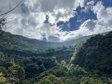
Photos of Peaks in the Central Central AmericaCerro Las Minas
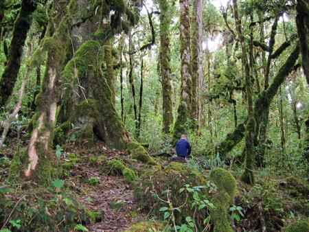
Cloud forest near the summit. Photo by Scott Patterson.
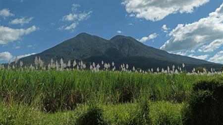
Click here for larger-size photo. | Cerro El Pital
El Pital Photo by Scott Patterson.
Click here for larger-size photo. | Cerro Montecristo

Trifinio / Cerro Montecristo summit with guide Bety, Chris, Celia, Andrew, Nuri, Kattya, Fernando, and Esmeralda. 3 Countries' borders meet here: El Salvador, Honduras, and Guatemala. Fernando and Esmeralda climbed the tall tower to get a panoramic view (2023-03-04). Photo by Christopher "Neo" L.
Click here for larger-size photo. | Volcán de Santa Ana
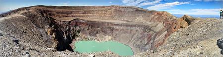
Crater rim and lake of Volcan de Santa Ana from the top of the tourist trail (2014-12-26). Photo by Matt Faust.
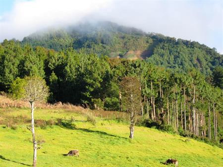
Click here for larger-size photo. | Volcán de San Vicente
San Vicente from Tepetitan (2021-12-15).
Click here for larger-size photo. Edit Photo Info | Volcán de Izalco
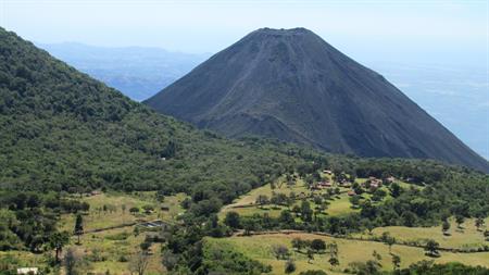
Izalco Photo by Scott Patterson.
Click here for larger-size photo. | Volcán San Salvador
Looking upward at jungle covered crater walls from the bottom of Boqueroncito Descent (2022-11-27). Photo by Christopher "Neo" L.
Click here for larger-size photo. | Volcán Maderas
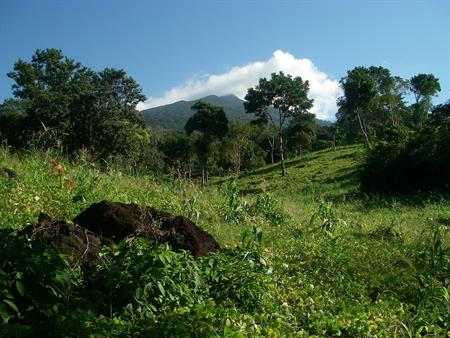
Volcan Maderas, view from near the begining of the Sendero El Porvenir trail (2009-01-04). Photo by Matt Faust.
Click here for larger-size photo. | Volcán Telica
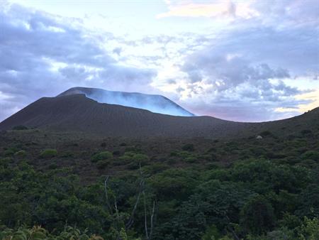
The crater from the east (2016-08-20). Photo by Johannes Lö.
Click here for larger-size photo. |
This page has been served 8636 times since 2004-11-01.
|