Roman Gordion
In the decades following Galatia’s annexation by the emperor Augustus in 25 BCE, a new settlement was founded atop the Gordion Citadel Mound during the late Julio-Claudian period (ca. 50 CE). Although the geographer Strabo, in the only surviving literary reference to Roman Gordion, describes the site during the Augustan period as a village only slightly larger than those that surrounded it (Geography 12.5.3), current evidence for the resettlement of the Citadel Mound places that event roughly half a century later. This settlement appears to have been occupied intermittently until the early fifth century CE, at which time the Citadel Mound was abandoned for reasons currently unknown.

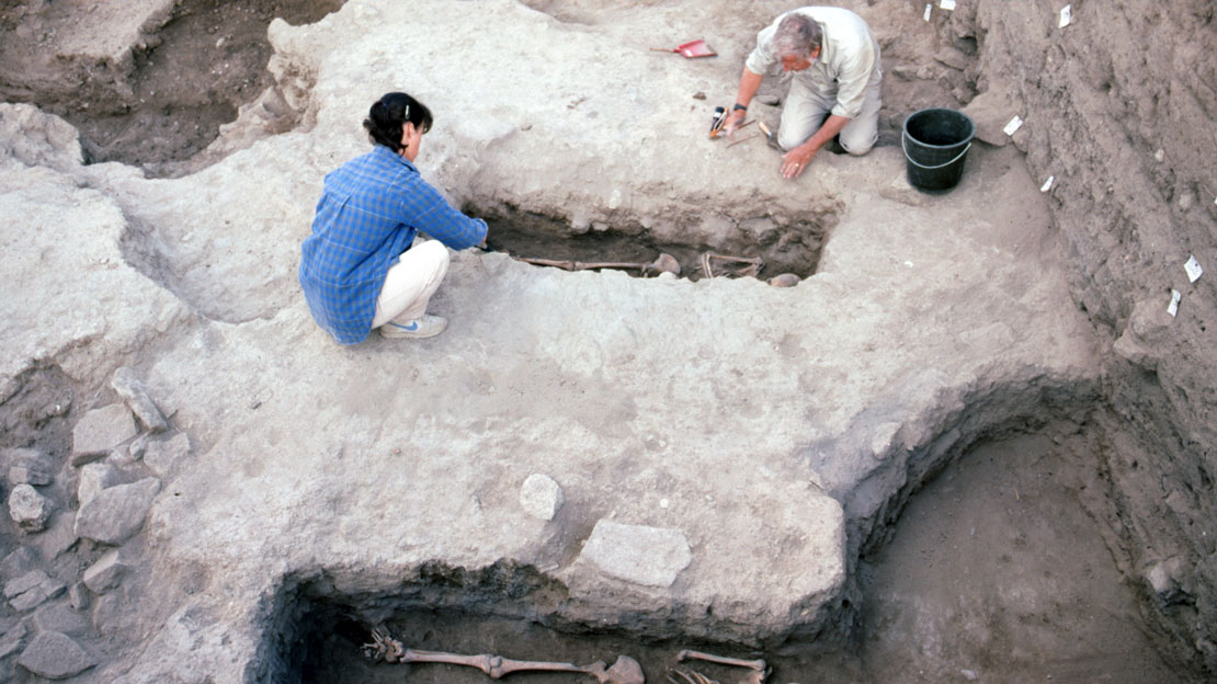
Only comparatively small portions of the Roman period settlement on the Citadel Mound have been excavated to date. In 1900, the Körte brothers, who concentrated their efforts in the southwest zone of the mound, unearthed scant traces of the Roman settlement in that area. R.S. Young exposed more substantial remains in that location and in the northwest zone during his initial 1950 field season, clearing two distinct building phases of the Roman period town in both areas. Operations in the northwest and southwest zones were halted after only a single season, however, following Young’s decision to concentrate in areas with more direct access to the Iron Age strata. Nevertheless, several fragmentary structures along the Roman settlement’s eastern edge were encountered by Young’s team in the “Central Cut” (CC) and “West City Wall” (WCW) trenches, excavated between 1967 and 1973.
Increased interest over the past decade in the site’s later strata led to a fresh exploration of the Roman town under more carefully controlled and recorded conditions. Between 1993 and 2002, M. M. Voigt and T. C. Young reinitiated work in both the northwest and southwest zones, where features previously identified by Young were re-recorded, and the town’s earliest known habitation phases, dating to the late Claudian period, were exposed for the first time. Most recently, in 2004 and 2005, A.L. Goldman directed the first series of excavations to target the Roman settlement, at three separate locations on the Citadel Mound. The project’s specific objectives included an investigation of the following interrelated issues: (1) the date of the town’s foundation and the character of its earliest habitation phases; (2) the pace of expansion and development of the town’s physical plan in different sectors of the Citadel Mound; (3) changes in site function and economic activity during the Roman imperial period; and (4) the spread and extent of ‘Romanized’ cultural patterns among the site’s inhabitants.

The recent investigations have substantially altered previous suppositions regarding the town’s foundation, which is now recognized as representing a carefully orchestrated re-foundation during the mid-first century CE, at which time the surface of the abandoned mound was leveled and a new town built atop its western half. These careful leveling and surveying activities, the adoption of a new north-south axis in the buildings (at variance with the northwest-southeast orientation observed in all pre-Roman phases), the careful laying of mudbrick floors and the construction of subterranean water conduits confirm that the settlement’s establishment was a far more deliberate endeavor than formerly imagined, with significant outside resources brought to the task. The longevity of the town’s occupation is now also evident: at least four major building phases have been identified between the foundation period and the town’s final abandonment in the early fifth century CE. The initial resettlement of the mound appears to have lasted roughly 75 years (ca. 50-125 CE), after which time the inhabitants appear to have moved elsewhere in the valley, perhaps to the immediate north or east of the Citadel Mound (more proximate to the Common Cemetery, where burials from the 2nd to 4th centuries were excavated in the 1950s and 60s). The recent discovery of two dedicatory military altars dating to ca. 214-5 CE have confirmed that a military presence in the area continued during this hiatus of activity on the Citadel Mound. The area’s inhabitants appear to have reoccupied the mound in the late 3rd century, perhaps as a response to the incursions of the Goths and Palmyrans during the 260s and 270s, before a final abandonment roughly a century later.
Furthermore, analysis of the material excavated by Young has revealed higher levels of internal organization and economic activity than formerly suspected. The introduction of sophisticated architectural refinements (e.g. a colonnaded street, a house with a peristyle plan), a comparatively high frequency of stray coin finds, and significant quantities of imported ceramics, glassware, and jewelry all indicate that at least some of the site’s inhabitants attained a moderate level of prosperity, particularly during the Flavian and Trajanic periods, from the second half of the first to early second centuries CE.

Our understanding of the town’s overall function(s) has likewise begun to improve. The discovery in 2004 and 2005 of Roman military equipment and the identification of likely barracks buildings at Gordion proves that the town existed as a minor military and/or administrative post for the local area. Ancient road itineraries place a posting station (statio) named either Vindia or Vinda in the immediate vicinity of Gordion, alongside the highway that ran between the provincial capitals of Ancyra and Pessinus (modern Ankara and Ballıhisar, respectively). Portions of this road have been excavated at Gordion, and field surveys of the route have led to the positive identification of the statio to the immediate west, at Colonia Germa (modern Babadat). Since Germa lies only ca. 25 km southwest of Gordion, at the approximate distance indicated on the itineraries, it has raised two possibilities: that Gordion and Vindia/Vinda are one and the same, or that they represent non-concurrent sites existing adjacent to each other. In the latter case, it is possible that Vindia represents a settlement in the lower valley created after the Citadel Mound was abandoned in the early second century, a fact which would help explain why a new name was adopted for the former Phrygian capital. In either case, Gordion’s selection as a military post is not entirely surprising, since the site is at a strategic location at the confluence of two river valleys (the Sangarius/Sakarya and Tembris/Porsuk). It is now clear that the town played at least a minor role in the provincial administrative and communication system (cursus publicus), located as it was at an important nexus of Rome’s local communication, transportation, and security network in Galatia.
Further reading
- Darbyshire, G., K.W Harl and A.L. Goldman. 2009. “”To the Victory of Caracalla.” New Roman Altars at Gordion,” Expedition 51.2, pp. 31–38.
- Goldman, A. L. 2005. “Reconstructing the Roman-period Town at Gordion,” in The Archaeology of Midas and the Phrygians. Recent Work at Gordion, ed. L. Kealhofer, Philadelphia, pp. 56-67.
- Goldman, A. L. 2010 “A Pannonian auxiliary’s epitaph from Roman Gordion.” in Anatolian Studies 6, pp. 129-146.
- Roller, L. E. 2002. “A Latin Epitaph from Gordion,” Zeitschrift für Papyrologie und Epigraphik 141, pp. 215-220.