How Armenia Plans to Become the Next World-Class Hiking Destination
Epic new trails in the Armenian Highland are putting the country’s outdoor offerings on the map
/https://tf-cmsv2-smithsonianmag-media.s3.amazonaws.com/accounts/headshot/LauraKiniry.png)
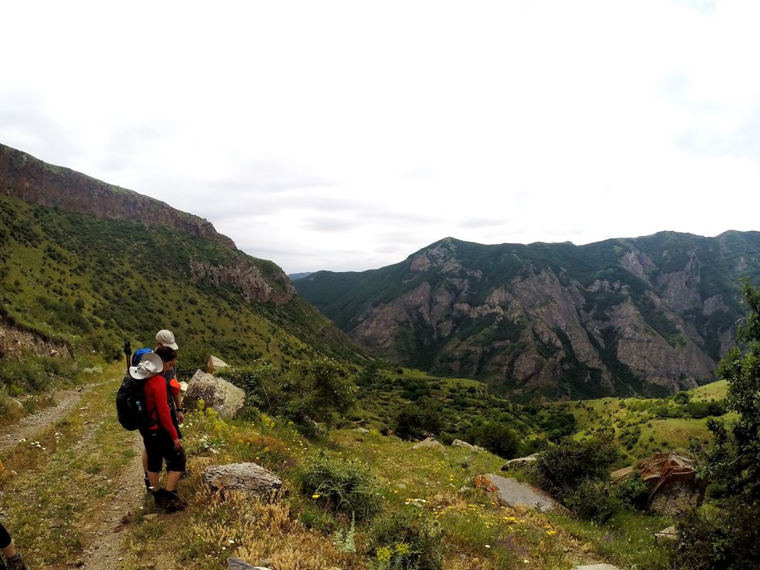
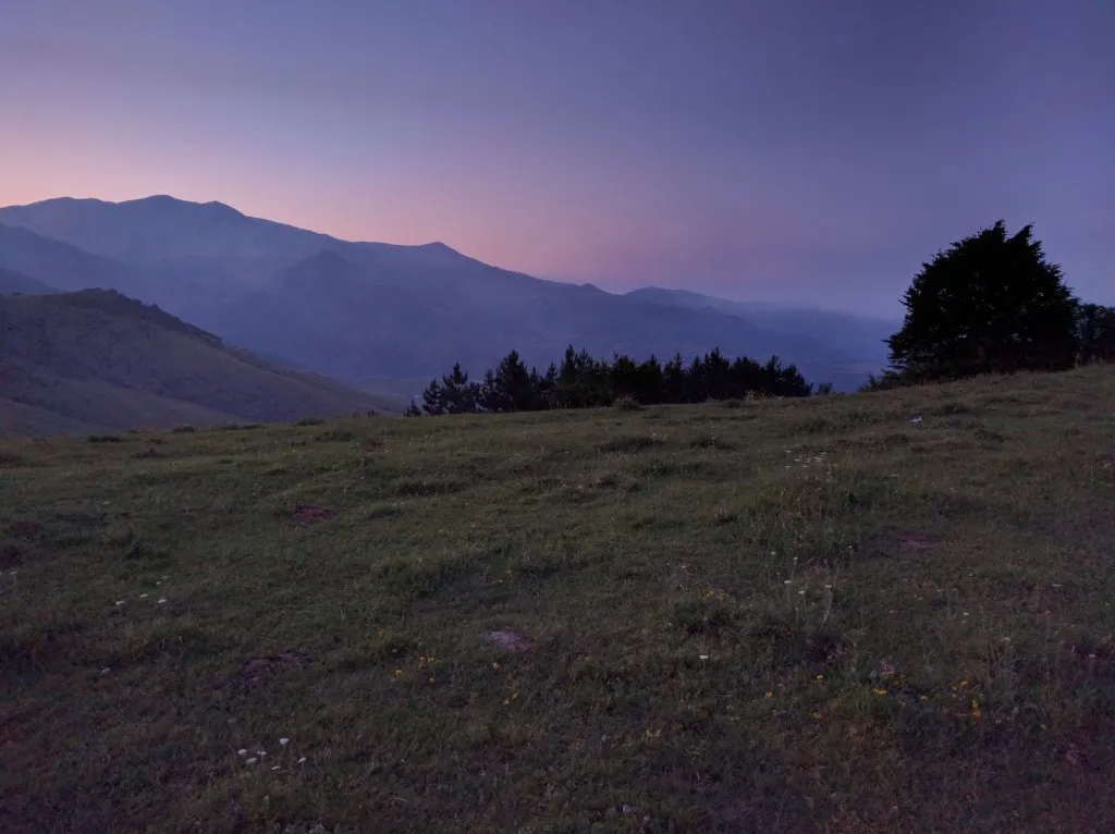
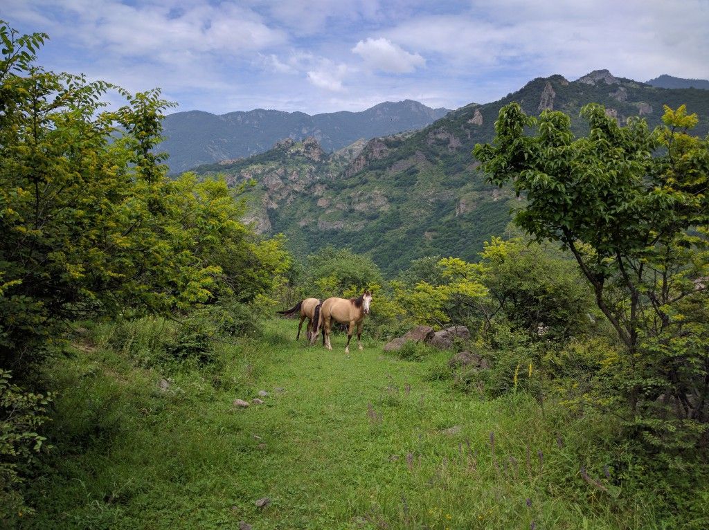
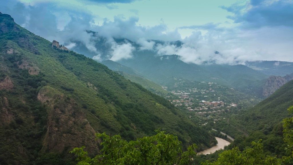
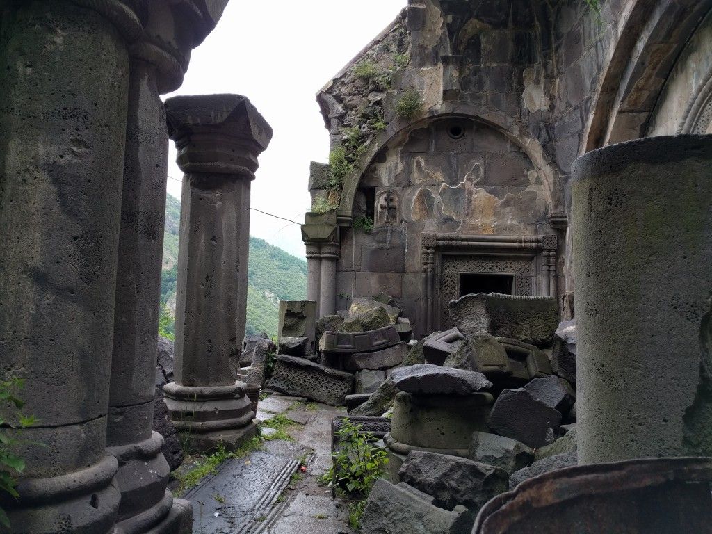
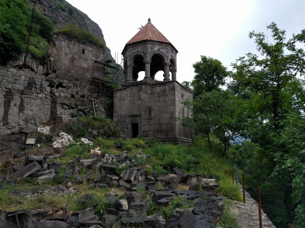
Dilijan National Park stretches across the mountains of Armenia's northeastern Tavush region, 92 square miles of beech and oak tree forests and pine-covered slopes that delve into deep gorges with wandering streams and rivers. Brown bear and deer are frequent park visitors, lured by the scent of blackcurrants and gooseberries, while rarer flora like Armenian Saint John's wort and edible scorzonera grow among rocks and along cliffsides. The park houses some of Armenia's finest cultural monuments as well: centuries-old monasteries like Matosavank and Goshavank, along with villages and towns like Dilijan, the “Little Switzerland of Armenia,” known for its reportedly healing natural spring waters.
With help this summer from a global network of volunteers, Dilijan National Park is also now home to the newest section of the Transcaucasian Trail (TCT)—two connected long-distance hiking trails—a northern route through Georgia and Azerbaijan, and a southern route through Georgia and Armenia—that, when finished, will span more than 1,864 miles and connect approximately two-dozen existing and proposed national parks throughout the Caucasus region, where the peaks of the Greater and Lesser Caucasus Mountains stretch between the Black and Caspian Seas. Together with ongoing projects such as HIKEArmenia, the TCT is part of an effort to transform modern Armenia into a worldwide trekking destination: one with the infrastructure to connect the country's rural communities and spur their economy and development through tourism.
Now funded by the Hovnanian Foundation, HIKEArmenia is steadily becoming the country's premier hiking development group, supporting Armenia’s outdoor adventuring community with hiking infrastructure, rural development, an information center and a website. With additional help from the Armenian Hiker’s Association of Armenia, HIKEArmenia's first step was to create a free app highlighting individual trails as they're marked and built and to provide details like GPS coordinates, info on trail difficulty, length, elevation and sites of notable interest along the way.
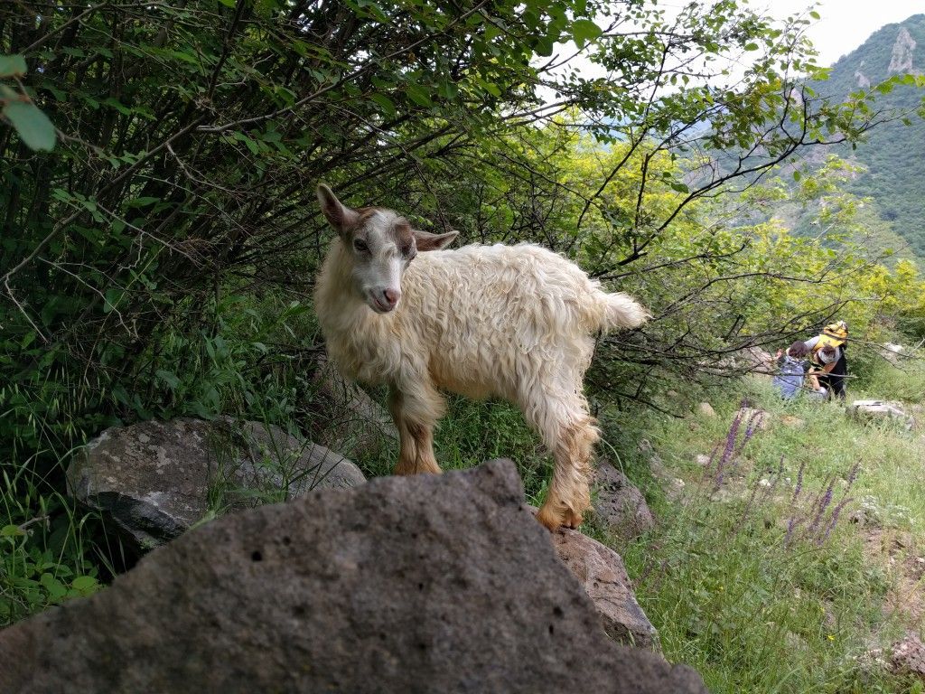
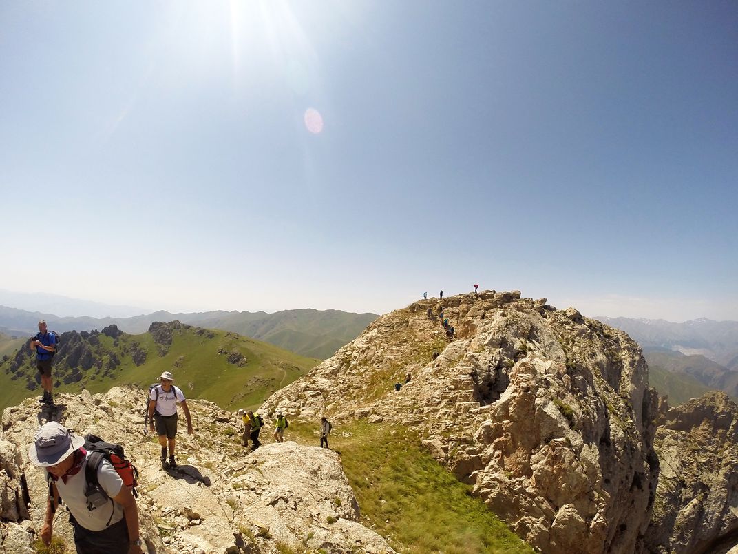
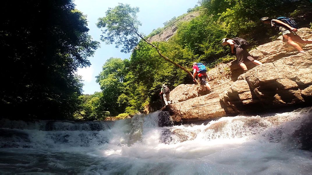
“It's impossible to promote Armenia to hikers without first establishing world-class hiking trails for them to explore,” says Ardag Kosian, HIKEArmenia's Project Manager. Last summer, the project joined forces with TCT Armenia—the NGO responsible for building the Dilijan National Park portion of the southern TCT route—and its “Explorer-in-Chief” Tom Allen, a creative nomad, Royal Geographical Society (RGS) Fellow and Ted Simon Foundation Advisor. Originally from England, Allen married an Armenian and moved to Yerevan—and to a country where he felt adventure didn't exist. That is, until he spent a summer trekking its mountains and traversing its wild landscapes, spurring the idea to construct Armenia's first-ever long-distance hiking trail. Together, the two set out to physically mark one of HIKEArmenia's first five hiking trails: a 5.6-mile trek from northern Armenia's Kobayr monastery to the historic village of Odzun, known for its unique connection to Thomas the Apostle, who is said to have buried the swaddling clothes of Jesus beneath the village's 5th century St. Astvatsatsin church. The trail meanders through a scenic river gorge with some moderate-to-steep climbs. If you're lucky, you may even encounter bezoar ibex, a type of wild goat, along the way.
Allen says that since attracting hikers calls for implementing “internationally recognized standards and practices,” the group set about physically marking the trail with easy-to-see red and white painted blazes—the same type being used in Georgia and several other European countries. “My personal goal is to make the Armenian landscape more accessible to explorers and nature lovers,” says Allen, “while developing a culture of respect and preservation toward the environment.” To help him achieve this, Caucasus Nature Funds (CNF) and the Hovnanian Foundation provided Allen with funding to build the TCT in Dilijan, and HIKEArmenia is continuing to update their maps with newly opened portions of the trail. “[Our partnership] came about as a result of overlapping interests,” says Allen, pointing out that for most of 2016, “TCT and ONEArmenia were the only agencies working to develop Armenia's public hiking infrastructure (as opposed to tour products) to increase its competitiveness as a hiking destination.” It's a win-win opportunity: Allen has funds to create what will eventually become the Transcaucasian Trail, which assists with one of HIKEArmenia's main focuses: becoming a virtual base for everything hiking- and ecotourism-related countrywide.
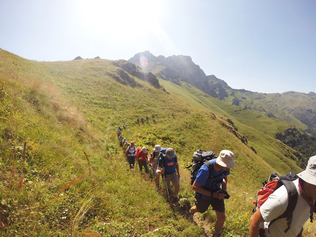
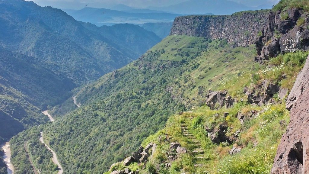
With the support of CNF, who helped to secure permission to build the trail in Dilijan National Park’s protected area, TCT Armenia broke ground on the trail in June 2017. This portion of the TCT—which will renovate 62 miles of trail in total—will be completed this fall. While it’s still under construction TCT Armenia offers a donation-based, five-day hiking trip which traverses completed portions of the trail, as well as existing dirt roads and footpaths that the trail will wind around when it’s finished. The horseshoe-shaped route runs through the heart of the national park, from Hovq, through the town of Dilijan and ending in Kachardzan. But the TCT blog, which provides updated maps and difficulty ratings for each new portion of the trail, also encourages hikers to try the route in reverse, or check out shorter, completed trail sections. On September 18, Allen announced the opening of two new trails that comprise 12-miles of the TCT and connect the town of Dilijan, Parz Lake and the Goshavank monastery—three of the park’s highlights by way of beautiful, pristine terrain. The trails are open to everyone, but TCT Armenia recommends that visitors not experienced with high-alpine hiking hire a guide for some of the higher-elevation trails.
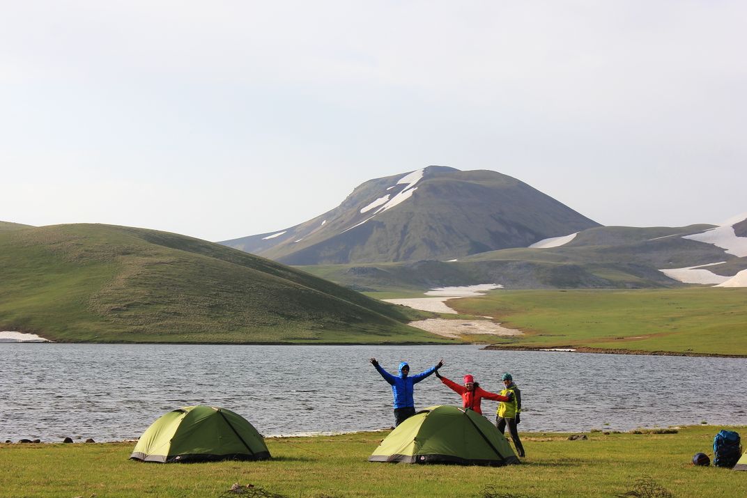
Completion of the entire TCT in both the southern and northern Caucasus Range will be a challenging multi-national effort. “In order to realize the overall vision, the TCT Association will need to coordinate the efforts of local TCT organizations and partners in all three nations, as well as negotiate the logistical complications of working in a region with closed borders and ongoing territorial conflicts—no small task!” Allen said in an email. But in the meantime, Armenia is becoming a prime hiking destination all its own. “The TCT has established the standard by which trails in Armenia will be built from now on,” says Kosian, referring to such things as rebuilding existing village-to-village routes that have fallen into disrepair, clearing downed trees and debris, and improving trail markers. Both HIKEArmenia and TCT Armenia have also partnered with organizations such as ARK Armenia, a non-profit NGO that's developing eco-camps in southern Armenia's Syunik province. ARK built their first ecocamp on a grassy hilltop about a 15-minute walk from Kaplan, Syunik's mountain-carved capital, complete with both kitchen and tent areas, mini bunk-filled cabins sporting six beds total, and even a proper bathroom and shower. Their second camp, The Dacha—which will feature 20 beds and an outdoor pool—remains under construction in the rural village of Arajadzor, about six miles from the capital city.
One of the main benefits of developing a world-class hiking infrastructure is that it can be a boon for local communities. HIKEArmenia's six marked trails cross the paths of tiny villages and fruit-filled orchards with produce stands, and the app recommendations lodgings like ARK's Kapan Eco-camp and the Harsnadzor Eco Resort—an upscale hostel with barrel-shaped wooden cabins and an onsite sauna near the Devil's Bridge trailhead and the Tatev monastery. It also features a section on local guides, providing both their email address and phone number so that users can contact them directly for advice, a guided hike, or both. The current dozen-or-so list includes Gevorg Gasparyan, a hiking and mountaineering specialist who runs the Armenian-based adventure tour company Arevi (and who first recorded the Kobayr to Odzun trek for HIKEArmenia), and Artyom Babayan—a writer and editor for the explore Armenia website, SelfTravelGuide, with a wealth of outdoor experience. Babayan helped HIKEArmenia scout their 3.4-mile featured trail between Saghmosavank monastery and Hovhannavank monastery in the country's western Aragatsotn province.
“Where the trail begins, at the 13th-century Saghmosavank monastery, you can see three mountains,” says Babayan. “Mt. Ara, Mt. Aragats and Mt. Ararat,” the latter a national symbol for Armenian people. “The trail then runs along the edge of the Kasagh river canyon, with wide open fields on your right and the canyon on your left, before reaching the village of Ohanavan, where the 13th century Hovhannavank monastery is located. You'll pass some apricot gardens, for which Armenia is famous, and there's a chance you'll see foxes and wild rabbits.” Along the way, Babayan provides hikers with background on the monasteries, architectural details and even a bit of folklore. “There's a legend that one day Armenia's patron saint Gregory the Illuminator was praying at the top of Mt. Aragats, when an ever-burning lantern came down from the sky and illuminated him. Many believe that the Lantern of Lusavorich (Illuminator) is still hanging there on the mountain, but only those with a pure heart can see it.”
/https://tf-cmsv2-smithsonianmag-media.s3.amazonaws.com/accounts/headshot/LauraKiniry.png)