This timeline provides an in-depth look at the evolution of territorial claims, disputes, governance issues and agreements concerning the Arctic Ocean and the Arctic littoral states. With average sea ice coverage expected to continue dissipating over the coming decades, new areas will become accesible for commercial fishing, shipping, and energy development, forcing Arctic states to map out sovereign boundaries to legally and peacefully utilize the region’s vast natural resource wealth.
Ongoing
Hans Island
Canada and Denmark (via Greenland) continue to dispute the status of Hans Island.
Both states currently dispute the territorial status of a small – 1.3 square kilometer – island in the Kennedy Channel of the Nares Strait between Canada’s Ellesmere Island and northern Greenland.The uninhabited island lies between the equidistant boundaries determined by a 1973 treaty between the two States. At the time, negotiators could not agree on the status of the island and left its status out of treaty negotiations. As recently as April 11, 2012, both States acknowledged the idea of splitting the island, but an agreement has yet to be reached.
Lomonosov Ridge
Canada, the Kingdom of Denmark (via Greenland), and the Russian Federation each assert that the Ridge is an extension of their own continental shelf. Proof of its continuation, would give the State access to the sea bed and natural resources beyond the current 200 nautical mile (nm) limit. The United States claims it to be an oceanic ridge and thus not an extension of any State’s continental shelf, and therefore refutes any claim to its ownership.
2014
16 December
Denmark is expected to submit a claim to the United Nations Commission on the Limits of the Continental Shelf (CLCS) within the United Nations Convention on the Law of the Sea (UNCLOS), to attempt to prove that the Lomonosov Ridge is an extension of Greenland’s land mass.
Within the 2011 “Kingdom of Denmark: Strategy for the Arctic 2011 – 2020,” Denmark asserts that it will submit data and other material to the CLCS as a basis for extension of the continental shelf beyond 200nm on three areas near Greenland, including the Lomonosov Ridge. Proof that the Lomonosov Ridge extends from Greenland’s continental shelf would give Denmark unfettered access to much of the seabed surrounding the North Pole. Currently, Canada, the Kingdom of Denmark and the Russian Federation assert that the Lomonosov Ridge are continuations of their own continental shelf, while the US claims it to be an oceanic ridge and thus not an extension of any State’s continental shelf.
2013
Canada is expected to submit a claim to the CLCS, within UNCLOS, to prove the Lomonosov Ridge is a continuation of its own continental shelf.
Canada is expected to claim that the ridge is an underwater extension of Ellesmere Island. If it’s proven that the Lomonosov Ridge is an extension of Canada’s continental shelf, Canada would obtain unfettered access beyond their exclusive economic zone (EEZ) of 200nm, and instead, would gain access to the seabed and its resources across the continental shelf. Canada would be required to submit bathymetry, seismic and gravity data to substantiate its claim.
2012
31 December
Shell’s oil Conical Drilling Unit (CDU) – the Kulluk – runs aground on the northern tip of Ocean Bay, located on the southeast side of Sitkalidak Island, Alaska, after tow connections were lost and regained over several days starting on 27 December.
The unit has since been towed safely to harbor intact without any oil or hazardous substance release to the environment; the unit contained nearly 150,000 gallons of diesel, aviation fuel and industrial lubricants.
Many critics mark this incident – and the Deepwater Horizon spill in the Gulf of Mexico – as clear demonstrations that oil companies are not ready to safely explore and develop energy resources in the Arctic. Critics assert that the slow response in the relatively calm waters in the Gulf pail in comparison to the difficulties present in the Arctic.
17 October
US Department of Interior’s Bureau of Safety and Environmental Enforcement (BSEE) approved of Shell Gulf of Mexico Inc.’s (Shell) Oil Spill Response Plan (OSRP) for the Chukchi Sea.
This has been documented by many as the last major hurdle to allow Shell to move forward with offshore oil drilling in the Chukchi Sea off the North Coast of Alaska. Shell has already gained a number of oil drilling leases from the Department of Interior in the Chukchi Sea. These steps are in line with President Obama’s commitment to an “all-of-the-above energy approach,” which includes a focus on safe and responsible production of domestic oil and natural gas resources.
2011
22 August
Denmark, releases “Kingdom of Denmark: Strategy for the Arctic 2011 – 2020.”
Denmark’s strategy – with preparation from the governments of the Faroe Islands and Greenland – lays out the kingdom’s Arctic interests and intents in the coming years. The main objectives of the Arctic strategy are to “ensure a peaceful, secure and safe Arctic, with economic growth and development, with respect to the vulnerable Arctic climate, environment and nature and close cooperation with our international partners.”
12 July
President Obama establishes Executive Order 13580 – Interagency Working Group on Coordination of Domestic Energy Development and Permitting in Alaska.
The Executive Order establishes the Interagency Working Group on the Coordination of Domestic Energy Development and Permitting in Alaska. The Chair, Deputy Secretary of the Interior David Hayes, will coordinate efforts across all federal agencies to develop energy in the Arctic. The executive order is intended to coordinate, streamline and efficiently share information and efforts by the Federal agencies responsible for overseeing energy development in Alaska and help reduce US dependence on foreign oil.
7 July
The Kingdom of Norway and the Russian Federation ratify the Treaty on Maritime Delimitation and Cooperation in the Barents Sea and the Arctic Ocean.
Ratification of the Treaty resolved a 40-year dispute over a 175,000 square kilometer (67,000 square miles) area in the Barents Sea that persisted between the boundaries of the two States. The treaty divides the disputed territory nearly in half. Both States have been previously unable to explore oil and gas development in the disputed area, which is believed to contain vast reserves.
2010
27 October
The United Nations Environmental Program (UNEP) releases “Protecting Arctic Biodiversity: Limitations and Strengths of Environmental Agreements.”
The report urges for further and more proactive protection of Arctic biodiversity, noting the threats and changes currently taking place from climate change and other anthropogenic causes in the region. The report attempts to analyze Arctic multilateral environmental agreements (MEA) and the role of the environment on impacting and influencing each MEA.
15 September
Norway and the Russian Federation sign Treaty on Maritime Delimitation and Cooperation in the Barents Sea and the Arctic Ocean.See 7 July 2011 for information regarding ratification of the treaty.
1 February
The Department of Defense releases its “Quadrennial Defense Review”
The QDR states that climate change in the Arctic is significant, and urges for the Department’s need to adapt and prepare for the decades ahead. The report suggests the need to coordinate efforts with the Coast Guard and the Department of Homeland Security to effectively address gaps in Arctic communications, domain awareness, search and rescue, environmental observation and forecasting capabilities. To achieve these goals, the QDR, “strongly supports accession” to UNCLOS.
2009
27 March
Norway receives recommendations from the Commission on the Limits of the Continental Shelf (CLCS) on its 27 November 2006 submission to the Commission.
Helps to clarify territorial disputes in the Barents Sea, Arctic Ocean, Norwegian and Greenland Seas. CLCS recommends that Norway and Russia pursue individual agreements.
28 May
The Ilulissat Declaration given following a political level meeting between the five coastal States bordering the Arctic Ocean – Canada, Denmark, Norway, the Russian Federation, and the United States – in Ilulissat, Greenland.
States met to discuss the Arctic in the face of coming climatic changes. The parties remain committed to the existing legal framework and to the orderly settlement of any possible overlapping claims without the need to create an extensive international regime to govern the Arctic Ocean. Parties agreed to the legal framework discussed in Oslo on 15 and 16 October 2007.
2008
May
The US Geological Survey (USGS) completed its “Circum-Arctic Resource Appraisal: Estimates of Undiscovered Oil and Gas North of the Arctic Circle.”
The USGS estimates that 90 billion barrels of oil, 1,669 trillion cubic feet of natural gas, and 44 billion barrels of natural gas liquids may remain in the Arctic. The report suggests that 84 percent of the resources are expected to occur in offshore areas.
6 February
Chukchi Sea Lease Sale 193.
Under the Bush Administration, roughly 80 million acres in Arctic waters were opened to energy development as part of the 2007-2012 offshore drilling plan. Six sales were planned, but only one occurred – Chukchi Sea Lease Sale 193 – before the DC Circuit Court of Appeals declared the plan illegal. Numerous companies, including Shell, acquired leases for exploration in the Chukchi Sea off the Alaskan Coast. In March 2010, the Obama administration cancelled all future lease sales in the Arctic Ocean, citing a lack of information to support moving forward, but kept the three million acre Chukchi Lease Sale 193 intact, amounting to nearly USD$2.7 billion.
2007
2 August
Russian explorers symbolically claim the North Pole by planting a titanium deep-sea flag on the seabed (14,000 feet) below the North Pole during the Arktika sea expedition.
During the expedition, which collected water and sediment samples in order to substantiate Russia’s claim to the Lomonosov Ridge, explorers planted the flag to assert that the seabed beneath the North Pole belongs to Russia. Samples were submitted as evidence to the CLCS that the Lomonosov Ridge is an extension of the Eurasian continental shelf. This would give the Russian Federation sole access to nearly one-half of the Arctic and the region of the North Pole.
2006
1 December
The Norwegian Government releases its “High North Strategy”
The report asserts that the Arctic is Norway’s number one foreign policy priority in the coming years. The initiative seeks to clarify long-term Norwegian policy in the Arctic in order to secure economic resources and its security into the future.
27 November
Norway submits claim to the CLCS to clarify disputed territory.
Norway, who ratified UNCLOS on 24 June 1996, sought to resolve territorial sea disputes, called the Loop Hole in the Barents Sea, the Western Nansen Basin in the Arctic Ocean, and the Banana Hole in the Norwegian Sea. Norway submitted evidence substantiating its claims to the areas in dispute.
2005
20 July
Canadian Minister of National Defence, Bill Graham, poses for pictures with the newly erected Canadian flag – placed on 13 July – on Hans Island during Exercise Frozen Beaver.
13 July
Exercise Frozen Beaver (Operation Sovereign Inukshuk) represents the first visit to Hans Island – an uninhabited island that both Canada and Denmark (via Greenland) claim – by Canadian Forces.
Canadian Forces helicopters and Canadian Rangers, landed on the island, and replaced a previously planted Danish flag with a Canadian one as well as left a plaque and an Inukshuk – a stone marker – on the island to symbolically claim sovereignty.
2004
16 November
Denmark ratifies UNCLOS. Denmark can submit disputed territorial claims to the CLCS.
2003
7 November
Canada ratifies the UNCLOS. Canada can submit disputed territorial claims to the CLCS.
2001
20 December
The Russian Federation delivered submission to the CLCS claiming that the Lomonosov Ridge was an extension of its continental shelf. Russia stood to potentially acquire nearly one-half of the Arctic Ocean, including the North Pole.
In 2002, the UN Commission neither rejected nor accepted the proposal, recommending additional research was necessary.
1997
12 March
The Russian Federation ratifies the UNCLOS. Russia can submit disputer territorial claims to the CLCS.
1996
19 September
Arctic Council emerges from the Ottawa Declaration of 1996.
The Arctic Council is created as a high-level intergovernmental forum to provide a means for promoting cooperation, coordination and interaction among the Arctic States, with the involvement of the Arctic Indigenous communities and other Arctic inhabitants on common Arctic issues. The Council oversees environmental preservation, sustainable development as well as encourages and promotes information and education of the Arctic.
Member states include: Canada, the Kingdom of Denmark (including Greenland and the Faroe Islands), Finland, Iceland, Norway, the Russian Federation, Sweden and the United States. Six international organization representing Arctic Indigenous Peoples have permanent participant status.
24 June
Norway ratifies UNCLOS. Norway can submit disputed territorial claims to the CLCS.
1994
16 November
The UN Convention of the Law of the Sea (UNCLOS) enters into force one year after its sixtieth signature.
The Convention defines the rights and responsibilities of nations in their use of the world’s oceans, establishing guidelines for businesses, the environment, and the management of marine natural resources. UNCLOS establishes the International Sea Bed Authority and Exclusive Economic Zones. UNCLOS builds on the four 1958 law of the sea conventions and sets forth a framework for future activities in parts of the oceans that are beyond national jurisdiction. Part VI of the convention, dealing with the Continental Shelf, and Annex II, which established a Commission on the Limits of the Continental Shelf, are most pertinent to the Arctic as it becomes more accessible due to a decrease in sea ice extent, bordered by the five coastal States.
1991
10 December
The Russian Federation submitted its claim – the first Arctic State to do so – to 1.2 million square kilometers of territory, including the North Pole to the CLCS in accordance with UNCLOS provisions.
1988
11 January
Agreement on Arctic Cooperation between Canada and the United States.
Following the United States Coast Guard Polar Sea’s crossing of the Northwest Passage without formal Canadian governmental consent, the Canadian government established straight baselines around Canada’s perimeter. The act reaffirmed Canada’s position that the Northwest Passage lays within its internal waters.
1985
The United States Coast Guard’s Polar Sea traverses the Northwest Passage – from Greenland to Seattle – without formal permission from Canada.
The US government notified the Canadian government of the impending voyage, but did not seek formal permission into what Canada considers its internal waters. The event provoked much opposition and controversy within Canada, in which, many claimed the event was a violation of its national sovereignty.
1984
31 July
US Arctic Research Commission established under the Arctic Research and Policy Act of 1984.
The commission established the national policy, priorities, and goals necessary to construct a federal program plan for basic and applied scientific research in the Arctic. The federal agency provides the President and Congress with reports, recommendations, and advice on Arctic research.
28 July
The Danes raise their national flag on the disputed Hans Island – the small uninhabited island in the Kennedy Channel of the Nares Strait between both Canada’s Ellesmere Island and northern Greenland. Both Canada and Denmark (via Greenland) claim the island that exists on both Canadian and Danish sides of the Strait.
1982
10 December
The United Nations Convention on the Law of the Sea (UNCLOS) is signed and opened to ratification by States. To come into force, the Convention requires sixty signatures and would only enter into force one year after its sixtieth signature. UNCLOS contains the Commission on the Limits of the Continental Shelf (CLCS) under Article 76, which allows for a nation to extend sovereignty beyond the limits of the EEZ if the CLCS verifies that a country’s continental shelf extends further.
1974
13 March
Agreement on the Delimitation of the Continental Shelf between Canada and the Kingdom of Denmark enters into force. The agreement distinguished territory between Canada and Greenland. Both delayed any decision regarding the sovereignty of Hans Island – a small 1.3 square kilometer uninhabited island – which lies on both sides of the territorial divide.
1973
17 December
Canada and the Kingdom of Denmark sign and submit agreement on the delimitation of the continental shelf between Greenland and Canada to the United Nations. The agreement was designed to distinguish territory for the purposes of exploration and exploitation of the natural resources of the continental shelf. Both delayed any decision regarding the sovereignty of Hans Island – a small 1.3 square kilometer uninhabited island – which lies on both sides of the territorial divide.
1971
22 December
The Nixon Administration establishes National Security Decision Memorandum 144.
After reviewing the NSC Under Secretaries Committee’s recommendations, conclusions and report regarding United States Arctic policy and organization arrangements for its implementation, President Nixon, decided that the US would support “sound and rational development” minimize adverse risks to the environment; promote international cooperation in the Arctic; and provide for the protection of security interests in the region.
1969
24 August – 14 September
US oil tanker, the SS Manhattan, becomes the first commercial vessel to cross the Northwest Passage.
Humble Oil, a US based company, attempted to determine the economic and logistical feasibility of sending oil tankers through the Canadian Archipelago. The company retrofitted the tanker to handle the rough ice breaking conditions necessary to traverse the Passage. Humble Oil did not formally ask Canada for permission to cross – the US did and does not consider the NW-Passage part of Canada’s internal waters, but a strait in international waters. In spite of successfully crossing the ice covered portions of the Passage, Humble Oil deemed that backing the Trans-Alaska pipeline was more economically feasible.
1946
July
Canadian Ambassador to Washington DC publishes, “Canada Looks Down North” in Foreign Affairs.
Ambassador Lester Pearson, attempted to claim not only the islands, but the frozen sea north of the mainland between the meridians of Canada’s east and west boundaries, extending up to the North Pole under Canadian sovereignty.
1945
28 September
President Truman establishes Proclamation 2667, “Policy of the US with Respect to the Natural Resources of the Subsoil and Sea Bed of the Continental Shelf”
In his proclamation, President Truman sought to preserve and utilize the natural resources of the subsoil and sea bed of the continental shelf (beyond the 3-mile limit) beneath the high sea that extended from the United States’ shores. He made clear that the right to free and unimpeded navigation would not be affected. President Truman affirmed that the United States had exclusive jurisdiction over its continental shelf resources.
1926
19 July
Canada establishes the Arctic Island Game Preserve.
Originally created to preserve muskoxen populations for Inuit populations in the region, the Preserve also addressed the issue of sovereignty in the Arctic Archipelago. By establishing the Preserve, Canada asserted its sovereignty over much of the Archipelago.
15 April
USSR Central Executive Committee issued its Arctic Decree.
In it, the USSR declared that all lands and islands, between the USSR and North Pole, were territory of the USSR. The Decree was seen as a response to previous Canadian claim to the territory between its mainland and the North Pole the previous year.
1925
1 June
Amendment to the Northwest Territories Act.
Canada became the first State to claim that its boundaries extended into to the Arctic and up to the North Pole.
1914-1915
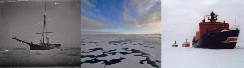
First ever traverse of the Northern Sea Route, included icebreakers Taimyr and Vaigach.
The 1910-1915 Arctic Ocean Hydrographic Expedition represented a great effort by the Imperial Russian Navy to explore, survey, and chart the Northern Sea Route for commercial purposes.
1909
1 July
Captain Joseph Bernier unveils a plaque on Melville Island in the Arctic Archipelago.
The plaque officially claimed the Arctic Islands for Canada.
6 April
Admiral Peary plants flag of the United States at the North Pole.
Though not substantiated, Peary, claimed to have reached the North Pole and placed a note in a glass bottle: ‘I have this day hoisted the national ensign of the United States of America at this place, which my observations indicate to be the North Polar axis of the earth, and have formally taken possession of the entire region, and adjacent, for and in the name of the President of the United States of America.’
1907
20 February
Canadian Senator Pascal Poirier proposed a resolution before the Canadian Senate to declare possession of the lands and islands between Canada and the North Pole. He deemed the resolution necessary to protect Canada’s right to the Arctic.
1903 – 1906
Norwegian explorer, Roald Amundsen, became the first successful explorer to traverse the Northwest Passage on the twenty-one meter Gjoa.
1903
Canada establishes the North-West Mounted Police detachment on Herschel Island off the North coast of the Yukon Territory.
By establishing the outpost, Canada hoped to secure its sovereignty in the western Arctic.