According to the U.S. Drought Monitor, 82 percent of the state of California currently falls in the "Extreme Drought" category. The years-long dry spell has tapped groundwater reserves and left reservoirs at record lows. Shasta Lake and Lake Oroville are both down to 30% of full capacity, exposing steep shorelines that were formerly under hundreds of feet of water. Marinas are crowding into ever-smaller coves as the water recedes, and ramps and roads no longer reach the shoreline. Getty Images photographer Justin Sullivan traveled to a number of these reservoirs last month and captured dramatic images, evidence of the severity of the water crisis in California.
Dramatic Photos of California's Historic Drought
Hints:
View this page full screen.
Skip to the next and previous photo by typing j/k or ←/→.
-
![]() Read more
Read moreA section of Lake Oroville is seen nearly dry on August 19, 2014 in Oroville, California. As the severe drought in California continues for a third straight year, water levels in the State's lakes and reservoirs are reaching historic lows. Lake Oroville is currently at 32 percent of its total 3,537,577 acre feet. #
Justin Sullivan/Getty Images -
-
![]() Read more
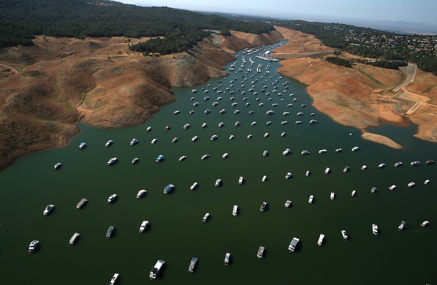
Read moreLow water levels are visible in the Bidwell Marina at Lake Oroville on August 19, 2014 in Oroville, California. #
Justin Sullivan/Getty Images -
![]() Read more
Read moreDry cracked earth on the banks of Shasta Lake at Holiday Harbor in Lakehead, California, on August 30, 2014. Shasta Lake is currently near 30 percent of its total capacity, the lowest it has been since 1977. #
Justin Sullivan/Getty Images -
![]() Read more
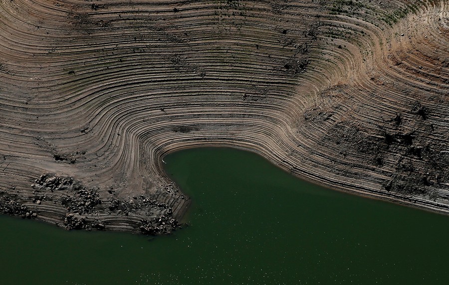
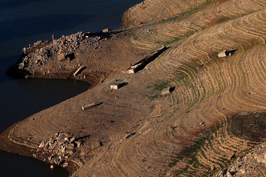
Read moreRings on the banks of Lake Oroville that used to be under water on August 19, 2014 in Oroville, California. #
Justin Sullivan/Getty Images -
-
![]() Read more
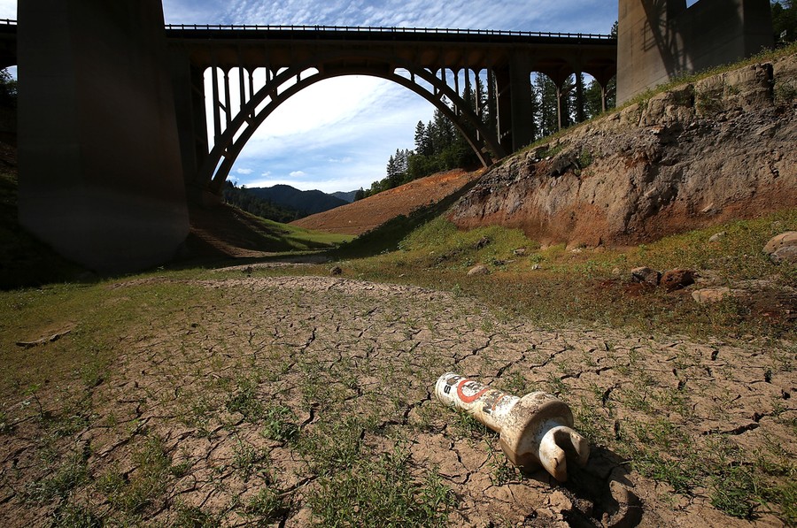
Read moreA buoy sits on dry cracked earth on a dry inlet of Shasta Lake on August 30, 2014 in Lakehead, California. #
Justin Sullivan/Getty Images -
![]() Read more
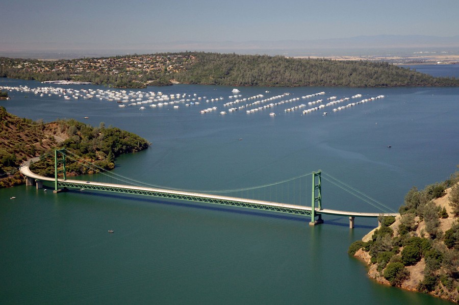
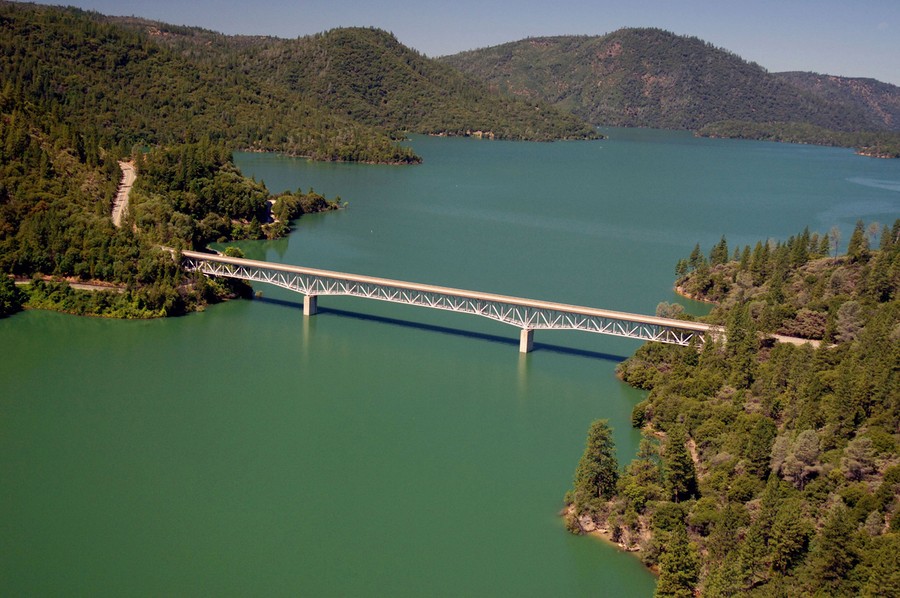
Read more(1 of 2) For a before-and-after comparison, first an image from a wetter time: the Green Bridge passes over full water levels at a section of Lake Oroville near the Bidwell Marina on July 20, 2011. #
Paul Hames/California Department of Water Resources via Getty Images -
![]() Read more
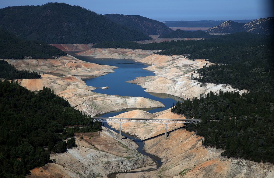
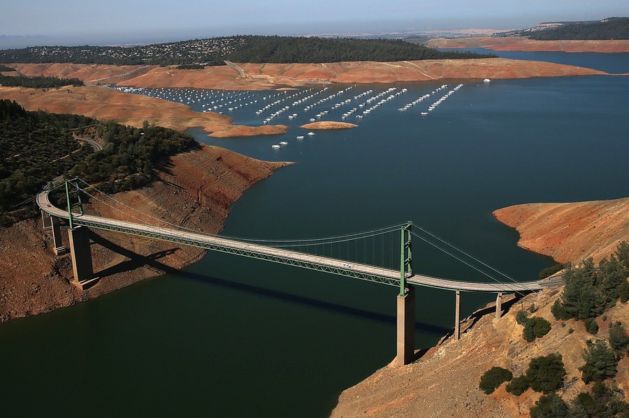
Read more(2 of 2) Seen from the same location as the previous image, the Green Bridge passes over low water levels at a section of Lake Oroville on August 19, 2014. #
Justin Sullivan/Getty Images -
-
![]() Read more
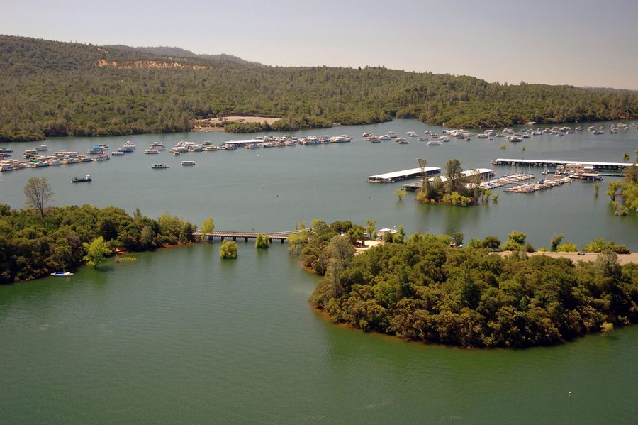
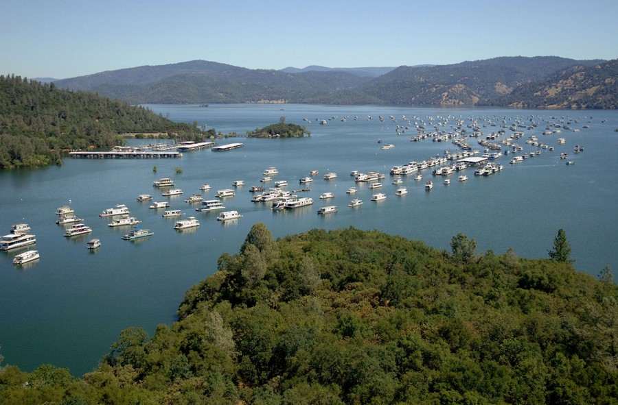
Read more(1 of 2) Full water levels in the Bidwell Marina at Lake Oroville on July 20, 2011. #
Paul Hames/California Department of Water Resources via Getty Images -
![]() Read more
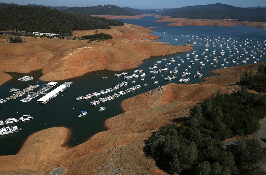
Read more(2 of 2) Low water levels in the Bidwell Marina at Lake Oroville on August 19, 2014. #
Justin Sullivan/Getty Images -
![]() Read more
Read more(1 of 2) Before: full water levels in the Bidwell Marina at Lake Oroville on on July 20, 2011. #
Paul Hames/California Department of Water Resources via Getty Images -
-
![]() Read more
Read more(2 of 2) After: low water levels in the Bidwell Marina at Lake Oroville on August 19, 2014. #
Justin Sullivan/Getty Images -
![]() Read more
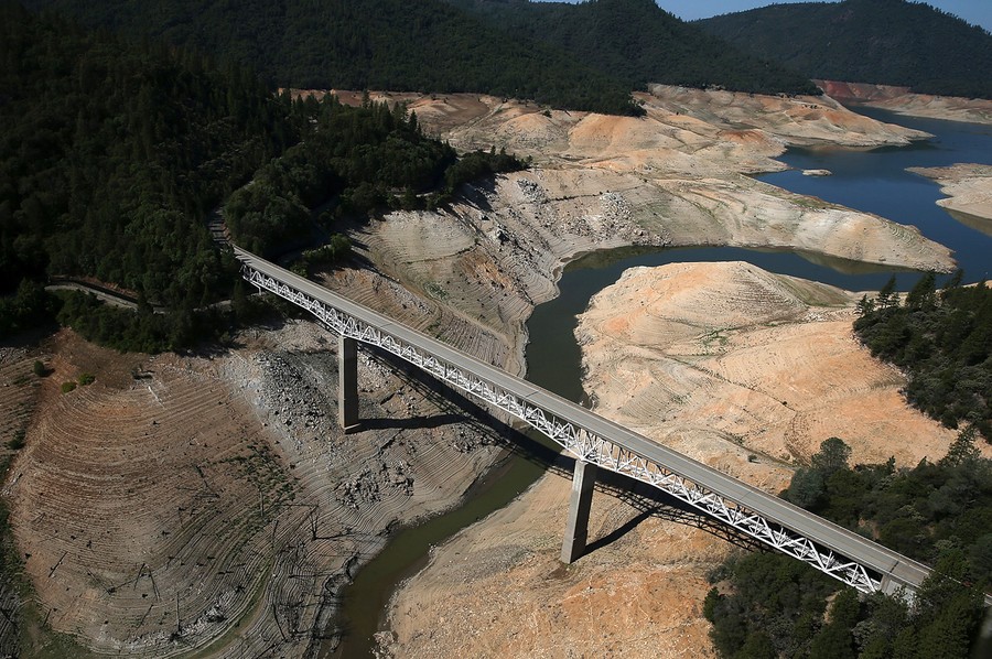
Read more(1 of 2) Before: the Enterprise Bridge passes over a full Lake Oroville on July 20, 2011. #
Paul Hames/California Department of Water Resources via Getty Images -
![]() Read more
Read more(2 of 2) After: the Enterprise Bridge passes over a nearly dry Lake Oroville on August 19, 2014. #
Justin Sullivan/Getty Images -
-
![]() Read more
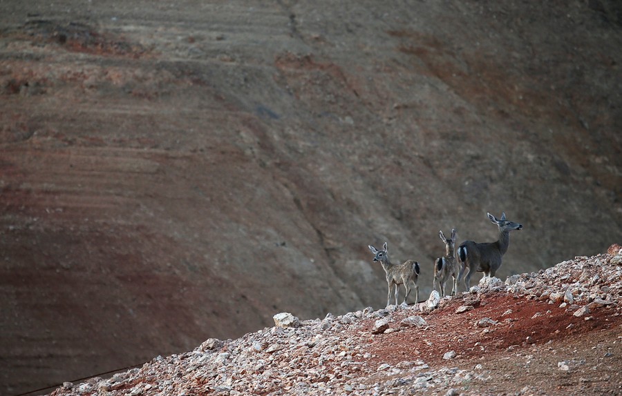
Read moreDeer walk on ground that used to be the bottom of Shasta Lake near Digger Bay Marina on August 30, 2014 in Redding, California. #
Justin Sullivan/Getty Images -
![]() Read more
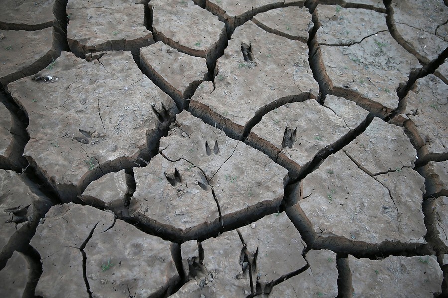
Read moreAnimal tracks in dry cracked earth on the banks of Shasta Lake on August 30, 2014 in Lakehead, California. #
Justin Sullivan/Getty Images -
![]() Read more
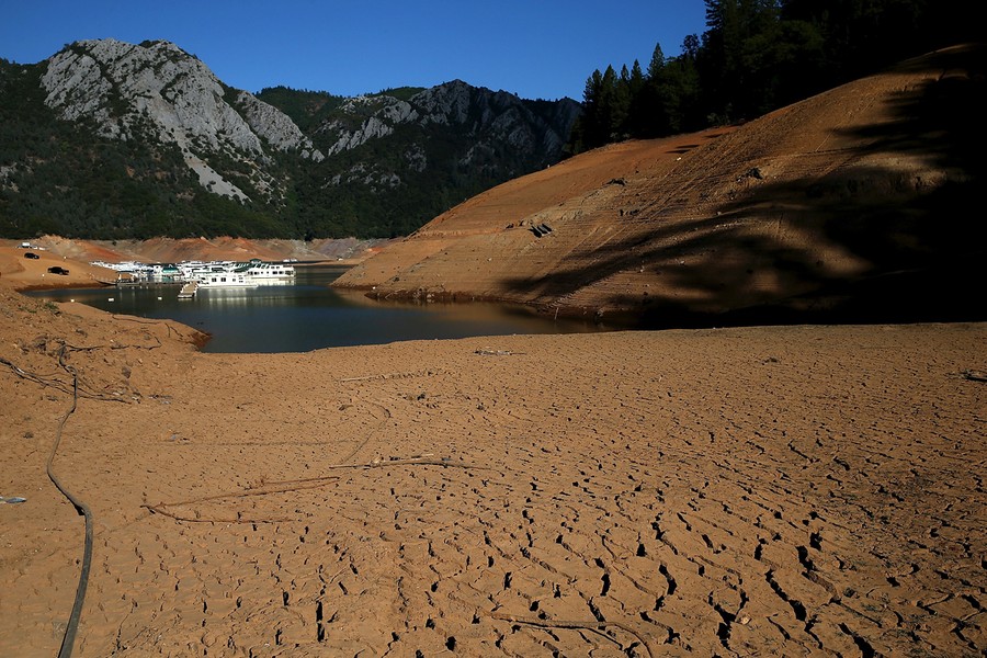
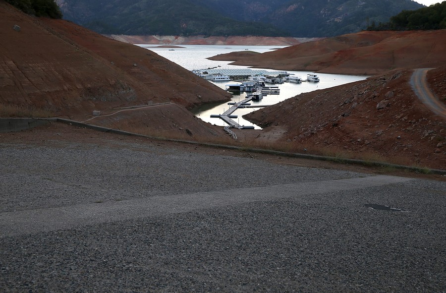
Read moreThe Digger Bay marina sits in the low waters of Shasta Lake far away from the boat ramp on August 30, 2014 in Redding, California. #
Justin Sullivan/Getty Images -
-
![]() Read more
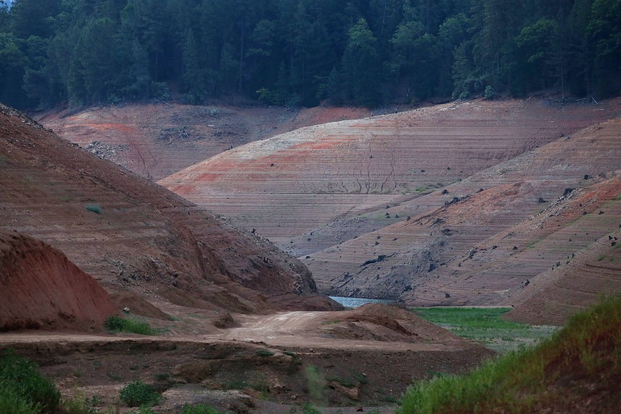
Read moreWater lines are visible in steep banks of Shasta Lake at Bridge Bay Resort in Redding, California, on August 30, 2014. #
Justin Sullivan/Getty Images -
![]() Read more
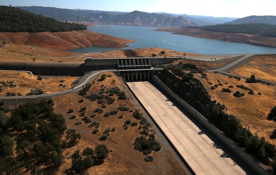
Read moreThe Oroville Dam spillway stands dry at Lake Oroville on August 19, 2014. #
Justin Sullivan/Getty Images -
![]() Read more
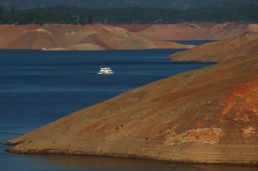
Read moreA houseboat is dwarfed by the steep banks of Shasta Lake on August 30, 2014 in Redding, California. #
Justin Sullivan/Getty Images -
-
![]() Read more
Read moreShasta Lake's Bailey Cove is seen completely dry on August 31, 2014 in Lakehead, California. #
Justin Sullivan/Getty Images -
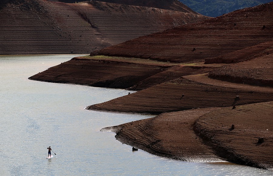
![]() Read more
Read moreA paddleboarder floats on the waters of Shasta Lake near the Shasta Marina Resort on August 30, 2014 in Lakehead, California. #
Justin Sullivan/Getty Images -
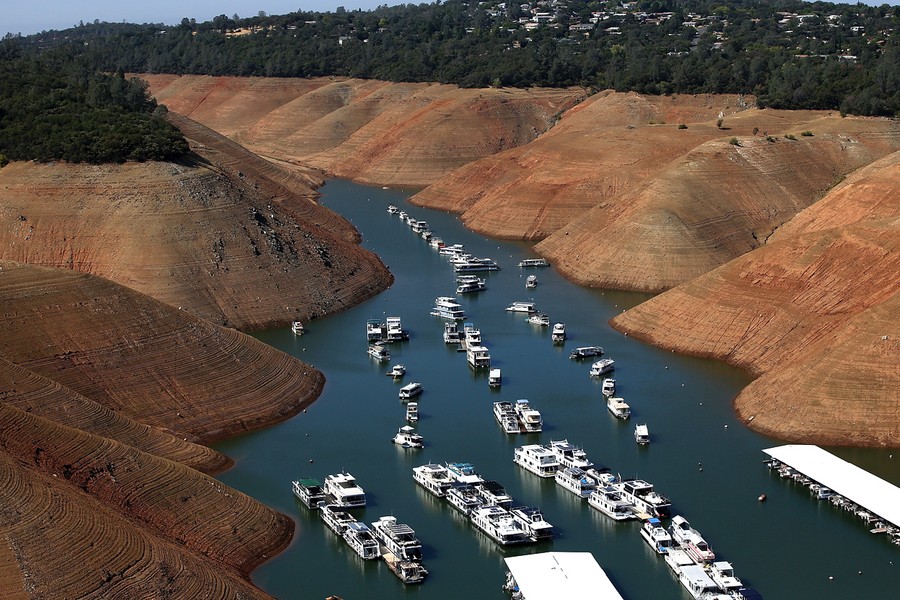
![]() Read more
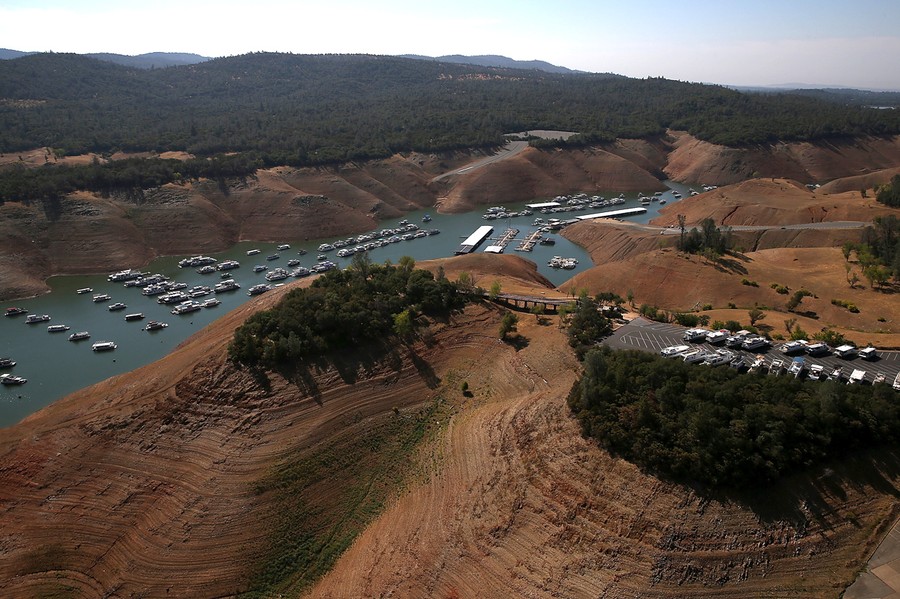
Read moreHouse boats are dwarfed by the steep banks of a shrinking Lake Oroville on August 19, 2014 in Oroville, California. As the severe drought in California continues for a third straight year, water levels in the State's lakes and reservoirs is reaching historic lows. Lake Oroville is currently at 32 percent of its capacity. #
Justin Sullivan/Getty Images -
We want to hear what you think about this article. Submit a letter to the editor or write to letters@theatlantic.com.